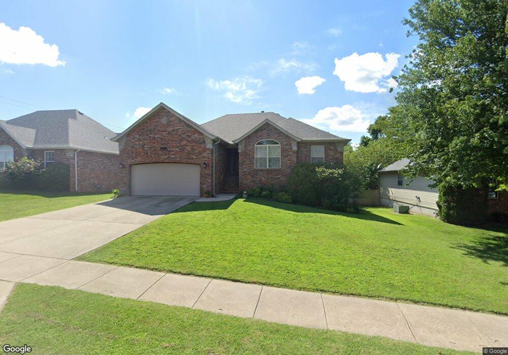
5783 S Parkhill Ave Springfield, MO 65810
Southwest Springfield NeighborhoodEstimated Value: $350,000 - $483,000
4
Beds
3
Baths
2,189
Sq Ft
$185/Sq Ft
Est. Value
About This Home
This home is located at 5783 S Parkhill Ave, Springfield, MO 65810 and is currently estimated at $404,716, approximately $184 per square foot. 5783 S Parkhill Ave is a home located in Greene County with nearby schools including Gray Elementary School, Wilson's Creek Intermediate School, and Cherokee Middle School.
Ownership History
Date
Name
Owned For
Owner Type
Purchase Details
Closed on
Jul 18, 2024
Sold by
Deal William Paul and Sims Melani
Bought by
Deal William Paul and Deal Melani B
Current Estimated Value
Purchase Details
Closed on
Jan 20, 2006
Sold by
Lacey Bros Construction Inc
Bought by
Deal William Paul and Sims Melani
Home Financials for this Owner
Home Financials are based on the most recent Mortgage that was taken out on this home.
Original Mortgage
$184,500
Interest Rate
6.25%
Mortgage Type
New Conventional
Create a Home Valuation Report for This Property
The Home Valuation Report is an in-depth analysis detailing your home's value as well as a comparison with similar homes in the area
Home Values in the Area
Average Home Value in this Area
Purchase History
| Date | Buyer | Sale Price | Title Company |
|---|---|---|---|
| Deal William Paul | -- | None Listed On Document | |
| Deal William Paul | -- | None Available |
Source: Public Records
Mortgage History
| Date | Status | Borrower | Loan Amount |
|---|---|---|---|
| Previous Owner | Deal William Paul | $184,500 |
Source: Public Records
Tax History Compared to Growth
Tax History
| Year | Tax Paid | Tax Assessment Tax Assessment Total Assessment is a certain percentage of the fair market value that is determined by local assessors to be the total taxable value of land and additions on the property. | Land | Improvement |
|---|---|---|---|---|
| 2025 | $2,194 | $45,550 | $7,130 | $38,420 |
| 2024 | $2,194 | $39,620 | $4,750 | $34,870 |
| 2023 | $2,183 | $39,620 | $4,750 | $34,870 |
| 2022 | $1,888 | $35,130 | $4,750 | $30,380 |
| 2021 | $1,887 | $35,130 | $4,750 | $30,380 |
| 2020 | $1,859 | $32,810 | $4,750 | $28,060 |
| 2019 | $1,806 | $32,810 | $4,750 | $28,060 |
| 2018 | $1,887 | $34,200 | $4,750 | $29,450 |
| 2017 | $1,868 | $31,430 | $4,750 | $26,680 |
| 2016 | $1,717 | $31,430 | $4,750 | $26,680 |
| 2015 | $1,704 | $31,430 | $4,750 | $26,680 |
| 2014 | $1,656 | $30,310 | $4,750 | $25,560 |
Source: Public Records
Map
Nearby Homes
- 5783 S Franklin Ave
- 5898 S Franklin Ave
- 5881 S Franklin Ave
- 1257 W Gaslight Dr
- 1276 W Sage Ct
- 1302 W Gaslight Dr
- 1173 W Highpoint St
- 5784 S Michigan Ave
- 5537 S Pinehurst Ave
- 5393 S Newton Ave
- 5381 S Newton Ave
- 5228 S Nettleton Ave
- 5216 S Nettleton Ave
- 5204 S Nettleton Ave
- 5964 S Nettleton Ave
- 5044 S Nettleton Ave
- 5558 S Dayton Ave
- 1532 W Gaslight Dr
- 1551 W Gaslight Dr
- 1563 W Gaslight Dr
- 5771 S Parkhill Ave
- 5795 S Parkhill Ave
- 5759 S Parkhill Ave
- 5782 S Fox Hollow Ave
- 5770 S Fox Hollow Ave
- 5794 S Fox Hollow Ave
- 5784 S Parkhill Ave
- 5758 S Fox Hollow Ave
- 5772 S Parkhill Ave
- 5796 S Parkhill Ave
- 5747 S Parkhill Ave
- 5760 S Parkhill Ave
- 5746 S Fox Hollow Ave
- 1043 W Gaslight Dr
- 5735 S Parkhill Ave
- 5748 S Parkhill Ave
- 5734 S Fox Hollow Ave
- 5781 S Fox Hollow Ave
- 5769 S Fox Hollow Ave
- 5793 S Fox Hollow Ave