Estimated Value: $170,000 - $255,000
--
Bed
--
Bath
2,074
Sq Ft
$105/Sq Ft
Est. Value
About This Home
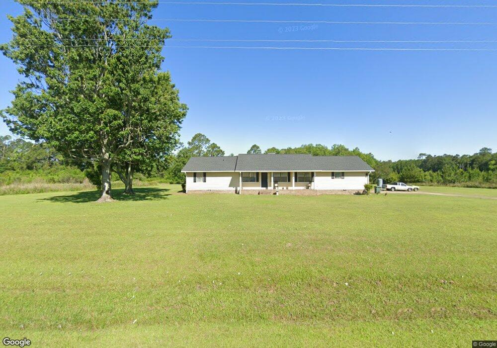
This home is located at 5787 Airline Rd, Pavo, GA 31778 and is currently estimated at $216,957, approximately $104 per square foot. 5787 Airline Rd is a home with nearby schools including Hand in Hand Primary School, Garrison-Pilcher Elementary School, and Cross Creek Elementary School.
Ownership History
Date
Name
Owned For
Owner Type
Purchase Details
Closed on
Mar 1, 2021
Sold by
Daniel Robert F
Bought by
Daniel Tabetha and Daniel Jacob
Current Estimated Value
Home Financials for this Owner
Home Financials are based on the most recent Mortgage that was taken out on this home.
Original Mortgage
$132,668
Outstanding Balance
$118,927
Interest Rate
2.7%
Mortgage Type
New Conventional
Estimated Equity
$98,030
Purchase Details
Closed on
Apr 29, 2019
Sold by
Willis Jeff
Bought by
Daniel Robert F and Daniel Jennifer L
Purchase Details
Closed on
Sep 2, 2010
Sold by
Willis Kay
Bought by
Willis Jeff D
Purchase Details
Closed on
Sep 1, 1996
Bought by
Willis Jeff D
Create a Home Valuation Report for This Property
The Home Valuation Report is an in-depth analysis detailing your home's value as well as a comparison with similar homes in the area
Home Values in the Area
Average Home Value in this Area
Purchase History
| Date | Buyer | Sale Price | Title Company |
|---|---|---|---|
| Daniel Tabetha | $140,000 | -- | |
| Daniel Robert F | $125,000 | -- | |
| Willis Jeff D | -- | -- | |
| Willis Jeff D | -- | -- |
Source: Public Records
Mortgage History
| Date | Status | Borrower | Loan Amount |
|---|---|---|---|
| Open | Daniel Tabetha | $132,668 |
Source: Public Records
Tax History Compared to Growth
Tax History
| Year | Tax Paid | Tax Assessment Tax Assessment Total Assessment is a certain percentage of the fair market value that is determined by local assessors to be the total taxable value of land and additions on the property. | Land | Improvement |
|---|---|---|---|---|
| 2024 | $1,637 | $79,350 | $5,175 | $74,175 |
| 2023 | $1,486 | $73,773 | $4,140 | $69,633 |
| 2022 | $1,245 | $65,110 | $4,140 | $60,970 |
| 2021 | $1,336 | $56,215 | $3,600 | $52,615 |
| 2020 | $1,213 | $53,835 | $3,600 | $50,235 |
| 2019 | $1,419 | $55,894 | $3,600 | $52,294 |
| 2018 | $1,433 | $55,327 | $3,600 | $51,727 |
| 2017 | $1,464 | $55,633 | $3,600 | $52,033 |
| 2016 | $1,430 | $53,950 | $3,600 | $50,350 |
| 2015 | $1,476 | $54,832 | $3,600 | $51,232 |
| 2014 | $1,452 | $53,701 | $3,600 | $50,101 |
| 2013 | -- | $53,701 | $3,600 | $50,101 |
Source: Public Records
Map
Nearby Homes
- 1230 Parrish Rd
- 16343 Ga Hwy 33 - 8 34 Acres Hwy
- 16343 Georgia 33
- 16343 Ga Hwy 33 -8 34 Acres
- 16343
- 13876 Ga Highway 122
- 813 Vonier Road (6 Acres)
- 2051 W Pear St
- 2055 S Roberts St
- 3812 Ponder Rd
- 100 Morgan Place
- 102 Morgan Place
- 258
- 110 Morgan Place
- 112 Morgan Place
- 4016 E Japonica Ave
- 0000 N
- 110 Nicole Britt Dr
- 21688 U S 319
- 21688 US Highway 319 N
- 1091 Antioch Church Rd
- 1221 Antioch Church Rd
- 255 Redding Rd
- 5447 Airline Rd
- 218 Redding Rd
- 260 Redding Rd
- 0 Airline Rd
- 632 Antioch Church Rd
- 6290 Airline Rd
- 1873 Harts Mill Rd
- 6449 Airline Rd
- 1804 Harts Mill Rd
- 1704 Harts Mill Rd
- 1670 Harts Mill Rd
- 1864 Harts Mill Rd
- 2051 Harts Mill Rd
- 1940 Harts Mill Rd
- 253 Antioch Church Rd
- 2036 Harts Mill Rd
- 20780 Ga Highway 188