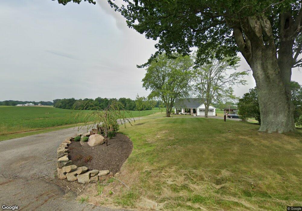
5787 Anderson Ave NE Alliance, OH 44601
Estimated Value: $290,000 - $395,293
3
Beds
2
Baths
1,802
Sq Ft
$188/Sq Ft
Est. Value
About This Home
This home is located at 5787 Anderson Ave NE, Alliance, OH 44601 and is currently estimated at $338,573, approximately $187 per square foot. 5787 Anderson Ave NE is a home located in Stark County with nearby schools including Marlington High School.
Ownership History
Date
Name
Owned For
Owner Type
Purchase Details
Closed on
Nov 19, 2019
Sold by
Grossman James Ray
Bought by
Manos Jeffrey L
Current Estimated Value
Purchase Details
Closed on
Nov 14, 2019
Sold by
Manos Jeffrey L and Manos Lisa R
Bought by
Manos Nathan J
Purchase Details
Closed on
Dec 22, 2010
Sold by
Grossman James R
Bought by
Manos Jeffrey L and Manos Lisa R
Home Financials for this Owner
Home Financials are based on the most recent Mortgage that was taken out on this home.
Original Mortgage
$145,000
Interest Rate
4.16%
Mortgage Type
Seller Take Back
Create a Home Valuation Report for This Property
The Home Valuation Report is an in-depth analysis detailing your home's value as well as a comparison with similar homes in the area
Home Values in the Area
Average Home Value in this Area
Purchase History
| Date | Buyer | Sale Price | Title Company |
|---|---|---|---|
| Manos Jeffrey L | -- | None Available | |
| Manos Nathan J | -- | None Available | |
| Manos Jeffrey L | $165,000 | None Available |
Source: Public Records
Mortgage History
| Date | Status | Borrower | Loan Amount |
|---|---|---|---|
| Previous Owner | Manos Jeffrey L | $145,000 |
Source: Public Records
Tax History Compared to Growth
Tax History
| Year | Tax Paid | Tax Assessment Tax Assessment Total Assessment is a certain percentage of the fair market value that is determined by local assessors to be the total taxable value of land and additions on the property. | Land | Improvement |
|---|---|---|---|---|
| 2025 | -- | $114,770 | $16,800 | $97,970 |
| 2024 | -- | $111,650 | $16,800 | $94,850 |
| 2023 | $2,849 | $89,220 | $13,440 | $75,780 |
| 2022 | $2,859 | $89,220 | $13,440 | $75,780 |
| 2021 | $2,844 | $89,220 | $13,440 | $75,780 |
| 2020 | $534 | $14,880 | $8,260 | $6,620 |
| 2019 | $532 | $14,920 | $8,300 | $6,620 |
| 2018 | $532 | $14,920 | $8,300 | $6,620 |
| 2017 | $572 | $15,160 | $9,870 | $5,290 |
| 2016 | $698 | $18,520 | $9,870 | $8,650 |
| 2015 | $701 | $18,560 | $9,870 | $8,690 |
| 2014 | $740 | $17,900 | $8,930 | $8,970 |
| 2013 | $370 | $17,900 | $8,930 | $8,970 |
Source: Public Records
Map
Nearby Homes
- 5200 Union Ave NE
- 6378 Union Ave NE
- 6434 Union Ave NE
- 5869 Beechwood Ave
- 16159 Salem Church St NE
- 13881 Salem Church St NE
- 540 E Bayton St
- 22120 Center Rd
- 1100 E Bayton St
- 3709 S Union Ave
- 13529 Louisville St NE
- 277 W Carol St
- 13479 Louisville St NE
- 1325 W Beech St
- 1835 Homeworth Rd
- 3636 S Mahoning Ave
- 3101 Ridgehill Ave
- 0 Winchester St
- 0 Winchester St Unit 5162877
- 22840 Buck Rd
- 5744 Anderson Ave NE
- 5880 Anderson Ave NE
- 14920 Cenfield St NE
- 15018 Cenfield St NE
- 14880 Cenfield St NE
- 5600 Anderson Ave NE
- 14953 Cenfield St NE
- 15121 Cenfield St NE
- 14750 Cenfield St NE
- 14652 Cenfield St NE
- 14859 Cenfield St NE
- 14730 Cenfield St NE
- 5508 Anderson Ave NE
- 14710 Cenfield St NE
- 14930 Salem Church St NE
- 14723 Salem Church St NE
- 14711 Cenfield St NE
- 14670 Cenfield St NE
- 14880 Salem Church St NE
- 14842 Salem Church St NE