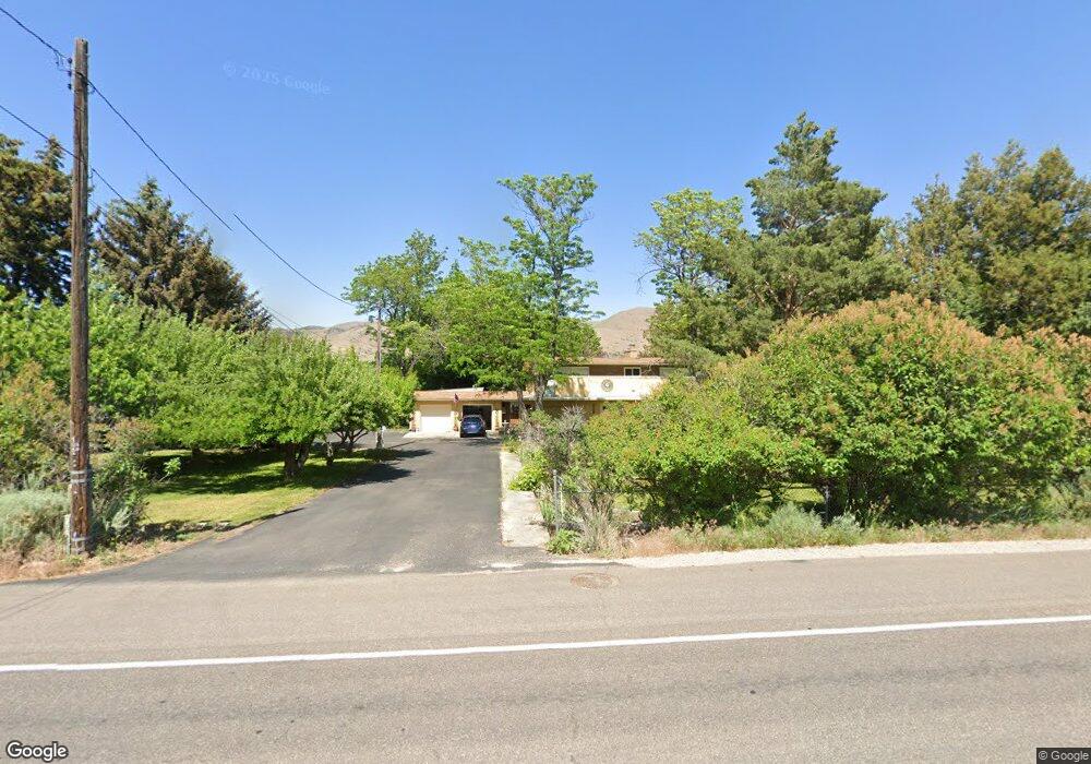
5788 Bannock Hwy Pocatello, ID 83204
South Pocatello NeighborhoodEstimated Value: $465,000 - $569,000
5
Beds
2
Baths
3,272
Sq Ft
$157/Sq Ft
Est. Value
About This Home
This home is located at 5788 Bannock Hwy, Pocatello, ID 83204 and is currently estimated at $513,962, approximately $157 per square foot. 5788 Bannock Hwy is a home located in Bannock County with nearby schools including Indian Hills Elementary School, Irving Middle School, and Pocatello High School.
Ownership History
Date
Name
Owned For
Owner Type
Purchase Details
Closed on
Jan 29, 2020
Sold by
Angle Roy and Angle Roy W
Bought by
Angle Roy William
Current Estimated Value
Home Financials for this Owner
Home Financials are based on the most recent Mortgage that was taken out on this home.
Original Mortgage
$104,750
Interest Rate
3.7%
Mortgage Type
New Conventional
Purchase Details
Closed on
Dec 2, 2019
Sold by
Angle Michelle
Bought by
Angle Roy
Home Financials for this Owner
Home Financials are based on the most recent Mortgage that was taken out on this home.
Original Mortgage
$104,750
Interest Rate
3.7%
Mortgage Type
New Conventional
Create a Home Valuation Report for This Property
The Home Valuation Report is an in-depth analysis detailing your home's value as well as a comparison with similar homes in the area
Home Values in the Area
Average Home Value in this Area
Purchase History
| Date | Buyer | Sale Price | Title Company |
|---|---|---|---|
| Angle Roy William | -- | None Available | |
| Angle Roy | -- | None Available |
Source: Public Records
Mortgage History
| Date | Status | Borrower | Loan Amount |
|---|---|---|---|
| Closed | Angle Roy William | $104,750 |
Source: Public Records
Tax History Compared to Growth
Tax History
| Year | Tax Paid | Tax Assessment Tax Assessment Total Assessment is a certain percentage of the fair market value that is determined by local assessors to be the total taxable value of land and additions on the property. | Land | Improvement |
|---|---|---|---|---|
| 2024 | $3,456 | $402,771 | $108,695 | $294,076 |
| 2023 | $3,556 | $426,064 | $108,695 | $317,369 |
| 2022 | $3,556 | $324,130 | $48,821 | $275,309 |
| 2021 | $3,353 | $368,549 | $48,821 | $319,728 |
| 2020 | $3,135 | $299,533 | $44,670 | $254,863 |
| 2019 | $3,607 | $286,745 | $44,670 | $242,075 |
| 2018 | $3,305 | $249,137 | $39,000 | $210,137 |
| 2017 | $3,279 | $249,137 | $39,000 | $210,137 |
| 2016 | $3,180 | $240,538 | $35,370 | $205,168 |
| 2015 | $3,324 | $0 | $0 | $0 |
| 2012 | -- | $240,538 | $35,370 | $205,168 |
Source: Public Records
Map
Nearby Homes
- 5431 Nez Perce Dr
- 6187 Arapahoe St
- 1459 Foxmore St
- 6183 Arapahoe St
- 9075 W Stoney Creek
- 1479 Huntington Dr
- 5175 Ethans Way
- 6740 Smile Ln
- 6787 Running Iron Ln
- 0 N Stephanie Rd
- 1605 Foxmore St
- 4780 Clearview Ave
- 615 Cree Ave
- 1675 Foxmore St
- TBD Stan's Way
- 6515 S 5th Ave
- 506 Mulligan Rd
- 1975 Arlington Dr
- 4785 Kim Dr
- 628 Double Eagle Dr
- 5722 Bannock Hwy
- 5680 Bannock Hwy
- 760 Green Dr
- 5900 Country Club Dr
- 770 Green Dr
- 5926 Country Club Dr
- 755 Green Dr
- 5888 Country Club Dr
- 5898 Bannock Hwy
- 784 Creekside Cir
- 5956 Country Club Dr
- 5901 Country Club Dr
- 780 Green Dr
- 5866 Country Club Dr
- 788 Creekside Cir
- 777 Green Dr
- 5956 Bannock Hwy
- 0 Creekside Cir
- 5965 Country Club Dr
- 5800 Country Club Dr