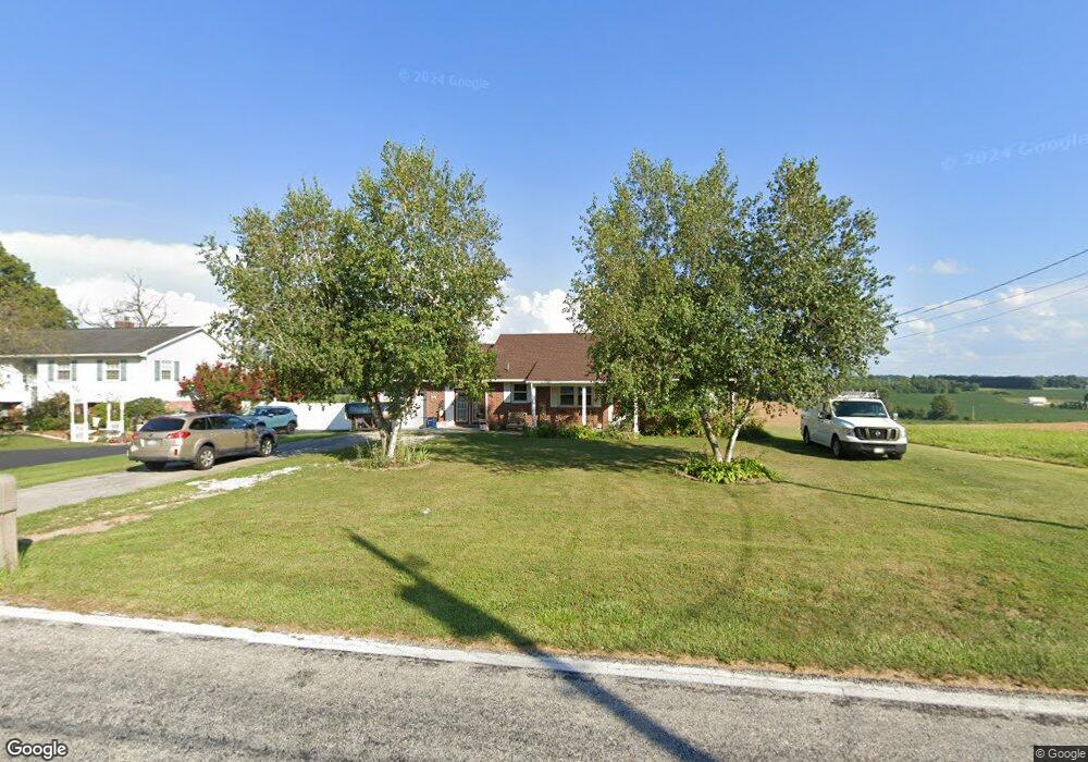
579 Bollinger Rd Littlestown, PA 17340
Estimated Value: $250,370 - $301,000
2
Beds
1
Bath
1,200
Sq Ft
$231/Sq Ft
Est. Value
About This Home
This home is located at 579 Bollinger Rd, Littlestown, PA 17340 and is currently estimated at $277,593, approximately $231 per square foot. 579 Bollinger Rd is a home located in Adams County with nearby schools including Rolling Acres El School, Maple Avenue Middle School, and Littlestown Senior High School.
Ownership History
Date
Name
Owned For
Owner Type
Purchase Details
Closed on
Apr 28, 2005
Sold by
Damiano Sara E and Cushing Sara E
Bought by
Kinsey Nicholas R
Current Estimated Value
Home Financials for this Owner
Home Financials are based on the most recent Mortgage that was taken out on this home.
Original Mortgage
$185,900
Outstanding Balance
$97,116
Interest Rate
5.87%
Mortgage Type
Adjustable Rate Mortgage/ARM
Estimated Equity
$180,477
Create a Home Valuation Report for This Property
The Home Valuation Report is an in-depth analysis detailing your home's value as well as a comparison with similar homes in the area
Home Values in the Area
Average Home Value in this Area
Purchase History
| Date | Buyer | Sale Price | Title Company |
|---|---|---|---|
| Kinsey Nicholas R | $195,700 | -- |
Source: Public Records
Mortgage History
| Date | Status | Borrower | Loan Amount |
|---|---|---|---|
| Open | Kinsey Nicholas R | $185,900 |
Source: Public Records
Tax History Compared to Growth
Tax History
| Year | Tax Paid | Tax Assessment Tax Assessment Total Assessment is a certain percentage of the fair market value that is determined by local assessors to be the total taxable value of land and additions on the property. | Land | Improvement |
|---|---|---|---|---|
| 2025 | $3,142 | $166,000 | $30,500 | $135,500 |
| 2024 | $3,004 | $166,000 | $30,500 | $135,500 |
| 2023 | $2,944 | $166,000 | $30,500 | $135,500 |
| 2022 | $2,943 | $166,000 | $30,500 | $135,500 |
| 2021 | $2,839 | $166,000 | $30,500 | $135,500 |
| 2020 | $2,798 | $166,000 | $30,500 | $135,500 |
| 2019 | $2,738 | $166,000 | $30,500 | $135,500 |
| 2018 | $2,679 | $166,000 | $30,500 | $135,500 |
| 2017 | $2,586 | $166,000 | $30,500 | $135,500 |
| 2016 | -- | $166,000 | $30,500 | $135,500 |
| 2015 | -- | $166,000 | $30,500 | $135,500 |
| 2014 | -- | $163,000 | $30,500 | $132,500 |
Source: Public Records
Map
Nearby Homes
- 630 Mehring Rd Unit 4
- LOT 9 Mehring Rd
- 1175 Bollinger Rd
- 567 Lumber St
- 559 Lumber St
- 535 Lumber St
- 128 Pine Grove Rd Unit 3
- 43 Ashfield Dr Unit 14
- 2100 Blacks School House Rd
- 211 E King St
- 241 M St
- 1555 Humbert Schoolhouse Rd
- 41 Smith Cir
- 61 E King St
- 106 E King St
- 115 Charles St
- 117 Charles St
- 1077 Pine Grove Rd Unit 7
- 893 Georgetown Rd
- 129 W King St
- 591 Bollinger Rd
- 607 Bollinger Rd
- 596 Bollinger Rd
- 590 Bollinger Rd Unit 3
- 610 Bollinger Rd Unit 8
- 542 Bollinger Rd Unit 2
- 625 Bollinger Rd
- 30 Woodcrest Cir Unit 25
- 620 Bollinger Rd Unit 9
- 530 Bollinger Rd
- 641 Bollinger Rd
- 20 Woodcrest Cir Unit 26
- 40 Juniper Dr Unit 17
- 509 Bollinger Rd
- 35 Woodcrest Cir Unit 24
- 710 Mehring Rd
- 657 Bollinger Rd
- 497 Bollinger Rd Unit 8
- 498 Bollinger Rd
- 650 Bollinger Rd