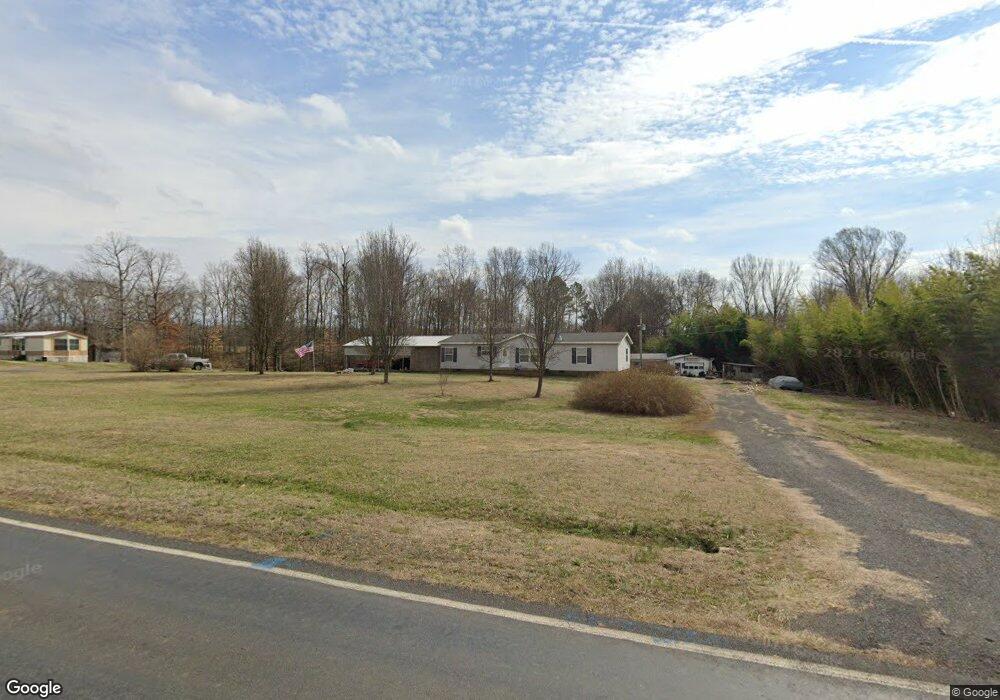
579 Pudding Ridge Rd Mocksville, NC 27028
Estimated Value: $264,000 - $554,000
3
Beds
2
Baths
2,052
Sq Ft
$177/Sq Ft
Est. Value
About This Home
This home is located at 579 Pudding Ridge Rd, Mocksville, NC 27028 and is currently estimated at $363,333, approximately $177 per square foot. 579 Pudding Ridge Rd is a home located in Davie County with nearby schools including Pinebrook Elementary School, North Davie Middle School, and Davie County High School.
Ownership History
Date
Name
Owned For
Owner Type
Purchase Details
Closed on
Mar 8, 2005
Sold by
Jones Homer Aldene
Bought by
Jones Homer Aldene and Jones Elizabeth H
Current Estimated Value
Home Financials for this Owner
Home Financials are based on the most recent Mortgage that was taken out on this home.
Original Mortgage
$126,650
Interest Rate
5.54%
Mortgage Type
New Conventional
Purchase Details
Closed on
Jan 1, 1987
Create a Home Valuation Report for This Property
The Home Valuation Report is an in-depth analysis detailing your home's value as well as a comparison with similar homes in the area
Home Values in the Area
Average Home Value in this Area
Purchase History
| Date | Buyer | Sale Price | Title Company |
|---|---|---|---|
| Jones Homer Aldene | -- | -- | |
| -- | $25,000 | -- |
Source: Public Records
Mortgage History
| Date | Status | Borrower | Loan Amount |
|---|---|---|---|
| Closed | Jones Homer Aldene | $126,650 |
Source: Public Records
Tax History Compared to Growth
Tax History
| Year | Tax Paid | Tax Assessment Tax Assessment Total Assessment is a certain percentage of the fair market value that is determined by local assessors to be the total taxable value of land and additions on the property. | Land | Improvement |
|---|---|---|---|---|
| 2025 | $1,372 | $199,200 | $80,490 | $118,710 |
| 2024 | $1,396 | $180,610 | $65,850 | $114,760 |
| 2023 | $1,396 | $180,610 | $65,850 | $114,760 |
| 2022 | $1,396 | $180,610 | $65,850 | $114,760 |
| 2021 | $1,396 | $180,610 | $65,850 | $114,760 |
| 2020 | $1,319 | $169,520 | $65,850 | $103,670 |
| 2019 | $1,319 | $169,520 | $65,850 | $103,670 |
| 2018 | $1,319 | $169,520 | $65,850 | $103,670 |
| 2017 | $1,302 | $169,520 | $0 | $0 |
| 2016 | $1,360 | $177,090 | $0 | $0 |
| 2015 | $1,360 | $177,090 | $0 | $0 |
| 2014 | $1,169 | $177,090 | $0 | $0 |
| 2013 | -- | $177,090 | $0 | $0 |
Source: Public Records
Map
Nearby Homes
- 123 Cornwallis Dr
- 193 Ashley Ln
- Lot 1 Ashley Ln
- 2643 Nc Highway 801 N
- 164 Dusty Hill Rd
- 00 Angell Rd
- 2007 Farmington Rd
- 228 Meadowlark Ln
- 153 Summerlyn Dr
- 118 Arrendal Ct
- 108 Arrendal Ct
- 0 Angell Rd
- 550 Danner Rd
- 3721 Nc Highway 801 N
- 197 Dare Ln
- 2418 US Highway 158
- 844 Rainbow Rd
- Knollwood Plan at Providence Place
- Aster Plan at Providence Place
- Ledford Plan at Providence Place
- 521 Pudding Ridge Rd
- 123 Cornwallis Dr Unit 34
- 136 Cedar Creek Rd
- 139 Cornwallis Dr
- 178 Stone Meadows Ln
- Lot 6 Country Meadows
- Lot 16 Country Meadows
- Lot 4 Country Meadows
- Lot 17 Country Meadows
- Lot 7 Country Meadows
- Lot 3 Country Meadows
- Lot 15 Country Meadows
- Lot 1 Country Meadows
- Lot 14 Country Meadows
- Lot 13 Country Meadows
- Lot 22 Country Meadows
- Lot 21 Country Meadows
- 15 Country Meadows
- 12 Country Meadows
- 4 Country Meadows