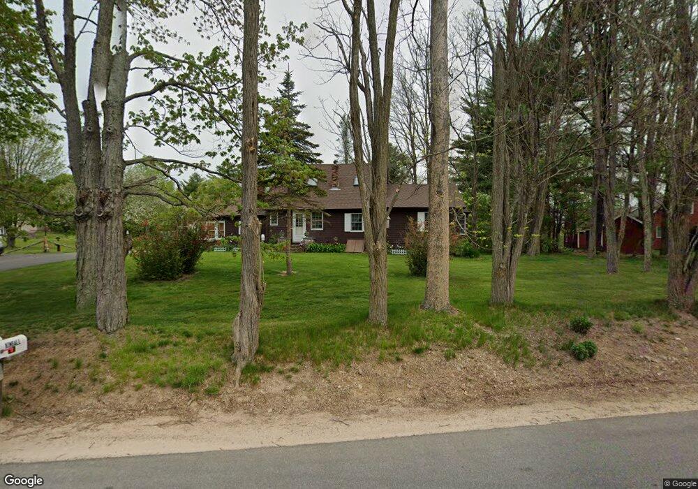
579 Ridge Rd Middleton, NH 03887
Estimated Value: $325,000 - $422,000
2
Beds
1
Bath
1,943
Sq Ft
$197/Sq Ft
Est. Value
About This Home
This home is located at 579 Ridge Rd, Middleton, NH 03887 and is currently estimated at $383,492, approximately $197 per square foot. 579 Ridge Rd is a home located in Strafford County with nearby schools including Valley View Community School, Henry Wilson Memorial School, and Farmington Senior High School.
Ownership History
Date
Name
Owned For
Owner Type
Purchase Details
Closed on
Jul 15, 1996
Sold by
Seavey Linda O
Bought by
Boyle Michael P and Boyle Lisa A
Current Estimated Value
Home Financials for this Owner
Home Financials are based on the most recent Mortgage that was taken out on this home.
Original Mortgage
$62,775
Interest Rate
7.98%
Create a Home Valuation Report for This Property
The Home Valuation Report is an in-depth analysis detailing your home's value as well as a comparison with similar homes in the area
Home Values in the Area
Average Home Value in this Area
Purchase History
| Date | Buyer | Sale Price | Title Company |
|---|---|---|---|
| Boyle Michael P | $79,900 | -- |
Source: Public Records
Mortgage History
| Date | Status | Borrower | Loan Amount |
|---|---|---|---|
| Open | Boyle Michael P | $150,450 | |
| Closed | Boyle Michael P | $147,079 | |
| Closed | Boyle Michael P | $143,173 | |
| Closed | Boyle Michael P | $62,775 |
Source: Public Records
Tax History
| Year | Tax Paid | Tax Assessment Tax Assessment Total Assessment is a certain percentage of the fair market value that is determined by local assessors to be the total taxable value of land and additions on the property. | Land | Improvement |
|---|---|---|---|---|
| 2025 | $5,533 | $350,400 | $129,900 | $220,500 |
| 2024 | $5,445 | $350,400 | $129,900 | $220,500 |
| 2023 | $5,270 | $350,400 | $129,900 | $220,500 |
| 2022 | $5,033 | $192,900 | $53,200 | $139,700 |
| 2021 | $5,297 | $192,900 | $53,200 | $139,700 |
| 2020 | $5,453 | $192,900 | $53,200 | $139,700 |
| 2019 | $5,069 | $192,900 | $53,200 | $139,700 |
| 2018 | $5,399 | $192,900 | $53,200 | $139,700 |
| 2017 | $4,643 | $172,300 | $49,500 | $122,800 |
| 2016 | $6,212 | $171,800 | $49,500 | $122,300 |
| 2015 | $4,902 | $171,100 | $49,500 | $121,600 |
| 2014 | $4,308 | $171,100 | $49,500 | $121,600 |
| 2013 | $4,038 | $171,100 | $49,500 | $121,600 |
Source: Public Records
Map
Nearby Homes
- 46-2 & 47 New Hampshire 153
- 0 Pine Ridge Rd Unit 51
- 66 Chapel St
- 15 Adams Way
- 271 Main St
- 336 Main St
- 372 Wakefield Rd
- lot 20 Access Rd
- Lot 19 Access Rd
- lot 15 Access Rd
- lot 14 Access Rd
- 10 New Durham Rd
- 57 Pinkham Rd
- 0 White Mountain Hwy Unit 5033185
- 0 Pinkham Rd Unit Map 8 Lot 6-4
- 266 Access Rd
- 123 Pinkham Rd
- 44 Shore Dr Unit 100
- 0 Fox Rd Unit 5010590
- 164 18 3 Mason Rd
Your Personal Tour Guide
Ask me questions while you tour the home.