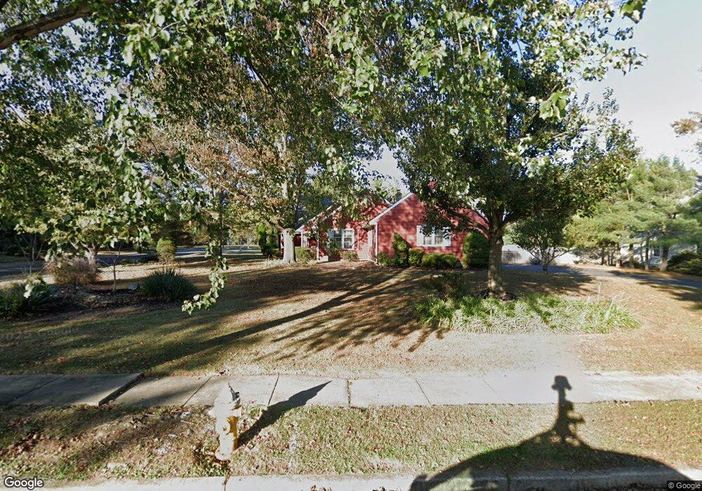
579 Sentinel Rd Moorestown, NJ 08057
Estimated Value: $708,000 - $1,326,000
--
Bed
--
Bath
4,244
Sq Ft
$263/Sq Ft
Est. Value
About This Home
This home is located at 579 Sentinel Rd, Moorestown, NJ 08057 and is currently estimated at $1,114,445, approximately $262 per square foot. 579 Sentinel Rd is a home located in Burlington County with nearby schools including George C. Baker Elementary School, Moorestown Upper Elementary School, and William Allen Middle School.
Ownership History
Date
Name
Owned For
Owner Type
Purchase Details
Closed on
Dec 10, 2004
Sold by
Weinberg Joseph M and Weinberg Diane
Bought by
Trinchieri Paolo and Trinchieri Maria Elena
Current Estimated Value
Home Financials for this Owner
Home Financials are based on the most recent Mortgage that was taken out on this home.
Original Mortgage
$333,700
Outstanding Balance
$166,895
Interest Rate
5.71%
Mortgage Type
Purchase Money Mortgage
Estimated Equity
$947,550
Create a Home Valuation Report for This Property
The Home Valuation Report is an in-depth analysis detailing your home's value as well as a comparison with similar homes in the area
Home Values in the Area
Average Home Value in this Area
Purchase History
| Date | Buyer | Sale Price | Title Company |
|---|---|---|---|
| Trinchieri Paolo | $595,000 | Congress Title Corp |
Source: Public Records
Mortgage History
| Date | Status | Borrower | Loan Amount |
|---|---|---|---|
| Open | Trinchieri Paolo | $333,700 |
Source: Public Records
Tax History Compared to Growth
Tax History
| Year | Tax Paid | Tax Assessment Tax Assessment Total Assessment is a certain percentage of the fair market value that is determined by local assessors to be the total taxable value of land and additions on the property. | Land | Improvement |
|---|---|---|---|---|
| 2025 | $19,198 | $676,700 | $230,600 | $446,100 |
| 2024 | $18,616 | $676,700 | $230,600 | $446,100 |
| 2023 | $18,616 | $676,700 | $230,600 | $446,100 |
| 2022 | $18,427 | $676,700 | $230,600 | $446,100 |
| 2021 | $18,183 | $676,700 | $230,600 | $446,100 |
| 2020 | $18,068 | $676,700 | $230,600 | $446,100 |
| 2019 | $17,750 | $676,700 | $230,600 | $446,100 |
| 2018 | $17,269 | $676,700 | $230,600 | $446,100 |
| 2017 | $17,418 | $676,700 | $230,600 | $446,100 |
| 2016 | $17,357 | $676,700 | $230,600 | $446,100 |
| 2015 | $17,148 | $676,700 | $230,600 | $446,100 |
| 2014 | $16,281 | $676,700 | $230,600 | $446,100 |
Source: Public Records
Map
Nearby Homes
- 628 Windsock Way
- 7 Whitetail Ct
- 57 Brooks Rd
- 693 Garwood Rd
- 744 Signal Light Rd
- 5 Murray Rd
- 97 Brooks Rd
- 39 Bramley Rd
- 863 Golf View Rd
- 740 Garwood Rd
- 415 Bridgeboro Rd
- 700 Bentley Ct
- 103 Congressional Ct
- 4327 Bridgeboro Rd
- 633 E Main St Unit B7
- 751 Garwood Rd
- 408 E 2nd St
- 514 E Main St
- 347 Tom Brown Rd
- 205 E Central Ave
- 581 Sentinel Rd
- 577 Sentinel Rd
- 580 Sentinel Rd
- 583 Sentinel Rd
- 799 Westfield Rd
- 582 Sentinel Rd
- 578 Sentinel Rd
- 575 Sentinel Rd
- 576 Sentinel Rd
- 585 Sentinel Rd
- 584 Sentinel Rd
- 4 Eaglebrook Ct
- 783 Westfield Rd
- 573 Sentinel Rd
- 574 Sentinel Rd
- 5 Eaglebrook Ct
- 807 Westfield Rd
- 587 Sentinel Rd
- 588 Sentinel Rd
- 552 Eaglebrook Dr