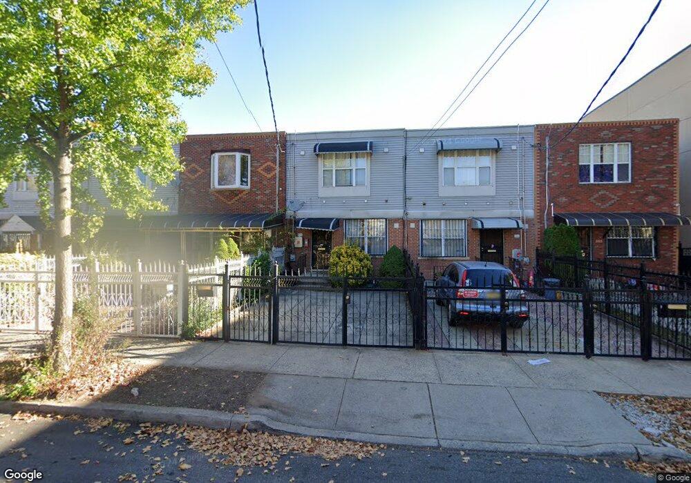
579 Snediker Ave Brooklyn, NY 11207
Brownsville NeighborhoodEstimated Value: $572,804 - $699,000
--
Bed
--
Bath
1,332
Sq Ft
$489/Sq Ft
Est. Value
About This Home
This home is located at 579 Snediker Ave, Brooklyn, NY 11207 and is currently estimated at $650,701, approximately $488 per square foot. 579 Snediker Ave is a home located in Kings County with nearby schools including P.S. 190 - Sheffield, Achievement First - East New York School, and Grace Christian Educational.
Ownership History
Date
Name
Owned For
Owner Type
Purchase Details
Closed on
Oct 9, 2020
Sold by
Estate Of Yanick Pierre-Paul
Bought by
Eustache Natasha and Jean-Baptiste Carlyn
Current Estimated Value
Purchase Details
Closed on
May 1, 2002
Sold by
Nehemiah Housing Develop
Bought by
Pierre-Paul Yanick
Home Financials for this Owner
Home Financials are based on the most recent Mortgage that was taken out on this home.
Original Mortgage
$77,000
Interest Rate
7.01%
Create a Home Valuation Report for This Property
The Home Valuation Report is an in-depth analysis detailing your home's value as well as a comparison with similar homes in the area
Home Values in the Area
Average Home Value in this Area
Purchase History
| Date | Buyer | Sale Price | Title Company |
|---|---|---|---|
| Eustache Natasha | -- | -- | |
| Pierre-Paul Yanick | -- | -- |
Source: Public Records
Mortgage History
| Date | Status | Borrower | Loan Amount |
|---|---|---|---|
| Previous Owner | Pierre-Paul Yanick | $77,000 |
Source: Public Records
Tax History Compared to Growth
Tax History
| Year | Tax Paid | Tax Assessment Tax Assessment Total Assessment is a certain percentage of the fair market value that is determined by local assessors to be the total taxable value of land and additions on the property. | Land | Improvement |
|---|---|---|---|---|
| 2025 | $3,216 | $37,320 | $11,280 | $26,040 |
| 2024 | $3,216 | $37,860 | $11,280 | $26,580 |
| 2023 | $1,785 | $37,560 | $11,280 | $26,280 |
| 2022 | $2,815 | $33,540 | $11,280 | $22,260 |
| 2021 | $2,762 | $29,940 | $11,280 | $18,660 |
| 2020 | $2,071 | $25,320 | $11,280 | $14,040 |
| 2019 | $1,816 | $24,960 | $11,280 | $13,680 |
| 2018 | $1,437 | $12,588 | $4,432 | $8,156 |
| 2017 | $1,356 | $12,588 | $5,148 | $7,440 |
| 2016 | $1,146 | $12,492 | $5,052 | $7,440 |
| 2015 | $197 | $11,785 | $4,345 | $7,440 |
| 2014 | $197 | $11,119 | $3,679 | $7,440 |
Source: Public Records
Map
Nearby Homes
- 541 Hinsdale St
- 533 Snediker Ave
- 576 Williams Ave
- 578 Williams Ave
- 582 Williams Ave
- 442 Newport St
- 584 Hinsdale St
- 589 Hinsdale St
- 606 Alabama Ave
- 610 Alabama Ave
- 650 Williams Ave
- 660 Williams Ave Unit 142
- 563 Powell St
- 546 Powell St
- 699 Sackman St
- 1755 Linden Blvd
- 1753 Linden Blvd
- 406 Hinsdale St
- 679 Georgia Ave
- 661 Sheffield Ave
- 581 Snediker Ave
- 577 Snediker Ave
- 575 Snediker Ave
- 583 Snediker Ave
- 571 Snediker Ave
- 585 Snediker Ave
- 446 Newport St
- 589 Snediker Ave
- 448 Newport St
- 448 Newport St Unit 2
- 591 Snediker Ave
- 430 Newport St
- 580 Hinsdale St
- 582 Hinsdale St
- 450 Newport St
- 593 Snediker Ave
- 428 Newport St
- 428 Newport St Unit 28
- 586 Hinsdale St
- 597 Snediker Ave