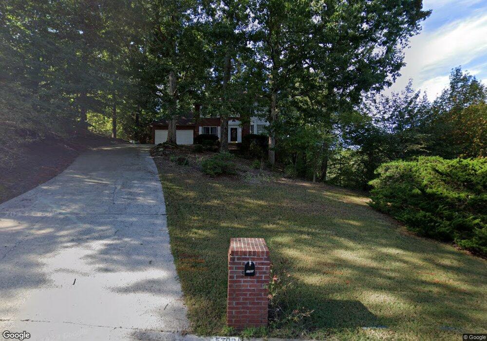
5790 Manuel Place Unit 2 Buford, GA 30518
Estimated Value: $485,436 - $532,000
4
Beds
3
Baths
2,382
Sq Ft
$216/Sq Ft
Est. Value
About This Home
This home is located at 5790 Manuel Place Unit 2, Buford, GA 30518 and is currently estimated at $513,359, approximately $215 per square foot. 5790 Manuel Place Unit 2 is a home located in Gwinnett County with nearby schools including White Oak Elementary School, Lanier Middle School, and Lanier High School.
Ownership History
Date
Name
Owned For
Owner Type
Purchase Details
Closed on
Dec 10, 2002
Sold by
Mcneill Donald J
Bought by
Mcneill Donald J and Mcneill Olga V
Current Estimated Value
Home Financials for this Owner
Home Financials are based on the most recent Mortgage that was taken out on this home.
Original Mortgage
$174,400
Outstanding Balance
$79,184
Interest Rate
6.08%
Mortgage Type
New Conventional
Estimated Equity
$434,175
Purchase Details
Closed on
Aug 14, 1996
Sold by
Kemp Lois G William
Bought by
Alegra Marcos A Rita
Create a Home Valuation Report for This Property
The Home Valuation Report is an in-depth analysis detailing your home's value as well as a comparison with similar homes in the area
Home Values in the Area
Average Home Value in this Area
Purchase History
| Date | Buyer | Sale Price | Title Company |
|---|---|---|---|
| Mcneill Donald J | -- | -- | |
| Mcneill Donald J | $218,000 | -- | |
| Alegra Marcos A Rita | $158,900 | -- |
Source: Public Records
Mortgage History
| Date | Status | Borrower | Loan Amount |
|---|---|---|---|
| Open | Mcneill Donald J | $174,400 | |
| Closed | Alegra Marcos A Rita | $0 |
Source: Public Records
Tax History Compared to Growth
Tax History
| Year | Tax Paid | Tax Assessment Tax Assessment Total Assessment is a certain percentage of the fair market value that is determined by local assessors to be the total taxable value of land and additions on the property. | Land | Improvement |
|---|---|---|---|---|
| 2025 | -- | $194,440 | $50,000 | $144,440 |
| 2024 | -- | $179,160 | $40,000 | $139,160 |
| 2023 | $1,103 | $161,720 | $40,000 | $121,720 |
| 2022 | $4,339 | $151,880 | $32,000 | $119,880 |
| 2021 | $3,609 | $114,040 | $25,520 | $88,520 |
| 2020 | $3,635 | $114,040 | $25,520 | $88,520 |
| 2019 | $3,246 | $100,280 | $25,520 | $74,760 |
| 2018 | $3,249 | $100,280 | $25,520 | $74,760 |
| 2016 | $2,981 | $86,880 | $16,000 | $70,880 |
| 2015 | $2,830 | $78,920 | $16,000 | $62,920 |
| 2014 | -- | $78,920 | $16,000 | $62,920 |
Source: Public Records
Map
Nearby Homes
- 585 Emerald Pkwy
- 535 Emerald Pkwy
- 465 Emerald Pkwy
- 561 Wagon Hill Ln
- 5720 Emerald Falls Way
- 5670 Cumming Hwy NE
- 5774 Henry Bailey Rd
- 5431 Cumming Hwy NE
- 779 Avonley Creek Trace
- 5828 Paliser Trace
- 6001 Haviland Alley
- 6003 Haviland Alley
- 6007 Haviland Alley Unit 45
- 6007 Haviland Alley
- 6005 Haviland Alley Unit 44
- 6003 Haviland Alley Unit 43
- 6001 Haviland Alley Unit 42
- 6005 Haviland Alley
- 5942 Cumming Hwy
- 330 La Perla Dr
- 5780 Manuel Place
- 540 Emerald Pkwy
- 545 Emerald Pkwy Unit 2
- 585 Emerald Pkwy Unit 15
- 5770 Manuel Place
- 560 Emerald Pkwy
- 570 Emerald Pkwy
- 580 Emerald Pkwy Unit 2
- 5777 Manuel Place
- 5750 Manuel Place Unit 3
- 605 Emerald Pkwy
- 5767 Manuel Place
- 590 Emerald Pkwy
- 464 Emerald Lake Ln
- 5740 Manuel Place Unit 3
- 0 Emerald Pkwy Unit 7516482
- 0 Emerald Pkwy Unit 7395179
- 0 Emerald Pkwy Unit 8380965
- 0 Emerald Pkwy Unit 8350731
- 0 Emerald Pkwy Unit 8305821