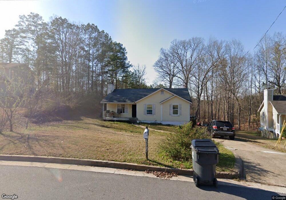
5797 Rock Rd Union City, GA 30291
Estimated Value: $177,000 - $242,413
3
Beds
2
Baths
1,156
Sq Ft
$183/Sq Ft
Est. Value
About This Home
This home is located at 5797 Rock Rd, Union City, GA 30291 and is currently estimated at $211,103, approximately $182 per square foot. 5797 Rock Rd is a home located in Fulton County with nearby schools including Liberty Point Elementary School, Camp Creek Middle School, and Langston Hughes High School.
Ownership History
Date
Name
Owned For
Owner Type
Purchase Details
Closed on
Jan 9, 2015
Sold by
Tobias Carlos Jose
Bought by
Echevarria Yahaira
Current Estimated Value
Purchase Details
Closed on
May 6, 2011
Sold by
Federal Home Loan Mortgage Corporation
Bought by
Tobias Carlos J
Purchase Details
Closed on
Dec 1, 2009
Sold by
Provident Fndg Assocs Lp
Bought by
Federal Home Loan Mortgage Corporation
Purchase Details
Closed on
Jun 28, 2007
Sold by
Brittian Sandra G
Bought by
Williams Sabrina P
Home Financials for this Owner
Home Financials are based on the most recent Mortgage that was taken out on this home.
Original Mortgage
$115,000
Interest Rate
6.37%
Mortgage Type
New Conventional
Purchase Details
Closed on
May 12, 2006
Sold by
Brittian J D
Bought by
Brittian Sandra G
Create a Home Valuation Report for This Property
The Home Valuation Report is an in-depth analysis detailing your home's value as well as a comparison with similar homes in the area
Home Values in the Area
Average Home Value in this Area
Purchase History
| Date | Buyer | Sale Price | Title Company |
|---|---|---|---|
| Echevarria Yahaira | -- | -- | |
| Tobias Carlos J | -- | -- | |
| Federal Home Loan Mortgage Corporation | -- | -- | |
| Provident Fndg Assocs Lp | $37,425 | -- | |
| Williams Sabrina P | $115,000 | -- | |
| Brittian Sandra G | -- | -- |
Source: Public Records
Mortgage History
| Date | Status | Borrower | Loan Amount |
|---|---|---|---|
| Previous Owner | Williams Sabrina P | $115,000 |
Source: Public Records
Tax History Compared to Growth
Tax History
| Year | Tax Paid | Tax Assessment Tax Assessment Total Assessment is a certain percentage of the fair market value that is determined by local assessors to be the total taxable value of land and additions on the property. | Land | Improvement |
|---|---|---|---|---|
| 2025 | $1,032 | $65,640 | $20,880 | $44,760 |
| 2023 | $2,036 | $72,120 | $24,440 | $47,680 |
| 2022 | $1,311 | $49,840 | $15,800 | $34,040 |
| 2021 | $1,010 | $37,240 | $9,800 | $27,440 |
| 2020 | $1,023 | $36,800 | $9,680 | $27,120 |
| 2019 | $1,162 | $27,520 | $6,920 | $20,600 |
| 2018 | $606 | $21,480 | $3,760 | $17,720 |
| 2017 | $627 | $21,480 | $3,760 | $17,720 |
| 2016 | $567 | $19,440 | $4,440 | $15,000 |
| 2015 | $875 | $19,440 | $4,440 | $15,000 |
| 2014 | $596 | $19,440 | $4,440 | $15,000 |
Source: Public Records
Map
Nearby Homes
- 6024 Diamond Ln
- 6000 Diamond Ln
- 5856 Rock Rd
- 4695 Ravenwood Loop
- 3227 Diamond Bluff
- 5910 Rock Rd
- 4605 Ravenwood Loop
- 4611 Ravenwood Loop
- 4615 Ravenwood Loop
- 0 Lower Dixie Lake Rd Unit 22475153
- 0 Lower Dixie Lake Rd Unit 7515143
- 000 Highpoint Rd
- 99 Highpoint Rd
- 5900 Union Woods Way
- 0 Lakeside Dr Unit 22475152
- 0 Lakeside Dr Unit 7515650
- 4111 Ravenwood Ct Unit 6
- 0 Highpoint Rd Unit 10553938
- 5787 Rock Rd Unit 5
- 5807 Rock Rd
- 5779 Rock Rd
- 5800 Rock Rd
- 5819 Rock Rd
- 5819 Rock Rd Unit 5819
- 5780 Rock Rd
- 5771 Rock Rd
- 5826 Rock Rd
- 4462 Ravenwood Dr
- 4460 Ravenwood Dr
- 4464 Ravenwood Dr
- 4458 Ravenwood Dr
- 4466 Ravenwood Dr Unit 301
- 4466 Ravenwood Dr
- 4456 Ravenwood Dr
- 3252 Diamond Bluff
- 3254 Diamond Bluff
- 4468 Ravenwood Dr
- 4454 Ravenwood Dr