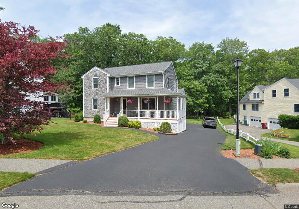
58 Athens Dr Lowell, MA 01854
Pawtucketville NeighborhoodEstimated Value: $689,658 - $761,000
3
Beds
3
Baths
2,648
Sq Ft
$269/Sq Ft
Est. Value
About This Home
This home is located at 58 Athens Dr, Lowell, MA 01854 and is currently estimated at $711,665, approximately $268 per square foot. 58 Athens Dr is a home located in Middlesex County with nearby schools including Joseph McAvinnue Elementary School, Charlotte M. Murkland Elementary School, and Dr. Gertrude Bailey Elementary School.
Ownership History
Date
Name
Owned For
Owner Type
Purchase Details
Closed on
Apr 6, 2021
Sold by
Spring Gary
Bought by
Gary G Spring 2007 Ret and Spring
Current Estimated Value
Purchase Details
Closed on
Oct 23, 2007
Sold by
Martin Lauren Ann
Bought by
Spring Gary
Create a Home Valuation Report for This Property
The Home Valuation Report is an in-depth analysis detailing your home's value as well as a comparison with similar homes in the area
Home Values in the Area
Average Home Value in this Area
Purchase History
| Date | Buyer | Sale Price | Title Company |
|---|---|---|---|
| Gary G Spring 2007 Ret | -- | None Available | |
| Gary G Spring 2007 Ret | -- | None Available | |
| Spring Gary | -- | -- | |
| Spring Gary | -- | -- | |
| Spring Gary | -- | -- |
Source: Public Records
Mortgage History
| Date | Status | Borrower | Loan Amount |
|---|---|---|---|
| Previous Owner | Spring Gary | $236,000 | |
| Previous Owner | Spring Gary | $243,660 |
Source: Public Records
Tax History Compared to Growth
Tax History
| Year | Tax Paid | Tax Assessment Tax Assessment Total Assessment is a certain percentage of the fair market value that is determined by local assessors to be the total taxable value of land and additions on the property. | Land | Improvement |
|---|---|---|---|---|
| 2025 | $7,370 | $642,000 | $178,900 | $463,100 |
| 2024 | $7,507 | $630,300 | $167,200 | $463,100 |
| 2023 | $7,245 | $583,300 | $145,400 | $437,900 |
| 2022 | $6,712 | $528,900 | $132,200 | $396,700 |
| 2021 | $6,244 | $463,900 | $114,900 | $349,000 |
| 2020 | $6,031 | $451,400 | $117,200 | $334,200 |
| 2019 | $6,089 | $433,700 | $103,300 | $330,400 |
| 2018 | $6,110 | $424,600 | $98,300 | $326,300 |
| 2017 | $5,808 | $389,300 | $89,400 | $299,900 |
| 2016 | $5,811 | $383,300 | $83,400 | $299,900 |
| 2015 | $5,423 | $350,300 | $81,600 | $268,700 |
| 2013 | $5,097 | $339,600 | $102,500 | $237,100 |
Source: Public Records
Map
Nearby Homes
- 101 Laurie Ln
- 591 Varnum Ave
- 6 Louis Farm Rd Unit 6
- 3 Louis Farm Rd Unit 3
- 527 Pawtucket Blvd Unit 304
- 527 Pawtucket Blvd Unit 207
- 1820 Skyline Dr Unit 18
- 311 Pawtucket Blvd Unit 9
- 20 Sandy Ln
- 307 Pawtucket Blvd Unit 24
- 2300 Skyline Dr Unit 3
- 149 Woodward Ave
- 1975 Middlesex St Unit 51
- 1975 Middlesex St Unit 10
- 25 W 5th Ave
- 530 Mammoth Rd Unit 42
- 24 Brouilette St Unit A
- 1401 Pawtucket Blvd Unit 10
- 4 Tamarack St
- 1461 Pawtucket Blvd Unit 12