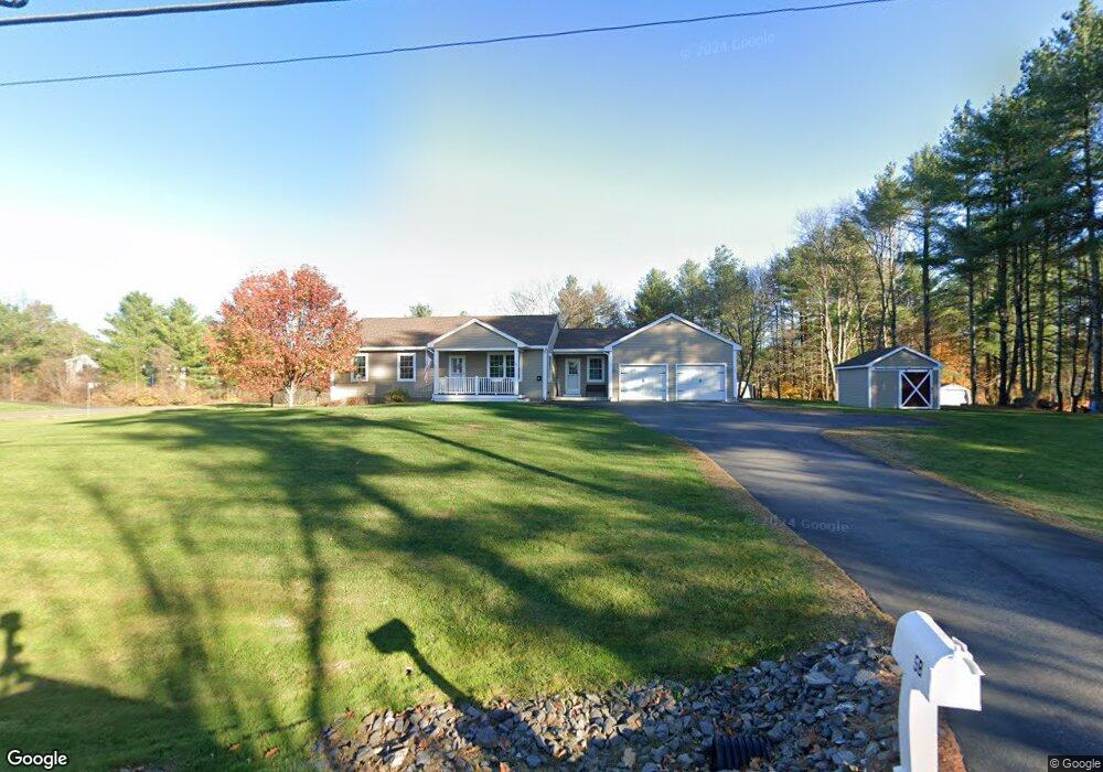
58 Bartlett Rd Gorham, ME 04038
Estimated Value: $456,000 - $611,000
3
Beds
2
Baths
1,376
Sq Ft
$380/Sq Ft
Est. Value
About This Home
This home is located at 58 Bartlett Rd, Gorham, ME 04038 and is currently estimated at $523,401, approximately $380 per square foot. 58 Bartlett Rd is a home with nearby schools including Narragansett Elementary School, Gorham Middle School, and Gorham High School.
Ownership History
Date
Name
Owned For
Owner Type
Purchase Details
Closed on
Sep 12, 2011
Sold by
John Peters Llc
Bought by
Rousseau Robert P and Rousseau Eilleen P
Current Estimated Value
Home Financials for this Owner
Home Financials are based on the most recent Mortgage that was taken out on this home.
Original Mortgage
$140,000
Outstanding Balance
$95,588
Interest Rate
4.58%
Mortgage Type
Purchase Money Mortgage
Estimated Equity
$427,813
Create a Home Valuation Report for This Property
The Home Valuation Report is an in-depth analysis detailing your home's value as well as a comparison with similar homes in the area
Home Values in the Area
Average Home Value in this Area
Purchase History
| Date | Buyer | Sale Price | Title Company |
|---|---|---|---|
| Rousseau Robert P | -- | -- |
Source: Public Records
Mortgage History
| Date | Status | Borrower | Loan Amount |
|---|---|---|---|
| Open | Rousseau Robert P | $140,000 |
Source: Public Records
Tax History
| Year | Tax Paid | Tax Assessment Tax Assessment Total Assessment is a certain percentage of the fair market value that is determined by local assessors to be the total taxable value of land and additions on the property. | Land | Improvement |
|---|---|---|---|---|
| 2025 | $6,188 | $418,100 | $97,600 | $320,500 |
| 2024 | $6,146 | $418,100 | $97,600 | $320,500 |
| 2023 | $5,749 | $418,100 | $97,600 | $320,500 |
| 2022 | $5,373 | $418,100 | $97,600 | $320,500 |
| 2021 | $4,759 | $245,300 | $81,400 | $163,900 |
| 2020 | $4,661 | $245,300 | $81,400 | $163,900 |
| 2019 | $4,648 | $245,300 | $81,400 | $163,900 |
| 2018 | $4,464 | $245,300 | $81,400 | $163,900 |
| 2017 | $4,839 | $245,300 | $81,400 | $163,900 |
| 2016 | $4,624 | $245,500 | $81,600 | $163,900 |
| 2015 | $4,002 | $245,500 | $81,600 | $163,900 |
| 2014 | $3,510 | $201,700 | $57,600 | $144,100 |
| 2013 | $3,676 | $212,500 | $68,400 | $144,100 |
Source: Public Records
Map
Nearby Homes
- 25 Longfellow Dr
- 280 Longfellow St Unit 17
- 218 Longfellow St
- 115 Saco St Unit 4
- 11 Dragonfly Ln
- 50 Hogan Cir Unit 2
- 52 Hogan Cir Unit 1
- 10 Hogan Cir Unit 35
- 12 Hogan Cir Unit 36
- 77 Mechanic St
- 17 Mechanic St
- 32 Kennard St
- 184 Central St
- 0 Cobb Rd
- 124 Brackett St
- 26 Stillwater Dr Unit 26
- 132 North St
- 18 Cole St
- 25 Cole St Unit 2
- 78 North St
- 6 Alberta Way
- Lot 2 Alberta Way
- 59 Bartlett Rd
- 14 Alberta Way
- 14 Alberta Way
- 342 New Portland Rd
- 348 New Portland Rd
- 346 New Portland Rd
- 00 Bartlett Rd
- 45 Bartlett Rd
- 17 Little Wing Ln
- 350 New Portland Rd
- 332 New Portland Rd
- 4 Bee Happy Way
- 42 Bartlett Rd
- 7 Little Wing Ln
- 352 New Portland Rd
- 329 New Portland Rd
- 25 Alberta Way
- 24 Alberta Way
Your Personal Tour Guide
Ask me questions while you tour the home.