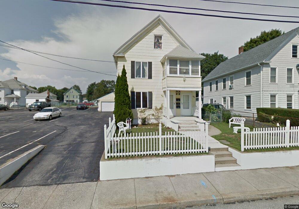
58 Denison Ave Groton, CT 06340
Estimated Value: $387,000 - $600,145
5
Beds
3
Baths
2,596
Sq Ft
$181/Sq Ft
Est. Value
About This Home
This home is located at 58 Denison Ave, Groton, CT 06340 and is currently estimated at $470,786, approximately $181 per square foot. 58 Denison Ave is a home located in New London County with nearby schools including Pleasant Valley School, Groton Middle School, and Robert E. Fitch High School.
Ownership History
Date
Name
Owned For
Owner Type
Purchase Details
Closed on
Jun 28, 2011
Sold by
Frankopoulos Angela
Bought by
Frankopoulos Patrick
Current Estimated Value
Purchase Details
Closed on
Jul 20, 2001
Sold by
Policarpo Jose V and Policarpo Luisa L
Bought by
Policarpo Luisa L and Grace Francis G
Purchase Details
Closed on
Aug 8, 1994
Sold by
Garagliano Thomas and Garagliano Arlene
Bought by
Frankopoulos Patrick and Frankopoulos Angela
Create a Home Valuation Report for This Property
The Home Valuation Report is an in-depth analysis detailing your home's value as well as a comparison with similar homes in the area
Home Values in the Area
Average Home Value in this Area
Purchase History
| Date | Buyer | Sale Price | Title Company |
|---|---|---|---|
| Frankopoulos Patrick | -- | -- | |
| Policarpo Luisa L | $75,000 | -- | |
| Frankopoulos Patrick | $150,000 | -- |
Source: Public Records
Mortgage History
| Date | Status | Borrower | Loan Amount |
|---|---|---|---|
| Previous Owner | Frankopoulos Patrick | $218,000 | |
| Previous Owner | Frankopoulos Patrick | $225,000 | |
| Previous Owner | Frankopoulos Patrick | $185,000 |
Source: Public Records
Tax History
| Year | Tax Paid | Tax Assessment Tax Assessment Total Assessment is a certain percentage of the fair market value that is determined by local assessors to be the total taxable value of land and additions on the property. | Land | Improvement |
|---|---|---|---|---|
| 2025 | $5,774 | $199,710 | $99,897 | $99,813 |
| 2024 | $5,291 | $196,770 | $99,015 | $97,755 |
| 2023 | $5,077 | $196,770 | $57,120 | $139,650 |
| 2022 | $4,909 | $196,770 | $57,120 | $139,650 |
| 2021 | $4,341 | $143,360 | $37,730 | $105,630 |
| 2020 | $4,216 | $143,360 | $37,730 | $105,630 |
| 2019 | $4,081 | $143,360 | $37,730 | $105,630 |
| 2018 | $4,122 | $143,360 | $37,730 | $105,630 |
| 2017 | $4,136 | $143,360 | $37,730 | $105,630 |
| 2016 | $4,404 | $162,120 | $46,340 | $115,780 |
| 2015 | $4,348 | $162,120 | $46,340 | $115,780 |
| 2014 | $4,045 | $162,120 | $46,340 | $115,780 |
Source: Public Records
Map
Nearby Homes
- 85 Baker Ave
- 3 George Ave
- 231 Poquonnock Rd
- 136 Blueberry Hill Rd
- 130 Meridian St Unit 301
- 50 School St
- 25 Morgan Ct
- 55 Virginia Ave Unit C
- 374 Meridian Street Extension Unit 68
- 279 Bridge St Unit 10
- 132 Thames St Unit R
- 108 Thames St
- 53 Bank St
- 147 Bank St
- 153 Bank St
- 41 Riverview Ave
- 400 Bank St Unit 402
- 9 Brewer St
- 0 Bonnie Cir
- 2 Coit St Unit 1
- 62 Denison Ave
- 69 Ledyard Ave
- 36 Denison Ave
- 43 Denison Ave
- 51 Denison Ave
- 83 Ledyard Ave
- 25 Denison Ave
- 49 Denison Ave
- 55 Denison Ave
- 59 Ledyard Ave
- 53 Denison Ave
- 17 Denison Ave
- 263 Mitchell St
- 61 Denison Ave
- 13 Denison Ave
- 65 Denison Ave
- 32 Denison Ave
- 84 Ledyard Ave
- 74 Ledyard Ave
- 90 Ledyard Ave
Your Personal Tour Guide
Ask me questions while you tour the home.