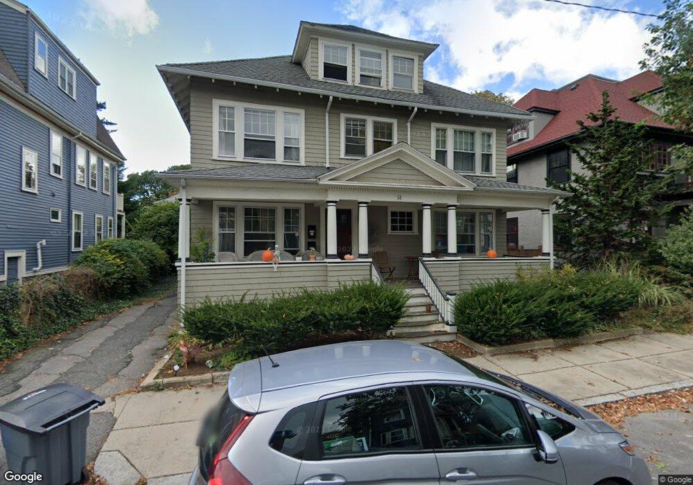
58 Dunster Rd Unit 2 Jamaica Plain, MA 02130
Jamaica Plain NeighborhoodEstimated Value: $1,002,000 - $1,860,000
4
Beds
2
Baths
2,340
Sq Ft
$625/Sq Ft
Est. Value
About This Home
This home is located at 58 Dunster Rd Unit 2, Jamaica Plain, MA 02130 and is currently estimated at $1,462,370, approximately $624 per square foot. 58 Dunster Rd Unit 2 is a home located in Suffolk County with nearby schools including The Croft School - Jamaica Plain and Meridian Academy.
Ownership History
Date
Name
Owned For
Owner Type
Purchase Details
Closed on
Mar 4, 2005
Sold by
Whittredge Donald G
Bought by
Whittredge Ann M and Whittredge Peter
Current Estimated Value
Create a Home Valuation Report for This Property
The Home Valuation Report is an in-depth analysis detailing your home's value as well as a comparison with similar homes in the area
Home Values in the Area
Average Home Value in this Area
Purchase History
| Date | Buyer | Sale Price | Title Company |
|---|---|---|---|
| Whittredge Ann M | -- | -- | |
| Whittredge Ann M | -- | -- |
Source: Public Records
Mortgage History
| Date | Status | Borrower | Loan Amount |
|---|---|---|---|
| Previous Owner | Whittredge Ann M | $201,600 |
Source: Public Records
Tax History Compared to Growth
Tax History
| Year | Tax Paid | Tax Assessment Tax Assessment Total Assessment is a certain percentage of the fair market value that is determined by local assessors to be the total taxable value of land and additions on the property. | Land | Improvement |
|---|---|---|---|---|
| 2025 | $15,044 | $1,299,100 | $462,800 | $836,300 |
| 2024 | $13,758 | $1,262,200 | $437,400 | $824,800 |
| 2023 | $13,417 | $1,249,300 | $432,900 | $816,400 |
| 2022 | $12,699 | $1,167,200 | $404,500 | $762,700 |
| 2021 | $11,531 | $1,080,700 | $374,500 | $706,200 |
| 2020 | $11,381 | $1,077,700 | $358,300 | $719,400 |
| 2019 | $10,795 | $1,024,200 | $284,800 | $739,400 |
| 2018 | $10,029 | $957,000 | $284,800 | $672,200 |
| 2017 | $10,135 | $957,000 | $284,800 | $672,200 |
| 2016 | $9,235 | $839,500 | $284,800 | $554,700 |
| 2015 | $9,196 | $759,400 | $218,600 | $540,800 |
| 2014 | $8,144 | $647,400 | $218,600 | $428,800 |
Source: Public Records
Map
Nearby Homes
- 54 Arborway
- 2 Brewer St
- 29 Goldsmith St Unit 1
- 27-29 Ballard St
- 55 South St
- 55 South St Unit 3
- 18 Atwood Square Unit 3
- 15 Harris Ave
- 41 Jamaica St
- 36 Alveston St
- 1000 Centre St Unit 4
- 584 Centre St
- 96 Jamaica St
- 93 Sedgwick St
- 16 Mcbride St Unit 1
- 16 Mcbride St
- 76 Elm St Unit G05
- 10 Jamaicaway Ct Unit 25
- 10 Jamaicaway Ct Unit 24
- 66 Seaverns Ave Unit 68B
- 58 Dunster Rd
- 58 Dunster Rd
- 54 Dunster Rd Unit 2
- 54 Dunster Rd Unit 1
- 62 Dunster Rd Unit 2
- 62 Dunster Rd Unit 1
- 62 Dunster Rd
- 53 Aldworth St
- 53 Aldworth St Unit 2
- 50 Dunster Rd Unit 2
- 50 Dunster Rd Unit 1
- 61 Aldworth St
- 49 Aldworth St
- 59 Dunster Rd Unit 2
- 59 Dunster Rd Unit 1
- 59 Dunster Rd
- 55 Dunster Rd
- 55 Dunster Rd Unit 1
- 16 Dane St
- 16 Dane St Unit 2