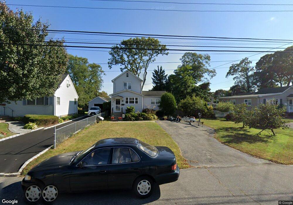
58 Independence Ave Babylon, NY 11702
Estimated Value: $564,052 - $677,000
3
Beds
2
Baths
1,090
Sq Ft
$572/Sq Ft
Est. Value
About This Home
This home is located at 58 Independence Ave, Babylon, NY 11702 and is currently estimated at $623,513, approximately $572 per square foot. 58 Independence Ave is a home located in Suffolk County with nearby schools including Robert Moses Middle School, North Babylon High School, and South Bay Junior Academy.
Ownership History
Date
Name
Owned For
Owner Type
Purchase Details
Closed on
Oct 23, 2013
Sold by
Stephenson David and Stephenson Scott
Bought by
Stephenson Family Trust
Current Estimated Value
Home Financials for this Owner
Home Financials are based on the most recent Mortgage that was taken out on this home.
Original Mortgage
$255,290
Outstanding Balance
$190,858
Interest Rate
4.37%
Mortgage Type
FHA
Estimated Equity
$432,655
Purchase Details
Closed on
Apr 25, 2007
Create a Home Valuation Report for This Property
The Home Valuation Report is an in-depth analysis detailing your home's value as well as a comparison with similar homes in the area
Home Values in the Area
Average Home Value in this Area
Purchase History
| Date | Buyer | Sale Price | Title Company |
|---|---|---|---|
| Stephenson Family Trust | $260,000 | -- | |
| -- | -- | -- |
Source: Public Records
Mortgage History
| Date | Status | Borrower | Loan Amount |
|---|---|---|---|
| Open | Stephenson Family Trust | $255,290 |
Source: Public Records
Tax History
| Year | Tax Paid | Tax Assessment Tax Assessment Total Assessment is a certain percentage of the fair market value that is determined by local assessors to be the total taxable value of land and additions on the property. | Land | Improvement |
|---|---|---|---|---|
| 2024 | $5,836 | $1,870 | $270 | $1,600 |
| 2023 | $5,836 | $1,870 | $270 | $1,600 |
| 2022 | $4,651 | $1,870 | $270 | $1,600 |
| 2021 | $4,651 | $1,870 | $270 | $1,600 |
| 2020 | $5,060 | $1,870 | $270 | $1,600 |
| 2019 | $5,060 | $0 | $0 | $0 |
| 2018 | $4,694 | $1,870 | $270 | $1,600 |
| 2017 | $4,694 | $1,870 | $270 | $1,600 |
| 2016 | $4,722 | $1,870 | $270 | $1,600 |
| 2015 | -- | $1,870 | $270 | $1,600 |
| 2014 | -- | $1,870 | $270 | $1,600 |
Source: Public Records
Map
Nearby Homes
- 103 Foster Blvd
- 109 Vesper Ct
- 967 Sunrise Hwy
- 326 Edmunton Dr Unit L-7
- 294 Edmunton Dr Unit K18
- 192 Edmunton Dr Unit D1
- 285 Edmunton Dr Unit 16
- 265 Edmunton Dr Unit I-12
- 112 Edmunton Dr Unit C4
- 205 Edmunton Dr Unit H-18
- 205 Edmunton Dr Unit H17
- 111 Edmunton Dr Unit G4
- 141 Edmunton Dr Unit G 18
- 51 Edmunton Dr Unit F17
- 53 Canterbury Ln
- 60 Liberty Ave
- 43 Springwood Dr
- 42 Springwood Dr
- 60 Pickwick Ln
- 7 Lico Place
- 56 Independence Ave
- 60 Independence Ave
- 50 Independence Ave
- 107 Foster Blvd
- 64 Independence Ave
- 103 Foster Blvd
- 111 Foster Blvd
- 44 Independence Ave
- 77 Independence Ave
- 99 Foster Blvd
- 71 Independence Ave
- 83 Independence Ave
- 80 Independence Ave
- 115 Foster Blvd
- 65 Independence Ave
- 95 Foster Blvd
- 40 Independence Ave
- 87 Independence Ave
- 57 Independence Ave
- 119 Foster Blvd
Your Personal Tour Guide
Ask me questions while you tour the home.