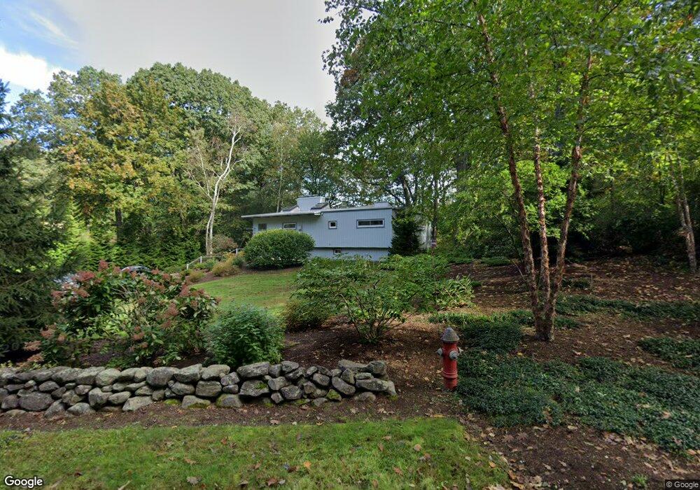
58 Jennie Dugan Rd Concord, MA 01742
Estimated Value: $1,189,000 - $1,287,000
4
Beds
3
Baths
1,296
Sq Ft
$958/Sq Ft
Est. Value
About This Home
This home is located at 58 Jennie Dugan Rd, Concord, MA 01742 and is currently estimated at $1,241,247, approximately $957 per square foot. 58 Jennie Dugan Rd is a home located in Middlesex County with nearby schools including Willard School, Concord Middle School, and Corwin-Russell School at Broccoli Hall.
Ownership History
Date
Name
Owned For
Owner Type
Purchase Details
Closed on
Oct 16, 1998
Sold by
Russell Anne E
Bought by
Clark Priscilla L
Current Estimated Value
Home Financials for this Owner
Home Financials are based on the most recent Mortgage that was taken out on this home.
Original Mortgage
$75,000
Outstanding Balance
$16,443
Interest Rate
6.64%
Estimated Equity
$1,224,804
Create a Home Valuation Report for This Property
The Home Valuation Report is an in-depth analysis detailing your home's value as well as a comparison with similar homes in the area
Home Values in the Area
Average Home Value in this Area
Purchase History
| Date | Buyer | Sale Price | Title Company |
|---|---|---|---|
| Clark Priscilla L | $379,000 | -- |
Source: Public Records
Mortgage History
| Date | Status | Borrower | Loan Amount |
|---|---|---|---|
| Open | Clark Priscilla L | $75,000 | |
| Open | Clark Priscilla L | $227,150 |
Source: Public Records
Tax History Compared to Growth
Tax History
| Year | Tax Paid | Tax Assessment Tax Assessment Total Assessment is a certain percentage of the fair market value that is determined by local assessors to be the total taxable value of land and additions on the property. | Land | Improvement |
|---|---|---|---|---|
| 2025 | $145 | $1,092,500 | $664,600 | $427,900 |
| 2024 | $13,881 | $1,057,200 | $664,600 | $392,600 |
| 2023 | $13,301 | $1,026,300 | $633,700 | $392,600 |
| 2022 | $12,258 | $830,500 | $508,300 | $322,200 |
| 2021 | $12,065 | $819,600 | $508,300 | $311,300 |
| 2020 | $11,388 | $800,300 | $508,300 | $292,000 |
| 2019 | $11,251 | $792,900 | $493,600 | $299,300 |
| 2018 | $10,539 | $737,500 | $448,900 | $288,600 |
| 2017 | $10,357 | $736,100 | $458,300 | $277,800 |
| 2016 | $10,320 | $741,400 | $458,300 | $283,100 |
| 2015 | $9,293 | $650,300 | $396,300 | $254,000 |
Source: Public Records
Map
Nearby Homes
- 40 Rookery Ln Unit 5
- 72 Rookery Ln Unit 3
- 121 White Pond Way Unit 121
- 24 Rookery Ln Unit 6
- 56 Rookery Ln Unit 4
- 401 Emery Ln Unit 104
- 37 Wolf Pine Way
- 42 Dakin Rd
- 497 Old Road to 9 Acre Corner
- 16 Blacksmith Dr
- 114 Upland Rd
- 12 S Meadow Ridge Unit 12
- 12 S Meadow Ridge
- 369 Border Rd
- 111 Central St
- 70 McCallar Ln
- 102 Highland St
- 29 Black Birch Ln Unit 29
- 1844 Main St Unit 1844
- 1053 Main St
- 44 Jennie Dugan Rd
- 76 Jennie Dugan Rd
- 472 Powder Mill Rd
- 460 Powder Mill Rd
- 98 Jennie Dugan Rd
- 71 Jennie Dugan Rd
- 85 Jennie Dugan Rd
- 25 Jennie Dugan Rd
- 22 Jennie Dugan Rd
- 30 Jennie Dugan Rd
- 118 Jennie Dugan Rd
- 97 Jennie Dugan Rd
- 414 Powder Mill Rd
- 473 Powder Mill Rd
- 132 Jennie Dugan Rd
- 429 Powder Mill Rd
- 113 Jennie Dugan Rd
- 10 Tracy St
- 125 Jennie Dugan Rd
- 400 Powder Mill Rd