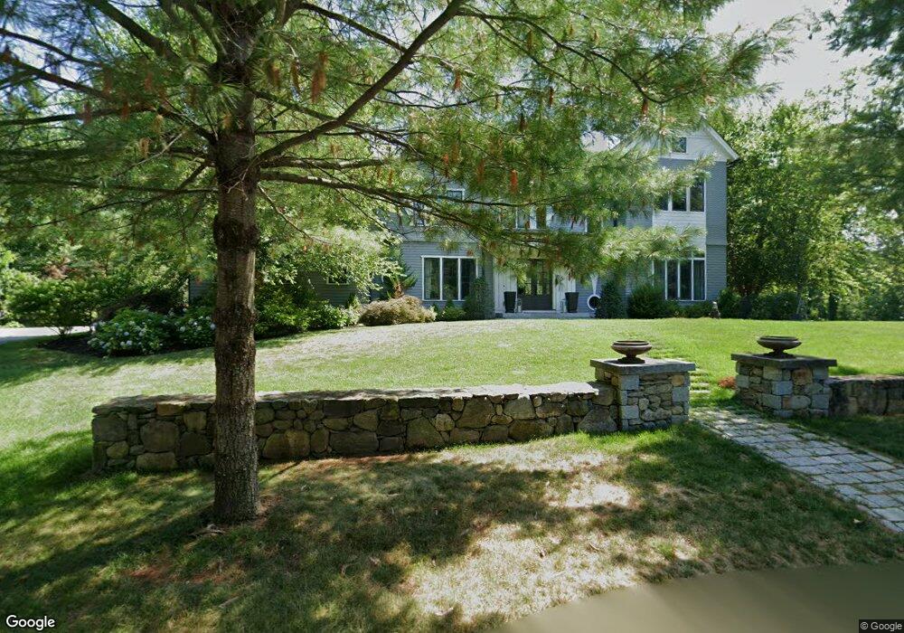
58 Johnson Rd Carlisle, MA 01741
Estimated Value: $2,178,521 - $2,542,000
5
Beds
5
Baths
5,763
Sq Ft
$407/Sq Ft
Est. Value
About This Home
This home is located at 58 Johnson Rd, Carlisle, MA 01741 and is currently estimated at $2,347,380, approximately $407 per square foot. 58 Johnson Rd is a home with nearby schools including Carlisle School and Middlesex School.
Ownership History
Date
Name
Owned For
Owner Type
Purchase Details
Closed on
Dec 9, 2014
Sold by
Mcgeough John T
Bought by
Mcgeough Nicole and Mcgeough John T
Current Estimated Value
Home Financials for this Owner
Home Financials are based on the most recent Mortgage that was taken out on this home.
Original Mortgage
$650,000
Outstanding Balance
$477,364
Interest Rate
3%
Mortgage Type
Adjustable Rate Mortgage/ARM
Estimated Equity
$1,870,016
Purchase Details
Closed on
Dec 23, 2013
Sold by
Wilkins Hill Realty Ll
Bought by
Mcgerough John T
Home Financials for this Owner
Home Financials are based on the most recent Mortgage that was taken out on this home.
Original Mortgage
$1,100,000
Interest Rate
4.15%
Mortgage Type
Purchase Money Mortgage
Create a Home Valuation Report for This Property
The Home Valuation Report is an in-depth analysis detailing your home's value as well as a comparison with similar homes in the area
Home Values in the Area
Average Home Value in this Area
Purchase History
| Date | Buyer | Sale Price | Title Company |
|---|---|---|---|
| Mcgeough Nicole | -- | -- | |
| Mcgerough John T | $410,000 | -- |
Source: Public Records
Mortgage History
| Date | Status | Borrower | Loan Amount |
|---|---|---|---|
| Open | Mcgeough Nicole | $650,000 | |
| Closed | Mcgeough Nicole | $630,000 | |
| Previous Owner | Mcgerough John T | $1,100,000 |
Source: Public Records
Tax History Compared to Growth
Tax History
| Year | Tax Paid | Tax Assessment Tax Assessment Total Assessment is a certain percentage of the fair market value that is determined by local assessors to be the total taxable value of land and additions on the property. | Land | Improvement |
|---|---|---|---|---|
| 2025 | $26,651 | $2,022,100 | $590,400 | $1,431,700 |
| 2024 | $26,577 | $1,993,800 | $546,800 | $1,447,000 |
| 2023 | $25,327 | $1,789,900 | $502,400 | $1,287,500 |
| 2022 | $26,852 | $1,627,400 | $480,000 | $1,147,400 |
| 2021 | $26,494 | $1,627,400 | $480,000 | $1,147,400 |
| 2020 | $27,437 | $1,494,400 | $392,800 | $1,101,600 |
| 2019 | $26,775 | $1,463,900 | $392,800 | $1,071,100 |
| 2018 | $25,307 | $1,392,800 | $392,800 | $1,000,000 |
| 2017 | $24,455 | $1,387,900 | $392,800 | $995,100 |
| 2016 | $23,872 | $1,387,900 | $392,800 | $995,100 |
| 2015 | $23,976 | $1,261,900 | $392,800 | $869,100 |
| 2014 | $7,322 | $392,800 | $392,800 | $0 |
Source: Public Records
Map
Nearby Homes
- 1420 Curve St
- 1056 Curve St
- 225 Lowell St
- 1 Garrison Way Unit 1
- 8 Kay's Walk Unit 13
- 14 Kay's Walk
- 6 Kay's Walk Unit 6
- 6 Kay's Walk
- 2 Kay's Walk Unit 18
- 4 Kay's Walk Unit 15
- 875 Acton St
- 12 Martin St
- 3 Kay's Walk
- 15 Kay's Walk
- 1 Kay's Walk Unit 1
- 1 Kay's Walk
- 13 Kay's Walk
- 15 Kay's Walk Unit 4
- 3 Kay's Walk Unit 3
- 232 Baldwin Rd
- 82 Johnson Rd
- 67 Johnson Rd
- 32 Johnson Rd
- 99 Johnson Rd
- 35 Johnson Rd
- 112 Johnson Rd
- 103 Johnson Rd
- 546 Westford St
- 15 Johnson Rd
- 131 Virginia Farme Ln
- 153 Virginia Farme Ln
- 180 Hanover Rd
- 171 Hanover Rd
- 105 Virginia Farme Ln
- 514 Westford St
- 547 Westford St
- 76 Sorli Way
- 90 Hanover Rd
- 183 Virginia Farme Ln
- 81 Virginia Farme Ln