
Seller's Agent in 2026
Robert Richardson
Crye-Leike
(501) 580-1808
1 in this area
155 Total Sales
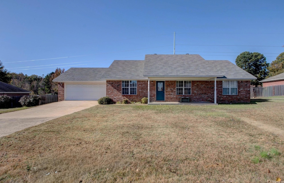
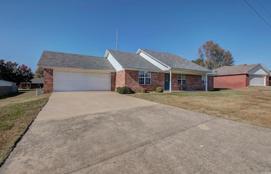
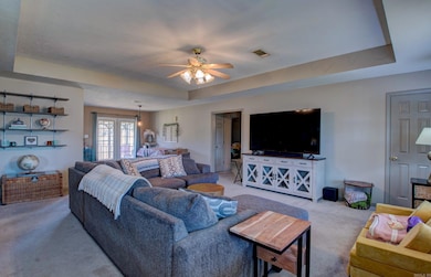
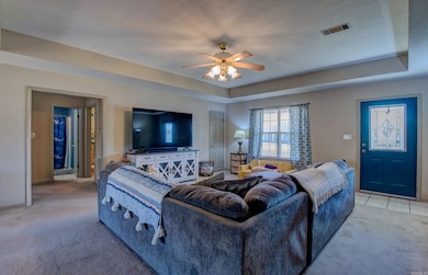
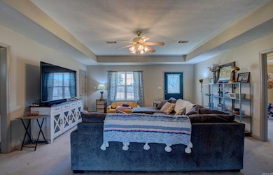
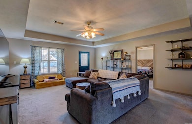
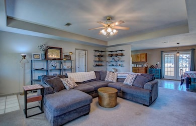
Welcome to this fantastic Mayflower home featuring an open, split floorplan on a spacious one-acre lot! Enjoy a bright and inviting living area that flows seamlessly into the kitchen, which offers abundant storage and a gas cooktop—perfect for home chefs. The primary suite is privately situated apart from the guest bedrooms for added comfort. Major updates include a 2019 roof and a 2021 water heater. The property also includes a two-car garage and plenty of room to spread out outdoors. A great blend of space, convenience, and modern comfort—don’t miss this one!
Last Agent to Sell the Property
Crye-Leike REALTORS Kanis Branch Listed on: 11/14/2025
| Date | Type | Sale Price | Title Company |
|---|---|---|---|
| Warranty Deed | $229,900 | None Listed On Document | |
| Warranty Deed | $145,000 | Attorney S Title Group Llc |
| Date | Status | Loan Amount | Loan Type |
|---|---|---|---|
| Open | $232,222 | New Conventional | |
| Previous Owner | $146,464 | New Conventional |
| Date | Event | Price | List to Sale | Price per Sq Ft |
|---|---|---|---|---|
| 02/27/2026 02/27/26 | Sold | $229,900 | 0.0% | $147 / Sq Ft |
| 01/17/2026 01/17/26 | Pending | -- | -- | -- |
| 11/14/2025 11/14/25 | For Sale | $229,900 | -- | $147 / Sq Ft |
| Year | Tax Paid | Tax Assessment Tax Assessment Total Assessment is a certain percentage of the fair market value that is determined by local assessors to be the total taxable value of land and additions on the property. | Land | Improvement |
|---|---|---|---|---|
| 2025 | $1,428 | $36,500 | $2,400 | $34,100 |
| 2024 | $1,373 | $36,500 | $2,400 | $34,100 |
| 2023 | $1,308 | $27,660 | $2,400 | $25,260 |
| 2022 | $941 | $27,660 | $2,400 | $25,260 |
| 2021 | $852 | $27,660 | $2,400 | $25,260 |
| 2020 | $797 | $21,530 | $2,400 | $19,130 |
| 2019 | $797 | $21,530 | $2,400 | $19,130 |
| 2018 | $822 | $21,530 | $2,400 | $19,130 |
| 2017 | $1,172 | $21,530 | $2,400 | $19,130 |
| 2016 | $1,172 | $21,530 | $2,400 | $19,130 |
| 2015 | $1,194 | $22,610 | $2,400 | $20,210 |
| 2014 | $1,229 | $22,610 | $2,400 | $20,210 |
Seller's Agent in 2026
Robert Richardson
Crye-Leike
(501) 580-1808
1 in this area
155 Total Sales
Buyer's Agent in 2026
Kenny Van Patten
Berkshire Hathaway HomeServices Arkansas Realty
(501) 951-1755
1 in this area
86 Total Sales
Source: Cooperative Arkansas REALTORS® MLS
MLS Number: 25045545
APN: 760-01227-020
Disclaimer: Certain information contained herein is derived from information provided by parties other than Homes.com. All information provided is deemed reliable, but is not guaranteed to be accurate and should be independently verified.
![]() IDX information is provided exclusively for personal, non-commercial use, and may not be used for any purpose other than to identify prospective properties consumers may be interested in purchasing.
IDX information is provided exclusively for personal, non-commercial use, and may not be used for any purpose other than to identify prospective properties consumers may be interested in purchasing.
Ask me questions while you tour the home.