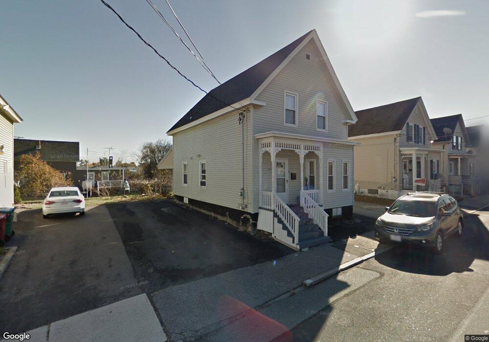
58 Main St Lowell, MA 01852
Sacred Heart NeighborhoodEstimated Value: $372,000 - $424,000
3
Beds
2
Baths
1,291
Sq Ft
$315/Sq Ft
Est. Value
About This Home
This home is located at 58 Main St, Lowell, MA 01852 and is currently estimated at $406,125, approximately $314 per square foot. 58 Main St is a home located in Middlesex County with nearby schools including Abraham Lincoln Elementary School, Moody Elementary School, and Greenhalge Elementary School.
Ownership History
Date
Name
Owned For
Owner Type
Purchase Details
Closed on
Sep 1, 2022
Sold by
Chea Tola
Bought by
Chea Tola and Khuon Sengthai
Current Estimated Value
Purchase Details
Closed on
Nov 15, 2019
Sold by
Khuon Sengthai and Chea Tola
Bought by
Chea Tola
Purchase Details
Closed on
Oct 16, 2017
Sold by
Valliere Charles J
Bought by
Khuon Sengthai and Chea Tola
Home Financials for this Owner
Home Financials are based on the most recent Mortgage that was taken out on this home.
Original Mortgage
$247,500
Interest Rate
3.82%
Mortgage Type
Commercial
Purchase Details
Closed on
Aug 15, 2017
Sold by
Robbins David A Est and Sullivan
Bought by
Valliere Charles J
Purchase Details
Closed on
May 5, 2005
Sold by
Robbins Bana Day and Robbins David A
Bought by
Robbins David A
Create a Home Valuation Report for This Property
The Home Valuation Report is an in-depth analysis detailing your home's value as well as a comparison with similar homes in the area
Home Values in the Area
Average Home Value in this Area
Purchase History
| Date | Buyer | Sale Price | Title Company |
|---|---|---|---|
| Chea Tola | -- | None Available | |
| Chea Tola | -- | None Available | |
| Chea Tola | -- | -- | |
| Chea Tola | -- | -- | |
| Khuon Sengthai | $247,500 | -- | |
| Valliere Charles J | $175,000 | -- | |
| Valliere Charles J | $175,000 | -- | |
| Robbins David A | -- | -- | |
| Robbins David A | -- | -- |
Source: Public Records
Mortgage History
| Date | Status | Borrower | Loan Amount |
|---|---|---|---|
| Previous Owner | Khuon Sengthai | $247,500 |
Source: Public Records
Tax History
| Year | Tax Paid | Tax Assessment Tax Assessment Total Assessment is a certain percentage of the fair market value that is determined by local assessors to be the total taxable value of land and additions on the property. | Land | Improvement |
|---|---|---|---|---|
| 2025 | $4,189 | $364,900 | $118,200 | $246,700 |
| 2024 | $4,082 | $342,700 | $110,500 | $232,200 |
| 2023 | $3,850 | $310,000 | $96,100 | $213,900 |
| 2022 | $3,514 | $276,900 | $87,400 | $189,500 |
| 2021 | $3,282 | $243,800 | $76,000 | $167,800 |
| 2020 | $3,169 | $237,200 | $72,200 | $165,000 |
| 2019 | $2,906 | $207,000 | $66,900 | $140,100 |
| 2018 | $2,964 | $189,200 | $63,700 | $125,500 |
| 2017 | $2,644 | $177,200 | $57,900 | $119,300 |
| 2016 | $2,423 | $159,800 | $50,600 | $109,200 |
| 2015 | $2,461 | $159,000 | $50,600 | $108,400 |
| 2013 | $2,528 | $168,400 | $56,500 | $111,900 |
Source: Public Records
Map
Nearby Homes
- 6 Cottage Place
- 131 London St
- 255 Plain St
- 28 Court St
- 84 Cambridge St
- 39 Moore St
- 186 Powell St
- 525 Chelmsford St
- 7 Butler Ave Unit 5
- 15 Barclay St
- 8 Cedar Ct
- 95 S Highland St
- 201 Thorndike St Unit 501
- 201 Thorndike St Unit 2-312
- 201 Thorndike St Unit 505
- 191 Thorndike St Unit 26
- 5 Floyd St
- 710 School St
- 106 Lundberg St Unit 6
- 85 B St
Your Personal Tour Guide
Ask me questions while you tour the home.