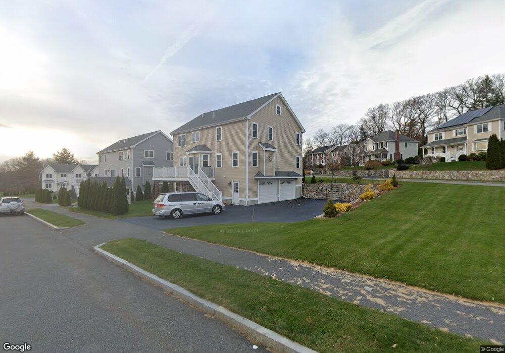
58 Matthew Ln Waltham, MA 02452
North Waltham NeighborhoodEstimated Value: $1,781,256 - $2,288,000
4
Beds
4
Baths
4,000
Sq Ft
$487/Sq Ft
Est. Value
About This Home
This home is located at 58 Matthew Ln, Waltham, MA 02452 and is currently estimated at $1,949,064, approximately $487 per square foot. 58 Matthew Ln is a home located in Middlesex County with nearby schools including Northeast Elementary School, John F Kennedy Middle School, and Waltham Sr High School.
Ownership History
Date
Name
Owned For
Owner Type
Purchase Details
Closed on
Oct 28, 2009
Sold by
9 Acres Dev Llc
Bought by
Barmakian Avedis G
Current Estimated Value
Home Financials for this Owner
Home Financials are based on the most recent Mortgage that was taken out on this home.
Original Mortgage
$417,000
Outstanding Balance
$273,119
Interest Rate
5.06%
Mortgage Type
Purchase Money Mortgage
Estimated Equity
$1,675,945
Create a Home Valuation Report for This Property
The Home Valuation Report is an in-depth analysis detailing your home's value as well as a comparison with similar homes in the area
Home Values in the Area
Average Home Value in this Area
Purchase History
| Date | Buyer | Sale Price | Title Company |
|---|---|---|---|
| Barmakian Avedis G | $1,052,000 | -- |
Source: Public Records
Mortgage History
| Date | Status | Borrower | Loan Amount |
|---|---|---|---|
| Open | Barmakian Avedis G | $417,000 |
Source: Public Records
Tax History Compared to Growth
Tax History
| Year | Tax Paid | Tax Assessment Tax Assessment Total Assessment is a certain percentage of the fair market value that is determined by local assessors to be the total taxable value of land and additions on the property. | Land | Improvement |
|---|---|---|---|---|
| 2025 | $15,885 | $1,617,600 | $479,700 | $1,137,900 |
| 2024 | $15,277 | $1,584,700 | $458,500 | $1,126,200 |
| 2023 | $15,199 | $1,472,800 | $416,000 | $1,056,800 |
| 2022 | $15,850 | $1,422,800 | $416,000 | $1,006,800 |
| 2021 | $15,403 | $1,360,700 | $399,000 | $961,700 |
| 2020 | $15,408 | $1,289,400 | $373,600 | $915,800 |
| 2019 | $14,275 | $1,127,600 | $366,800 | $760,800 |
| 2018 | $12,899 | $1,022,900 | $339,600 | $683,300 |
| 2017 | $12,261 | $976,200 | $292,900 | $683,300 |
| 2016 | $11,689 | $955,000 | $271,700 | $683,300 |
| 2015 | $12,055 | $918,100 | $267,400 | $650,700 |
Source: Public Records
Map
Nearby Homes
- 116 Raffaele Dr
- 55 Circle Dr
- 70 Rosewood Dr
- 750 Trapelo Rd
- 28 College Farm Rd Unit 2
- 23 Wight St
- 107 Clocktower Dr Unit 3302
- 170 Clocktower Dr Unit 5103
- 30 Jacqueline Rd Unit C
- 87 Clocktower Dr Unit 2207
- 65 Woburn St
- 14 Piedmont Ave
- 44 Sachem St
- 129 Lake St
- 30 Wampum Ave
- 511 Lexington St
- 65 Montclair Ave
- 1105 Lexington St Unit 102
- 49 Lincoln St
- 28 Hillcrest St
- 57 Matthew Ln
- 56 Matthew Ln
- 55 Matthew Ln
- 29 Michaelchris Dr
- 220 Bishops Forest Dr
- 219 Bishops Forest Dr
- 218 Bishops Forest Dr
- 217 Bishops Forest Dr
- 216 Bishops Forest Dr
- 215 Bishops Forest Dr
- 214 Bishops Forest Dr
- 213 Bishops Forest Dr
- 212 Bishops Forest Dr
- 211 Bishops Forest Dr
- 210 Bishops Forest Dr
- 209 Bishops Forest Dr
- 208 Bishops Forest Dr
- 206 Bishops Forest Dr
- 205 Bishops Forest Dr
- 204 Bishops Forest Dr