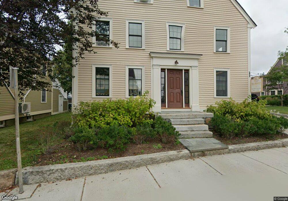
58 Middle St Gloucester, MA 01930
Central Gloucester Neighborhood
2
Beds
5
Baths
2,947
Sq Ft
7,710
Sq Ft Lot
About This Home
This home is located at 58 Middle St, Gloucester, MA 01930. 58 Middle St is a home located in Essex County with nearby schools including Beeman Memorial, Ralph B O'maley Middle School, and Gloucester High School.
Ownership History
Date
Name
Owned For
Owner Type
Purchase Details
Closed on
Dec 30, 2021
Sold by
Mary C Babson Ret and Babson
Bought by
Roger Babson Hmtead Llc
Purchase Details
Closed on
Nov 1, 2018
Sold by
58 Middle Street Rt
Bought by
Beaver-Massone Patrick D and Massone Kenneth J
Home Financials for this Owner
Home Financials are based on the most recent Mortgage that was taken out on this home.
Original Mortgage
$400,000
Interest Rate
4.6%
Mortgage Type
New Conventional
Purchase Details
Closed on
Jan 21, 1994
Sold by
Open Church Foundation
Bought by
Homestead Roger and Homestead Babson
Home Financials for this Owner
Home Financials are based on the most recent Mortgage that was taken out on this home.
Original Mortgage
$140,000
Interest Rate
7.08%
Mortgage Type
Commercial
Create a Home Valuation Report for This Property
The Home Valuation Report is an in-depth analysis detailing your home's value as well as a comparison with similar homes in the area
Home Values in the Area
Average Home Value in this Area
Purchase History
| Date | Buyer | Sale Price | Title Company |
|---|---|---|---|
| Roger Babson Hmtead Llc | -- | None Available | |
| Mary C Babson Ret | $235,422 | None Available | |
| Noyes Ruth | -- | None Available | |
| Roger Babson Hmtead Llc | -- | None Available | |
| Mary C Babson Ret | $235,422 | None Available | |
| Noyes Ruth | -- | None Available | |
| Beaver-Massone Patrick D | $981,000 | -- | |
| Beaver-Massone Patrick | $981,000 | -- | |
| Homestead Roger | $121,500 | -- | |
| Roger Babson Homestead | $121,500 | -- |
Source: Public Records
Mortgage History
| Date | Status | Borrower | Loan Amount |
|---|---|---|---|
| Previous Owner | Beaver-Massone Patrick | $400,000 | |
| Previous Owner | Roger Babson Homestead | $140,000 |
Source: Public Records
Tax History
| Year | Tax Paid | Tax Assessment Tax Assessment Total Assessment is a certain percentage of the fair market value that is determined by local assessors to be the total taxable value of land and additions on the property. | Land | Improvement |
|---|---|---|---|---|
| 2025 | $6,018 | $619,100 | $219,300 | $399,800 |
| 2024 | $5,058 | $589,000 | $208,900 | $380,100 |
| 2023 | $0 | $561,200 | $186,500 | $374,700 |
| 2022 | $0 | $483,700 | $162,200 | $321,500 |
| 2021 | $0 | $415,600 | $147,400 | $268,200 |
| 2020 | $5,058 | $397,000 | $147,400 | $249,600 |
| 2019 | $0 | $394,300 | $147,400 | $246,900 |
| 2018 | $0 | $389,000 | $147,400 | $241,600 |
| 2017 | $0 | $379,400 | $140,500 | $238,900 |
| 2016 | -- | $379,900 | $141,000 | $238,900 |
| 2015 | -- | $379,900 | $141,000 | $238,900 |
Source: Public Records
Map
Nearby Homes
- 35 Middle St Unit 4
- 33 Middle St
- 191 Main St Unit 3
- 191 Main St Unit 2A
- 20 Beacon St
- 20 Beacon St Unit 2
- 20 Beacon St Unit 1
- 33 Maplewood Ave Unit 310
- 120 Washington St
- 113 Pleasant St
- 50 Warner St
- 13 Leslie o Johnson Rd
- 14R Spring St Unit 3
- 9 Cleveland Place
- 15 Harvard St
- 12 Arthur St
- 40 Sargent St
- 98 Maplewood Ave
- 60 Rocky Neck Ave Unit 202
- 73 Rocky Neck Ave Unit 2
- 64 Middle St
- 56 Middle St
- 56 Middle St Unit 2
- 45 Middle St
- 3 Church St
- 5 Church St
- 9 Church St
- 52 Middle St
- 51 Middle St
- 13 Short St Unit A
- 13 Short St Unit B
- 15 Short St
- 43 Middle St
- 15 Short St Unit 2
- 5 Proctor St
- 11 Church St
- 11 Proctor St
- 57 Middle St Unit 3
- 57 Middle St Unit 2
- 57 Middle St Unit 1
Your Personal Tour Guide
Ask me questions while you tour the home.