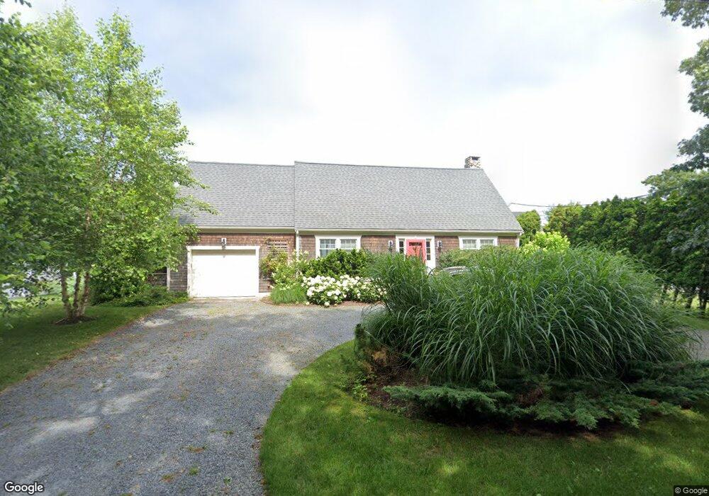
58 Ocean Dr Mattapoisett, MA 02739
Estimated Value: $1,061,000 - $1,309,000
2
Beds
2
Baths
1,746
Sq Ft
$696/Sq Ft
Est. Value
About This Home
This home is located at 58 Ocean Dr, Mattapoisett, MA 02739 and is currently estimated at $1,214,950, approximately $695 per square foot. 58 Ocean Dr is a home located in Plymouth County with nearby schools including Center School, Old Hammondtown Elementary, and Old Rochester Regional High School.
Ownership History
Date
Name
Owned For
Owner Type
Purchase Details
Closed on
Dec 3, 2024
Sold by
Appleton John P and Appleton Sara M
Bought by
Appleton Sara M
Current Estimated Value
Purchase Details
Closed on
Mar 12, 2022
Sold by
Engstrom Kirk M and Jo-Engstrom Mary
Bought by
Appleton John P and Appleton Sara M
Purchase Details
Closed on
Oct 16, 2008
Sold by
Appleton John P and Appleton Sara M
Bought by
Engstrom Kirk E and Engstrom Mary-Jo
Purchase Details
Closed on
Apr 12, 1996
Sold by
Dennis Mahoney & Sons
Bought by
Mcintire David J and Mcintire Sara E
Create a Home Valuation Report for This Property
The Home Valuation Report is an in-depth analysis detailing your home's value as well as a comparison with similar homes in the area
Home Values in the Area
Average Home Value in this Area
Purchase History
| Date | Buyer | Sale Price | Title Company |
|---|---|---|---|
| Appleton Sara M | -- | None Available | |
| Appleton Sara M | -- | None Available | |
| Appleton Sara M | -- | None Available | |
| Appleton John P | $225,000 | None Available | |
| Appleton John P | $225,000 | None Available | |
| Appleton John P | $225,000 | None Available | |
| Engstrom Kirk E | $200,000 | -- | |
| Mcintire David J | $220,000 | -- | |
| Engstrom Kirk E | $200,000 | -- | |
| Mcintire David J | $220,000 | -- |
Source: Public Records
Mortgage History
| Date | Status | Borrower | Loan Amount |
|---|---|---|---|
| Previous Owner | Mcintire David J | $30,000 | |
| Previous Owner | Mcintire David J | $290,000 |
Source: Public Records
Tax History Compared to Growth
Tax History
| Year | Tax Paid | Tax Assessment Tax Assessment Total Assessment is a certain percentage of the fair market value that is determined by local assessors to be the total taxable value of land and additions on the property. | Land | Improvement |
|---|---|---|---|---|
| 2025 | $12,042 | $1,119,100 | $759,600 | $359,500 |
| 2024 | $11,718 | $1,114,900 | $759,600 | $355,300 |
| 2023 | $11,541 | $1,025,836 | $678,036 | $347,800 |
| 2022 | $10,835 | $873,800 | $564,300 | $309,500 |
| 2021 | $11,341 | $875,062 | $624,762 | $250,300 |
| 2020 | $10,105 | $749,053 | $538,053 | $211,000 |
| 2019 | $9,966 | $754,400 | $545,700 | $208,700 |
| 2018 | $10,613 | $815,100 | $596,100 | $219,000 |
| 2017 | $10,070 | $770,500 | $561,900 | $208,600 |
| 2016 | $9,897 | $749,800 | $561,900 | $187,900 |
| 2015 | $10,102 | $777,100 | $589,200 | $187,900 |
| 2014 | $9,829 | $772,700 | $596,100 | $176,600 |
Source: Public Records
Map
Nearby Homes
- 0 Harbor Acres Ln - Lot B
- 7 Mattakiset Rd
- 1 Starboard Way
- 41 Starboard Way
- 0 Marina Dr Unit 72497908
- 0 Marina Dr Unit 72497877
- 6 Meadowbrook Ln
- 15 Ned's Point Rd
- 0 Whalers Way
- 6 Ocean Breeze Ln
- 1 Angelica Ave
- 3 Rock St
- 11 Captains Ln
- 8 Captains Ln
- 28 Brandt Beach Ave
- 7 Pearl St
- 8 Channel St
- 0 (Lot D) Angelica Ave
- 35 North St
- 11 Cove St
- 14 Pleasantview Ave
- 47 Ocean Dr
- 56 Ocean Dr
- 57 Ocean Dr
- 15 Pleasantview Ave
- 17 Pleasantview Ave
- 18 Pleasantview Ave
- 54 Ocean Dr
- 13 Pleasantview Ave
- 19 Pleasantview Ave
- 14 Highland View Ave
- 14 Highland View Ave Unit 1
- 16 Highland View Ave
- 61 Ocean Dr
- 11 Pleasantview Ave
- 18 Highland View Ave
- 9 Pleasantview Ave
- 52 Ocean Dr
- 4 Pleasantview Ave
- 4 Pleasantview Ave Unit 1