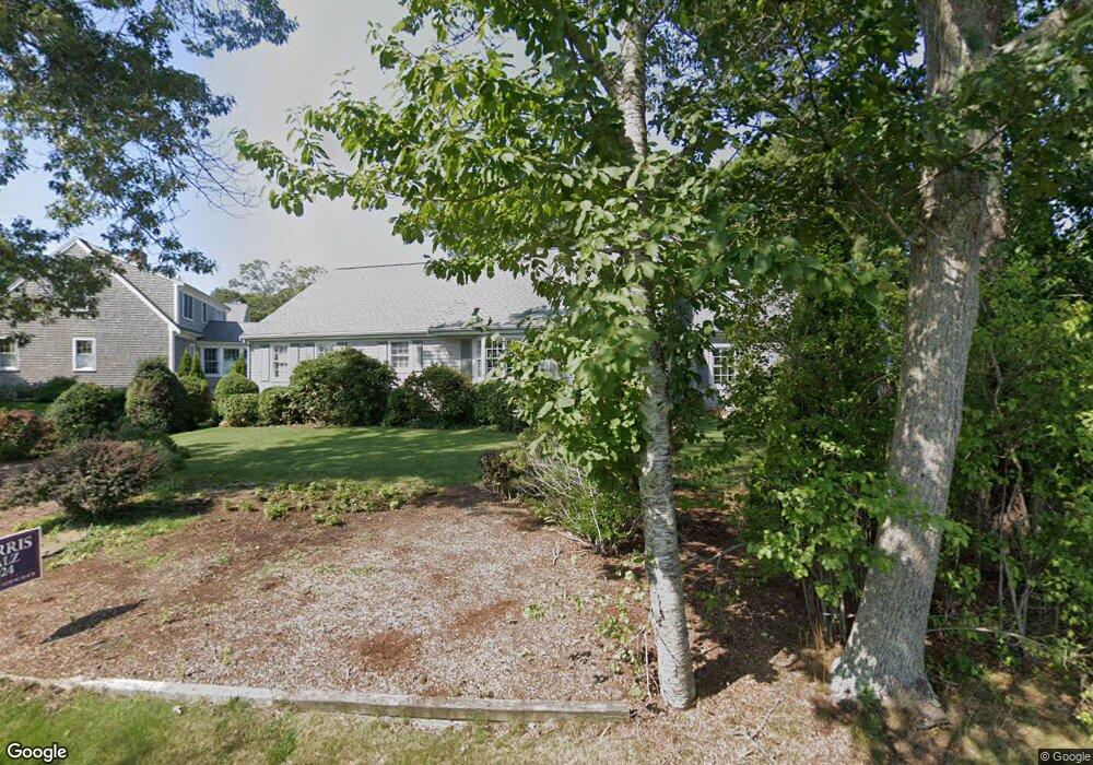
58 Pheasant Cove Cir Yarmouth Port, MA 02675
Yarmouth Port NeighborhoodEstimated Value: $980,000 - $1,300,000
3
Beds
3
Baths
1,512
Sq Ft
$704/Sq Ft
Est. Value
About This Home
This home is located at 58 Pheasant Cove Cir, Yarmouth Port, MA 02675 and is currently estimated at $1,064,902, approximately $704 per square foot. 58 Pheasant Cove Cir is a home located in Barnstable County with nearby schools including Dennis-Yarmouth Regional High School and St. Pius X. School.
Ownership History
Date
Name
Owned For
Owner Type
Purchase Details
Closed on
Feb 18, 2016
Bought by
Richard D Carroll T and Carroll Richard D
Current Estimated Value
Home Financials for this Owner
Home Financials are based on the most recent Mortgage that was taken out on this home.
Original Mortgage
$95,000
Outstanding Balance
$75,855
Interest Rate
4%
Mortgage Type
Adjustable Rate Mortgage/ARM
Estimated Equity
$989,047
Purchase Details
Closed on
Nov 25, 2009
Sold by
Carroll Richard D and Carroll Judith E
Bought by
Richard D Carroll T and Carroll Richard D
Purchase Details
Closed on
Aug 21, 1998
Sold by
Jordan Peirce Corp
Bought by
Carroll Richard D and Carroll Judith E
Home Financials for this Owner
Home Financials are based on the most recent Mortgage that was taken out on this home.
Original Mortgage
$235,000
Interest Rate
6.86%
Mortgage Type
Purchase Money Mortgage
Create a Home Valuation Report for This Property
The Home Valuation Report is an in-depth analysis detailing your home's value as well as a comparison with similar homes in the area
Home Values in the Area
Average Home Value in this Area
Purchase History
| Date | Buyer | Sale Price | Title Company |
|---|---|---|---|
| Richard D Carroll T | -- | -- | |
| Richard D Carroll T | -- | -- | |
| Carroll Richard D | $70,000 | -- |
Source: Public Records
Mortgage History
| Date | Status | Borrower | Loan Amount |
|---|---|---|---|
| Open | Richard D Carroll T | $95,000 | |
| Previous Owner | Carroll Richard D | $75,000 | |
| Previous Owner | Carroll Richard D | $235,000 | |
| Closed | Carroll Richard D | $89,000 |
Source: Public Records
Tax History Compared to Growth
Tax History
| Year | Tax Paid | Tax Assessment Tax Assessment Total Assessment is a certain percentage of the fair market value that is determined by local assessors to be the total taxable value of land and additions on the property. | Land | Improvement |
|---|---|---|---|---|
| 2025 | $6,900 | $974,600 | $353,800 | $620,800 |
| 2024 | $6,479 | $877,900 | $307,700 | $570,200 |
| 2023 | $6,355 | $783,600 | $280,700 | $502,900 |
| 2022 | $6,599 | $718,800 | $318,700 | $400,100 |
| 2021 | $6,148 | $643,100 | $304,100 | $339,000 |
| 2020 | $6,057 | $605,700 | $303,500 | $302,200 |
| 2019 | $5,673 | $561,700 | $303,500 | $258,200 |
| 2018 | $5,641 | $548,200 | $290,000 | $258,200 |
| 2017 | $5,493 | $548,200 | $290,000 | $258,200 |
| 2016 | $5,471 | $548,200 | $290,000 | $258,200 |
| 2015 | $5,436 | $541,400 | $290,000 | $251,400 |
Source: Public Records
Map
Nearby Homes
- 30 W Woods
- 30 W Woods Cir Unit 30
- 2 Pine Grove
- 158 Kates Path
- 25 Oak Glen Village Unit 25
- 25 Oak Glen
- 28 Oak Glen
- 23 Dauphine Dr
- 19 John Hall Cartway Unit E
- 50 John Hall Cartway
- 50 John Hall Cartway Unit 50
- 19 John Halls Cartpath Village Unit E
- 42 John Hall Cartway Unit 42
- 228 Kates Path
- 17 Kates Path Unit A
- 17 Nottingham Dr
- 64 Kates Path
- 43 Canterbury Rd
- 21 Boxwood Cir
- 24 Minnetuxet Way
- 44 Pheasant Cove Cir
- 68 Pheasant Cove Cir
- 57 Pheasant Cove Cir
- 74 Pheasant Cove Cir
- 61 Pheasant Cove Cir
- 47 & 49 Pheasant Cove Cir
- 47 Pheasant Cove Cir
- 49 Pheasant Cove Cir
- 41 Pheasant Cove Cir
- 35 Pheasant Cove Cir
- 30 Pheasant Cove Cir
- 79 Pheasant Cove Cir
- 29 Pheasant Cove Cir
- 78 Pheasant Cove Cir
- 22 Pheasant Cove Cir
- 49 Pheasant Cove Cir
- 0 Pheasant Cove Cir
- 67 Pheasant Cove Cir
- 16 Marsh Point
- 25 Loch Rannoch Way