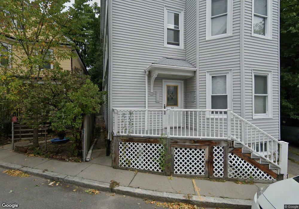
58 Prince St Unit 3 Brookline, MA 02445
Brookline Village NeighborhoodEstimated Value: $847,000 - $1,127,000
3
Beds
2
Baths
1,256
Sq Ft
$792/Sq Ft
Est. Value
About This Home
This home is located at 58 Prince St Unit 3, Brookline, MA 02445 and is currently estimated at $994,651, approximately $791 per square foot. 58 Prince St Unit 3 is a home located in Norfolk County with nearby schools including William H. Lincoln School, Brookline High School, and Maimonides School.
Ownership History
Date
Name
Owned For
Owner Type
Purchase Details
Closed on
Jul 24, 1998
Sold by
Ab & I Rt
Bought by
Catlin Ann
Current Estimated Value
Home Financials for this Owner
Home Financials are based on the most recent Mortgage that was taken out on this home.
Original Mortgage
$290,000
Outstanding Balance
$59,295
Interest Rate
6.99%
Mortgage Type
Purchase Money Mortgage
Estimated Equity
$935,356
Create a Home Valuation Report for This Property
The Home Valuation Report is an in-depth analysis detailing your home's value as well as a comparison with similar homes in the area
Home Values in the Area
Average Home Value in this Area
Purchase History
We collect this data history from publicly available records. To have your information removed, we recommend requesting removal directly through your county’s website.
| Date | Buyer | Sale Price | Title Company |
|---|---|---|---|
| Catlin Ann | $290,000 | -- |
Source: Public Records
Mortgage History
We collect this data history from publicly available records. To have your information removed, we recommend requesting removal directly through your county’s website.
| Date | Status | Borrower | Loan Amount |
|---|---|---|---|
| Open | Catlin Ann | $290,000 |
Source: Public Records
Tax History
| Year | Tax Paid | Tax Assessment Tax Assessment Total Assessment is a certain percentage of the fair market value that is determined by local assessors to be the total taxable value of land and additions on the property. | Land | Improvement |
|---|---|---|---|---|
| 2025 | $8,524 | $863,600 | $0 | $863,600 |
| 2024 | $8,272 | $846,700 | $0 | $846,700 |
| 2023 | $7,443 | $746,500 | $0 | $746,500 |
| 2022 | $7,385 | $724,700 | $0 | $724,700 |
| 2021 | $7,032 | $717,600 | $0 | $717,600 |
| 2020 | $6,714 | $710,500 | $0 | $710,500 |
| 2019 | $6,341 | $676,700 | $0 | $676,700 |
| 2018 | $6,096 | $644,400 | $0 | $644,400 |
| 2017 | $5,895 | $596,700 | $0 | $596,700 |
| 2016 | $5,653 | $542,500 | $0 | $542,500 |
| 2015 | $5,266 | $493,100 | $0 | $493,100 |
| 2014 | $5,296 | $465,000 | $0 | $465,000 |
Source: Public Records
Map
Nearby Homes
- 68 Chestnut St Unit 2
- 22 Chestnut Place Unit 210
- 18 Chestnut Place
- 1 Chestnut Place
- 293 Cypress St
- 166 Chestnut St Unit 1
- 16 Kennard Rd
- 428 Boylston St
- 8 Leverett St Unit 4
- 241 Perkins St Unit D204
- 241 Perkins St Unit G102
- 57-59 Highland Rd Unit 57
- 114 Davis Ave Unit 2
- 65 Glen Rd Unit H1
- 54 Clark Rd
- 60 Glen Rd Unit 306
- 60 Glen Rd Unit 101
- 69 Walnut St Unit 4
- 50 Sumner Rd
- 185 Warren St
- 58 Prince St Unit 2
- 58 Prince St Unit 1
- 58 Prince St Unit 1 58
- 58 Prince St Unit 2,58
- 58 Prince St Unit 1,58
- 52 Prince St Unit 2
- 52 Prince St Unit 1
- 52 Prince St Unit 1,52
- 52 Prince St
- 11 Kendall St
- 19 Kendall St
- 7 Kendall St
- 7 Kendall St Unit 3
- 7 Kendall St Unit 2
- 15 Kendall St
- 15A Kendall St
- 59 Prince St
- 59 Prince St Unit 2
- 59 Prince St
- 59 Prince St Unit 1
Your Personal Tour Guide
Ask me questions while you tour the home.