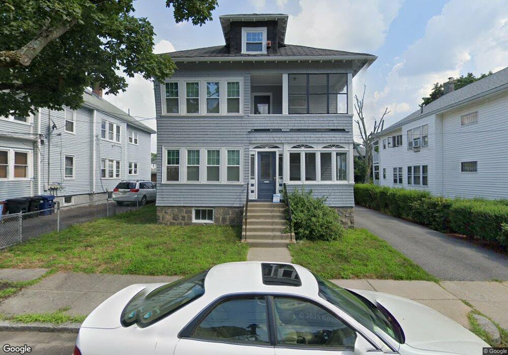
58 Rosewood St Unit 2 Mattapan, MA 02126
Southern Mattapan NeighborhoodEstimated Value: $789,000 - $850,000
3
Beds
1
Bath
1,145
Sq Ft
$722/Sq Ft
Est. Value
About This Home
This home is located at 58 Rosewood St Unit 2, Mattapan, MA 02126 and is currently estimated at $826,851, approximately $722 per square foot. 58 Rosewood St Unit 2 is a home located in Suffolk County with nearby schools including KIPP Academy Boston Charter School, Berea Seventh-day Adventist Academy, and St. Mary of the Hills School.
Ownership History
Date
Name
Owned For
Owner Type
Purchase Details
Closed on
Jul 1, 2015
Sold by
Vangos John
Bought by
Wisdom Paul A
Current Estimated Value
Home Financials for this Owner
Home Financials are based on the most recent Mortgage that was taken out on this home.
Original Mortgage
$481,124
Outstanding Balance
$370,368
Interest Rate
3.5%
Mortgage Type
FHA
Estimated Equity
$456,483
Purchase Details
Closed on
Sep 8, 2014
Sold by
Sullivan Lillian E Est
Bought by
Vangos John
Create a Home Valuation Report for This Property
The Home Valuation Report is an in-depth analysis detailing your home's value as well as a comparison with similar homes in the area
Home Values in the Area
Average Home Value in this Area
Purchase History
| Date | Buyer | Sale Price | Title Company |
|---|---|---|---|
| Wisdom Paul A | $490,000 | -- | |
| Vangos John | $280,000 | -- |
Source: Public Records
Mortgage History
| Date | Status | Borrower | Loan Amount |
|---|---|---|---|
| Open | Wisdom Paul A | $481,124 |
Source: Public Records
Tax History Compared to Growth
Tax History
| Year | Tax Paid | Tax Assessment Tax Assessment Total Assessment is a certain percentage of the fair market value that is determined by local assessors to be the total taxable value of land and additions on the property. | Land | Improvement |
|---|---|---|---|---|
| 2025 | $7,955 | $687,000 | $259,500 | $427,500 |
| 2024 | $7,502 | $688,300 | $234,500 | $453,800 |
| 2023 | $6,973 | $649,300 | $221,200 | $428,100 |
| 2022 | $7,064 | $649,300 | $221,200 | $428,100 |
| 2021 | $6,299 | $590,300 | $201,100 | $389,200 |
| 2020 | $5,562 | $526,700 | $203,700 | $323,000 |
| 2019 | $5,161 | $489,700 | $155,700 | $334,000 |
| 2018 | $4,583 | $437,300 | $155,700 | $281,600 |
| 2017 | $4,453 | $420,500 | $155,700 | $264,800 |
| 2016 | $3,868 | $351,600 | $155,700 | $195,900 |
| 2015 | $3,088 | $255,000 | $121,200 | $133,800 |
| 2014 | $2,970 | $236,100 | $121,200 | $114,900 |
Source: Public Records
Map
Nearby Homes
- 48-50 Rockdale St
- 90 Hollingsworth St
- 23 Caton St
- 645 River St
- 770 Cummins Hwy Unit 1
- 770 Cummins Hwy Unit 22
- 25 Alpine St Unit 7
- 10 Brockton St
- 16 Blue Hill Ave
- 95 Woodhaven St
- 839-843 Cummins Hwy
- 84 Blue Hills Pkwy
- 20 Massasoit St
- 112 Brush Hill Rd
- 96 Brook Rd
- 7 Winborough St
- 128 Blue Hills Pkwy
- 42 Osceola St
- 27 Hawthorn Rd
- 34 Ridlon Rd
- 58 Rosewood St
- 54 Rosewood St
- 62 Rosewood St
- 50 Rosewood St
- 63 Rockdale St
- 59 Rockdale St
- 67 Rockdale St Unit 69
- 66 Rosewood St
- 61-63 Rosewood St
- 55 Rockdale St
- 57 Rosewood St Unit 59
- 61 Rosewood St Unit 63
- 61 Rosewood St Unit 1
- 48 Rosewood St
- 48 Rosewood St Unit 2
- 71 Rockdale St
- 53 Rosewood St
- 65 Rosewood St
- 51 Rockdale St
- 76 Rosewood St