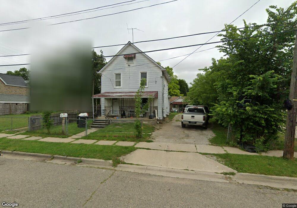
58 Sheridan St Pontiac, MI 48342
Estimated Value: $119,000 - $152,000
4
Beds
3
Baths
1,363
Sq Ft
$99/Sq Ft
Est. Value
About This Home
This home is located at 58 Sheridan St, Pontiac, MI 48342 and is currently estimated at $134,321, approximately $98 per square foot. 58 Sheridan St is a home located in Oakland County with nearby schools including Owen Elementary School, Pontiac Middle School, and Pontiac High School.
Ownership History
Date
Name
Owned For
Owner Type
Purchase Details
Closed on
May 20, 2021
Sold by
Yang Sia Vang and Yang Damus
Bought by
Cerda Arnaldo Flores
Current Estimated Value
Purchase Details
Closed on
May 18, 2016
Sold by
Yang Keng
Bought by
Yang Sia Vang and Yang Damus
Purchase Details
Closed on
Dec 2, 2014
Sold by
Liobardo and Huantes Irene
Bought by
Yana Kena Chi
Purchase Details
Closed on
May 13, 1999
Sold by
Huantes Liobardo
Bought by
Choua Yang Por
Purchase Details
Closed on
Feb 14, 1995
Sold by
Shrf Jon P Clever Pr
Bought by
Towne Mortgage Co
Create a Home Valuation Report for This Property
The Home Valuation Report is an in-depth analysis detailing your home's value as well as a comparison with similar homes in the area
Home Values in the Area
Average Home Value in this Area
Purchase History
| Date | Buyer | Sale Price | Title Company |
|---|---|---|---|
| Cerda Arnaldo Flores | $65,000 | Ata National Title Group Llc | |
| Yang Sia Vang | $25,000 | First American Title Ins Co | |
| Yana Kena Chi | $45,000 | None Available | |
| Choua Yang Por | $45,000 | -- | |
| Towne Mortgage Co | $38,755 | -- |
Source: Public Records
Tax History Compared to Growth
Tax History
| Year | Tax Paid | Tax Assessment Tax Assessment Total Assessment is a certain percentage of the fair market value that is determined by local assessors to be the total taxable value of land and additions on the property. | Land | Improvement |
|---|---|---|---|---|
| 2024 | $1,714 | $35,650 | $0 | $0 |
| 2023 | $1,633 | $31,930 | $0 | $0 |
| 2022 | $1,639 | $28,310 | $0 | $0 |
| 2021 | $672 | $25,340 | $0 | $0 |
| 2020 | $649 | $22,980 | $0 | $0 |
| 2019 | $669 | $20,070 | $0 | $0 |
| 2018 | $657 | $16,980 | $0 | $0 |
| 2017 | $619 | $16,620 | $0 | $0 |
| 2016 | $542 | $15,840 | $0 | $0 |
| 2015 | -- | $15,760 | $0 | $0 |
| 2014 | -- | $14,970 | $0 | $0 |
| 2011 | -- | $19,750 | $0 | $0 |
Source: Public Records
Map
Nearby Homes
- 388 N Perry St
- 431 Perry St
- 352 N Perry St
- 25 Elwood St
- 124 Kemp St
- 217 Edison St
- 421 N Paddock St
- 80 Oakhill St
- 52 Whitfield St
- 11 Lexington Place
- 36 Clairmont Place
- 37 Poplar Ave
- 73 Poplar Ave
- 633 N Perry St
- 130 Baldwin Ave
- 100 Oliver St
- 0 Baldwin Rd Unit 20251027987
- 0 Baldwin Ave Unit 20240055811
- 669 N Perry St
- 123 Adelaide St
- 50 Sheridan St
- 66 Sheridan St
- 46 Sheridan St
- 146 Chamberlain St
- 150 Chamberlain St
- 40 Sheridan St
- 0 Chamberlain St
- 51 Gingell Ct
- 154 Chamberlain St
- 57 Sheridan St
- 43 Gingell Ct
- 36 Sheridan St
- 158 Chamberlain St
- 37 Gingell Ct
- 51 Sheridan St
- 61 Sheridan St
- 30 Sheridan St
- 45 Sheridan St
- 65 Sheridan St
- 133 Chamberlain St