Estimated Value: $701,534 - $774,000
2
Beds
2
Baths
1,316
Sq Ft
$553/Sq Ft
Est. Value
About This Home
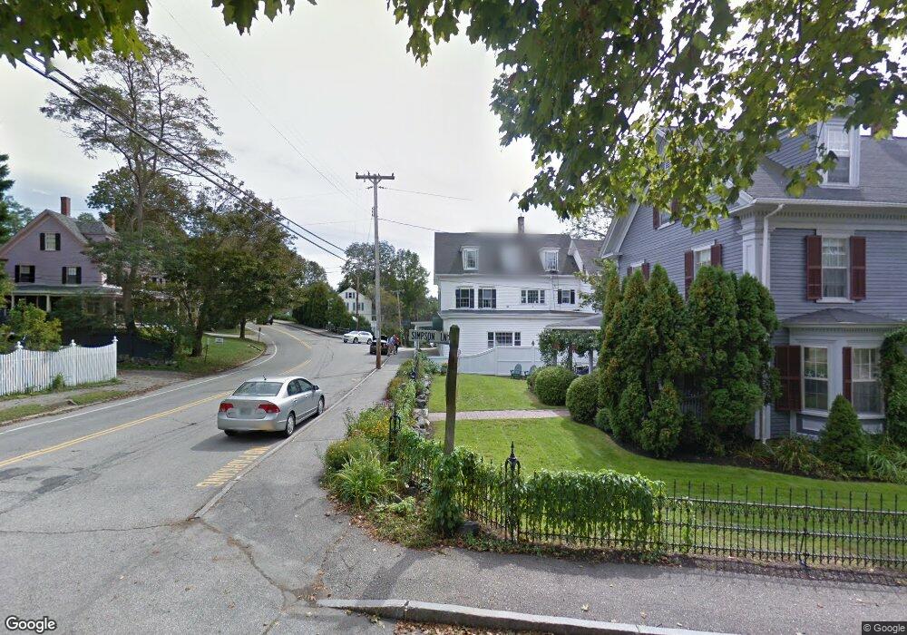
This home is located at 58 Simpsons Ln, York, ME 03909 and is currently estimated at $727,511, approximately $552 per square foot. 58 Simpsons Ln is a home located in York County with nearby schools including Coastal Ridge Elementary School, Village Elementary School, and York Middle School.
Ownership History
Date
Name
Owned For
Owner Type
Purchase Details
Closed on
Oct 3, 2024
Sold by
Sponsler Holly L and Sponsler
Bought by
Sponsler Holly L and Millette Thomas E
Current Estimated Value
Purchase Details
Closed on
Oct 21, 2013
Sold by
Herrin John C
Bought by
John C Herrin Ret and Herrin
Create a Home Valuation Report for This Property
The Home Valuation Report is an in-depth analysis detailing your home's value as well as a comparison with similar homes in the area
Home Values in the Area
Average Home Value in this Area
Purchase History
| Date | Buyer | Sale Price | Title Company |
|---|---|---|---|
| Sponsler Holly L | -- | None Available | |
| Sponsler Holly L | -- | None Available | |
| Sponsler Holly L | -- | None Available | |
| Sponsler Holly L | -- | None Available | |
| Sponsler Holly L | -- | None Available | |
| Sponsler Holly L | -- | None Available | |
| Sponsler Holly L | -- | None Available | |
| John C Herrin Ret | -- | -- | |
| John C Herrin Ret | -- | -- |
Source: Public Records
Tax History Compared to Growth
Tax History
| Year | Tax Paid | Tax Assessment Tax Assessment Total Assessment is a certain percentage of the fair market value that is determined by local assessors to be the total taxable value of land and additions on the property. | Land | Improvement |
|---|---|---|---|---|
| 2024 | $4,664 | $555,200 | $227,600 | $327,600 |
| 2023 | $0 | $477,300 | $146,300 | $331,000 |
| 2022 | $3,941 | $460,900 | $146,300 | $314,600 |
| 2021 | $4,107 | $412,800 | $146,300 | $266,500 |
| 2020 | $4,069 | $366,600 | $146,300 | $220,300 |
| 2019 | $3,884 | $348,300 | $130,000 | $218,300 |
| 2018 | $1,483 | $133,000 | $130,000 | $3,000 |
| 2017 | $2,782 | $254,100 | $130,000 | $124,100 |
| 2016 | $2,617 | $234,700 | $110,600 | $124,100 |
| 2015 | $2,555 | $232,300 | $110,600 | $121,700 |
| 2014 | $2,486 | $232,300 | $110,600 | $121,700 |
| 2013 | $2,493 | $239,000 | $110,600 | $128,400 |
Source: Public Records
Map
Nearby Homes
- 55 Simpson Hill Rd
- 147 River Rd
- 4 Hamlin Place
- 1 Cassidy Way
- 7 Cappy's Ln
- 39 Main St
- Lot # B Newport Ave
- 16 Passaic Rd
- 1376 Us Route 1
- 2 Beach St Unit 16
- 1 Ocean Ave Unit 306/308 Fraction 5
- 1 Ocean Ave Unit 306/308 Fraction 4
- 1 Ocean Ave Unit 406/408 Fraction 4
- 1 Ocean Ave Unit 210/212 Fraction 3
- 1 Ocean Ave Unit 402/404 Fraction 1
- 10 Pine Mountain Rd
- 384 Ridge Rd
- 35 Gunnison Rd
- 11 Ossipee Rd
- 6 Passaic Rd
- 33 Simpson Hill Rd
- 48 Simpson Hill Rd
- 7 Simpson Hill Rd
- 65 Cape Neddick Rd
- 11 Simpson Hill Rd
- 46 Simpsons Ln
- 45 Simpsons Ln
- 46 Simpson Hill Rd
- 12 Simpsons Ln
- 61 Cape Neddick Rd
- 77 Cape Neddick Rd
- 43 Cape Neddick Rd
- 12 Simpson Hill Rd
- 23 Simpsons Ln
- 118 Main St
- 49 Cape Neddick Rd
- 4 Harbor Pines Ln
- 6 Riversedge Dr
- 23 Clark Rd
- 32 Simpsons Ln