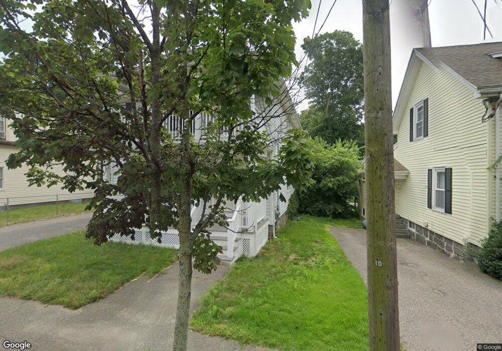
58 West St Quincy, MA 02169
South Quincy NeighborhoodEstimated Value: $793,000 - $925,000
4
Beds
2
Baths
2,140
Sq Ft
$398/Sq Ft
Est. Value
About This Home
This home is located at 58 West St, Quincy, MA 02169 and is currently estimated at $852,253, approximately $398 per square foot. 58 West St is a home located in Norfolk County with nearby schools including South West Middle School, Lincoln-Hancock Community School, and Quincy High School.
Ownership History
Date
Name
Owned For
Owner Type
Purchase Details
Closed on
Jan 12, 2022
Sold by
Mannion Ronan F
Bought by
58 West Street Llc
Current Estimated Value
Purchase Details
Closed on
Dec 6, 2010
Sold by
Fnma
Bought by
Mannion Ronan F
Home Financials for this Owner
Home Financials are based on the most recent Mortgage that was taken out on this home.
Original Mortgage
$315,748
Interest Rate
4.22%
Mortgage Type
Purchase Money Mortgage
Purchase Details
Closed on
Aug 24, 2010
Sold by
Joyce Michael J
Bought by
Federal National Mortgage Association
Purchase Details
Closed on
Apr 13, 1992
Sold by
Conroy Peter F and Conroy Margaret M
Bought by
Joyce Michael J and Joyce Anne M
Home Financials for this Owner
Home Financials are based on the most recent Mortgage that was taken out on this home.
Original Mortgage
$159,300
Interest Rate
8.73%
Mortgage Type
Purchase Money Mortgage
Create a Home Valuation Report for This Property
The Home Valuation Report is an in-depth analysis detailing your home's value as well as a comparison with similar homes in the area
Home Values in the Area
Average Home Value in this Area
Purchase History
| Date | Buyer | Sale Price | Title Company |
|---|---|---|---|
| 58 West Street Llc | -- | None Available | |
| Mannion Ronan F | $320,000 | -- | |
| Federal National Mortgage Association | $396,961 | -- | |
| Joyce Michael J | $177,000 | -- |
Source: Public Records
Mortgage History
| Date | Status | Borrower | Loan Amount |
|---|---|---|---|
| Previous Owner | Mannion Ronan F | $315,748 | |
| Previous Owner | Joyce Michael J | $134,800 | |
| Previous Owner | Joyce Michael J | $153,000 | |
| Previous Owner | Joyce Michael J | $159,300 | |
| Previous Owner | Joyce Michael J | $93,500 |
Source: Public Records
Tax History
| Year | Tax Paid | Tax Assessment Tax Assessment Total Assessment is a certain percentage of the fair market value that is determined by local assessors to be the total taxable value of land and additions on the property. | Land | Improvement |
|---|---|---|---|---|
| 2025 | $8,999 | $780,500 | $329,600 | $450,900 |
| 2024 | $8,475 | $752,000 | $314,800 | $437,200 |
| 2023 | $7,920 | $711,600 | $288,000 | $423,600 |
| 2022 | $7,658 | $639,200 | $243,200 | $396,000 |
| 2021 | $7,791 | $641,800 | $243,200 | $398,600 |
| 2020 | $7,740 | $622,700 | $243,200 | $379,500 |
| 2019 | $7,389 | $588,800 | $230,600 | $358,200 |
| 2018 | $6,994 | $524,300 | $215,000 | $309,300 |
| 2017 | $7,058 | $498,100 | $205,600 | $292,500 |
| 2016 | $6,252 | $435,400 | $181,400 | $254,000 |
| 2015 | $6,161 | $422,000 | $181,400 | $240,600 |
| 2014 | $5,525 | $371,800 | $181,400 | $190,400 |
Source: Public Records
Map
Nearby Homes
- 9 Westford St
- 25 McDonald St
- 211 Copeland St
- 132 Centre St
- 510 Willard St
- 459 Willard St Unit 303
- 14 Arthur Ave
- 12 Nelson St
- 21 Arthur St
- 40 Cross St Unit 1
- 39 Cross St
- 87 Village Dr
- 91 Garfield St
- 51 Branch St Unit 2
- 51 Branch St Unit 3
- 1 Cityview Ln Unit 709
- 1 Cityview Ln Unit 707
- 52 Packards Ln Unit 4
- 21 Totman St Unit 205
- 21 Totman St Unit 404
- 55 West St Unit 2
- 58 W St-60
- 64 West St Unit 64
- 62 West St
- 54 West St
- 50 West St
- 61 West St
- 70 West St
- 53 West St
- 53 West St Unit 2
- 44 West St
- 44 West St Unit 4
- 44 West St Unit 3
- 44 West St Unit 2
- 44 West St Unit 1
- 44 West St Unit 1,1
- 44 West St Unit 2,1
- 44 West St Unit 3,1
- 44 West St Unit 4,1
- 11 Hynes Ave Unit 2
Your Personal Tour Guide
Ask me questions while you tour the home.