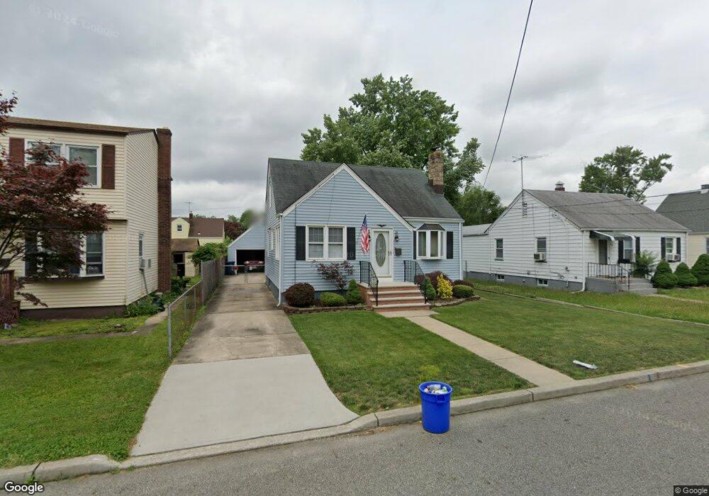
580 1st Ave North Brunswick, NJ 08902
Estimated Value: $409,993 - $462,000
--
Bed
--
Bath
877
Sq Ft
$494/Sq Ft
Est. Value
About This Home
This home is located at 580 1st Ave, North Brunswick, NJ 08902 and is currently estimated at $433,248, approximately $494 per square foot. 580 1st Ave is a home located in Middlesex County with nearby schools including Parsons Elementary School, Linwood Middle School, and North Brunswick Twp High School.
Ownership History
Date
Name
Owned For
Owner Type
Purchase Details
Closed on
Nov 20, 2007
Sold by
Awad Grant and Awad Samia
Bought by
Tecum Marcos
Current Estimated Value
Home Financials for this Owner
Home Financials are based on the most recent Mortgage that was taken out on this home.
Original Mortgage
$327,700
Outstanding Balance
$269,820
Interest Rate
6.48%
Mortgage Type
Purchase Money Mortgage
Estimated Equity
$163,428
Purchase Details
Closed on
Nov 23, 1976
Bought by
Butler William and Butler Lucille
Create a Home Valuation Report for This Property
The Home Valuation Report is an in-depth analysis detailing your home's value as well as a comparison with similar homes in the area
Home Values in the Area
Average Home Value in this Area
Purchase History
| Date | Buyer | Sale Price | Title Company |
|---|---|---|---|
| Tecum Marcos | $345,000 | None Available | |
| Butler William | $31,500 | -- |
Source: Public Records
Mortgage History
| Date | Status | Borrower | Loan Amount |
|---|---|---|---|
| Open | Tecum Marcos | $327,700 |
Source: Public Records
Tax History Compared to Growth
Tax History
| Year | Tax Paid | Tax Assessment Tax Assessment Total Assessment is a certain percentage of the fair market value that is determined by local assessors to be the total taxable value of land and additions on the property. | Land | Improvement |
|---|---|---|---|---|
| 2025 | $7,236 | $118,000 | $51,000 | $67,000 |
| 2024 | $7,106 | $114,200 | $51,000 | $63,200 |
| 2023 | $7,106 | $114,200 | $51,000 | $63,200 |
| 2022 | $6,863 | $114,200 | $51,000 | $63,200 |
| 2021 | $6,700 | $114,200 | $51,000 | $63,200 |
| 2020 | $6,608 | $114,200 | $51,000 | $63,200 |
| 2019 | $6,473 | $114,200 | $51,000 | $63,200 |
| 2018 | $6,340 | $114,200 | $51,000 | $63,200 |
| 2017 | $6,228 | $114,200 | $51,000 | $63,200 |
| 2016 | $6,098 | $114,200 | $51,000 | $63,200 |
| 2015 | $5,994 | $114,200 | $51,000 | $63,200 |
| 2014 | $5,927 | $114,200 | $51,000 | $63,200 |
Source: Public Records
Map
Nearby Homes
- 803 Nassau St
- 44 S Ward St
- 37 Hazelhurst St
- 80A Larch Ave
- 80 Larch Ave
- 82 S Ward St
- 50 Columbia Ave
- 1224 Dogwood Ct
- 18 N Talmadge St
- 15 N Talmadge St
- 147 Rutgers St
- 122 Lawrence St Unit 26
- 7 Oakwood Place
- 790 Cranbury Cross Rd
- 640 Livingston Ave
- 201 Fulton St
- 79 Booream Ave
- 721 Livingston Ave
- 200 Talmadge St
- 855 Newton St