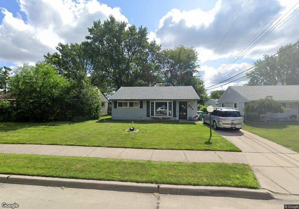
580 Brandt St Garden City, MI 48135
Estimated Value: $149,902 - $176,000
2
Beds
1
Bath
818
Sq Ft
$200/Sq Ft
Est. Value
About This Home
This home is located at 580 Brandt St, Garden City, MI 48135 and is currently estimated at $163,476, approximately $199 per square foot. 580 Brandt St is a home located in Wayne County with nearby schools including Memorial Elementary 1-2 Campus, Douglas Elementary 3-4 Campus, and Farmington 5-6 Campus.
Ownership History
Date
Name
Owned For
Owner Type
Purchase Details
Closed on
Jul 30, 2012
Sold by
Thompson Bruce L and Thompson Jeannie M
Bought by
Thompson Jessica Kara
Current Estimated Value
Purchase Details
Closed on
Aug 9, 2011
Sold by
Federal Home Loan Mortgage Corporation
Bought by
Thompson Bruce L
Purchase Details
Closed on
Sep 29, 2010
Sold by
Jones Kimberly A
Bought by
Federal Home Loan Mortgage Corp
Purchase Details
Closed on
Nov 25, 1998
Sold by
Lward Kathleen
Bought by
Charlotte Kbadour
Create a Home Valuation Report for This Property
The Home Valuation Report is an in-depth analysis detailing your home's value as well as a comparison with similar homes in the area
Home Values in the Area
Average Home Value in this Area
Purchase History
| Date | Buyer | Sale Price | Title Company |
|---|---|---|---|
| Thompson Jessica Kara | -- | None Available | |
| Thompson Bruce L | $20,000 | Attorneys Title Agency Llc | |
| Federal Home Loan Mortgage Corp | $92,052 | None Available | |
| Charlotte Kbadour | $82,500 | -- |
Source: Public Records
Tax History Compared to Growth
Tax History
| Year | Tax Paid | Tax Assessment Tax Assessment Total Assessment is a certain percentage of the fair market value that is determined by local assessors to be the total taxable value of land and additions on the property. | Land | Improvement |
|---|---|---|---|---|
| 2025 | $1,989 | $67,800 | $0 | $0 |
| 2024 | $1,989 | $62,700 | $0 | $0 |
| 2023 | $1,867 | $54,300 | $0 | $0 |
| 2022 | $2,311 | $44,300 | $0 | $0 |
| 2021 | $2,257 | $40,600 | $0 | $0 |
| 2020 | $2,262 | $40,200 | $0 | $0 |
| 2019 | $1,696 | $35,600 | $0 | $0 |
| 2018 | $1,536 | $30,200 | $0 | $0 |
| 2017 | $889 | $29,700 | $0 | $0 |
| 2016 | $1,939 | $29,100 | $0 | $0 |
| 2015 | $2,519 | $27,500 | $0 | $0 |
| 2013 | $2,440 | $25,300 | $0 | $0 |
| 2012 | $1,397 | $26,400 | $8,800 | $17,600 |
Source: Public Records
Map
Nearby Homes
- 577 Brandt St
- 29487 Florence St
- 1125 Brandt St
- 489 Henry Ruff Rd
- 29031 Rosslyn Ave
- 29578 Brown Ct
- 30414 Cherry Hill Rd
- 30639 Florence St
- 28999 Beechnut St
- 28783 Leona St
- 0000 Brandt St
- 30808 Sheridan St
- 29643 Steinhauer St
- 29760 Birchwood St
- 329 Shotka St
- 29404 Meadow Ln Unit 1
- 30806 Fernwood St
- 30901 Cherry Hill Rd
- 724 Clair St
- 28501 Leona St
- 596 Brandt St
- 560 Brandt St
- 538 Brandt St
- 577 Lytle Place
- 555 Lytle Place
- 595 Lytle Place
- 545 Lytle Place
- 518 Brandt St
- 595 Brandt St
- 561 Brandt St
- 541 Brandt St
- 29734 Florence St
- 29724 Florence St
- 494 Brandt St
- 521 Brandt St
- 29744 Florence St
- 29714 Florence St
- 29754 Florence St
- 29664 Florence St
- 501 Brandt St