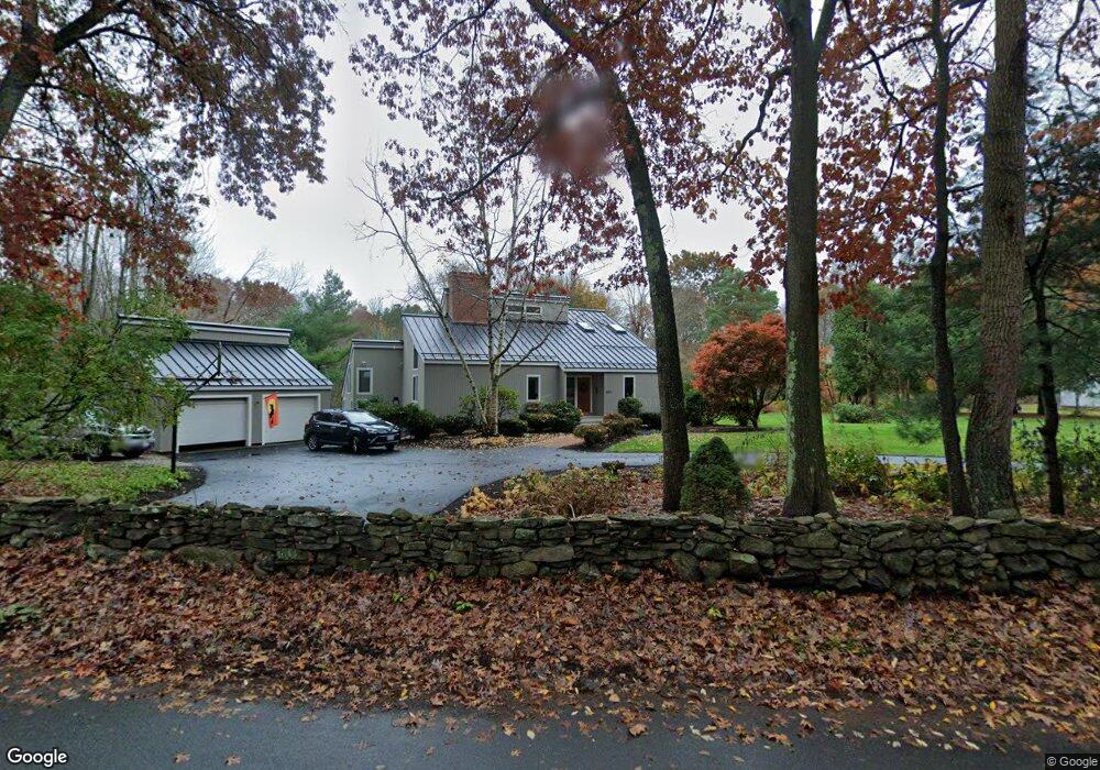
580 Flag Hill Rd Boxborough, MA 01719
Estimated Value: $894,988 - $993,000
3
Beds
3
Baths
2,184
Sq Ft
$429/Sq Ft
Est. Value
About This Home
This home is located at 580 Flag Hill Rd, Boxborough, MA 01719 and is currently estimated at $937,497, approximately $429 per square foot. 580 Flag Hill Rd is a home located in Middlesex County with nearby schools including Acton-Boxborough Regional High School and The Imago School.
Create a Home Valuation Report for This Property
The Home Valuation Report is an in-depth analysis detailing your home's value as well as a comparison with similar homes in the area
Home Values in the Area
Average Home Value in this Area
Tax History Compared to Growth
Tax History
| Year | Tax Paid | Tax Assessment Tax Assessment Total Assessment is a certain percentage of the fair market value that is determined by local assessors to be the total taxable value of land and additions on the property. | Land | Improvement |
|---|---|---|---|---|
| 2025 | $12,886 | $851,100 | $311,400 | $539,700 |
| 2024 | $12,293 | $820,100 | $299,400 | $520,700 |
| 2023 | $10,693 | $689,000 | $247,000 | $442,000 |
| 2022 | $10,314 | $592,100 | $247,000 | $345,100 |
| 2020 | $9,156 | $547,600 | $247,000 | $300,600 |
| 2019 | $8,992 | $547,600 | $247,000 | $300,600 |
| 2018 | $11,245 | $532,400 | $235,600 | $296,800 |
| 2017 | $3,743 | $509,400 | $235,600 | $273,800 |
| 2016 | $8,353 | $510,600 | $235,600 | $275,000 |
| 2015 | $8,207 | $492,900 | $212,300 | $280,600 |
| 2014 | $8,642 | $488,500 | $206,200 | $282,300 |
Source: Public Records
Map
Nearby Homes
- 207 Boxboro Rd
- 351 Burroughs Rd
- 30 Paul Revere Rd
- 20 Lyons Ln Unit 20
- 20 Lyons Ln
- 52 Mayfair Dr
- 30-6 Taylor Rd
- 404 Arlington St
- 68 Macintosh Ln
- 134 Russet Ln
- 17 Cherry Ridge Rd
- 349 Arlington St
- 92 Willow St Unit 3
- 92 Willow St Unit 2
- 90 Willow St Unit 1
- 1155 Burroughs Rd
- 777 Depot Rd
- 424 Great Rd
- 79 Robbins St
- 26 Overlook Dr