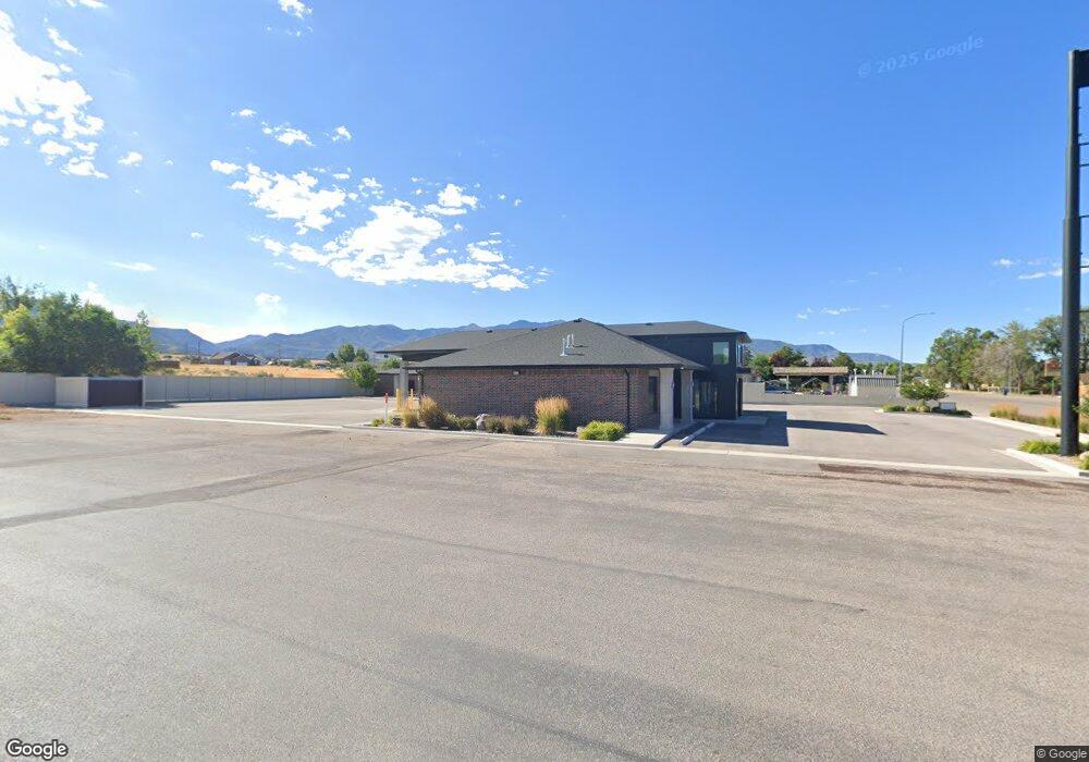
580 N Main St Fillmore, UT 84631
--
Bed
--
Bath
--
Sq Ft
0.68
Acres
About This Home
This home is located at 580 N Main St, Fillmore, UT 84631. 580 N Main St is a home located in Millard County.
Ownership History
Date
Name
Owned For
Owner Type
Purchase Details
Closed on
Jan 8, 2019
Sold by
Rna Investments Llc
Bought by
Ps4h Ltd
Purchase Details
Closed on
Feb 13, 2007
Sold by
Western Sky Enterprises Llc
Bought by
Old Frontier Properties Llc
Purchase Details
Closed on
Feb 1, 2005
Sold by
Lockwood Ti Mothy C
Bought by
Western Sky Enterprises Llc
Home Financials for this Owner
Home Financials are based on the most recent Mortgage that was taken out on this home.
Original Mortgage
$80,000
Interest Rate
5.74%
Mortgage Type
Commercial
Create a Home Valuation Report for This Property
The Home Valuation Report is an in-depth analysis detailing your home's value as well as a comparison with similar homes in the area
Home Values in the Area
Average Home Value in this Area
Purchase History
| Date | Buyer | Sale Price | Title Company |
|---|---|---|---|
| Ps4h Ltd | -- | First American Title | |
| Old Frontier Properties Llc | -- | -- | |
| Western Sky Enterprises Llc | -- | First American Title Insuran |
Source: Public Records
Mortgage History
| Date | Status | Borrower | Loan Amount |
|---|---|---|---|
| Previous Owner | Western Sky Enterprises Llc | $80,000 |
Source: Public Records
Tax History Compared to Growth
Tax History
| Year | Tax Paid | Tax Assessment Tax Assessment Total Assessment is a certain percentage of the fair market value that is determined by local assessors to be the total taxable value of land and additions on the property. | Land | Improvement |
|---|---|---|---|---|
| 2025 | $6,800 | $854,074 | $74,052 | $780,022 |
| 2024 | $6,800 | $507,883 | $59,834 | $448,049 |
| 2023 | $4,990 | $507,883 | $59,834 | $448,049 |
| 2022 | $5,597 | $502,551 | $54,502 | $448,049 |
| 2021 | $5,451 | $469,991 | $54,502 | $415,489 |
| 2020 | $5,420 | $469,991 | $54,502 | $415,489 |
| 2019 | $2,116 | $184,060 | $54,502 | $129,558 |
| 2018 | $2,067 | $184,060 | $54,502 | $129,558 |
| 2017 | $2,650 | $224,291 | $58,750 | $165,541 |
| 2016 | $2,083 | $184,322 | $58,750 | $125,572 |
| 2015 | $1,554 | $137,447 | $58,750 | $78,697 |
| 2014 | -- | $75,081 | $58,750 | $16,331 |
| 2013 | -- | $186,784 | $58,750 | $128,034 |
Source: Public Records
Map
Nearby Homes
- 390 N 100 W
- 380 N 200 St W
- 295 N 100 West St
- 335 W 400 North St
- 165 N 100 W
- 225 W 200 St N
- 75 N 100 West St
- 2155 N Cedar Mountain Rd
- 2835 N Cedar Mountain Rd
- 40 S 100 Rd E
- 410 W 400 N
- 600 E 1200 St N
- 120 S 100 East Rd
- 220 S 200 E
- 430 E Canyon Rd
- 190 W 400 St S
- 310 S 600 E
- 310 S 500 West Rd
- 155 E 500 St S
- 157 E 500 South St
- 590 N Main St
- 560 N Main St
- 80 E 600 N
- 595 N Main St
- 565 N Main St
- 610 N Main St
- 545 N Main St
- 300 W 600 St N Unit 1-4
- 300 W 600 St N
- 90 E 600 N
- 635 N Main St
- 142 E 600 St N Unit 1-20
- 179 E 600 St N Unit 17
- 176 E 600 St N Unit 16
- 155 E 600 St N Unit 18
- 142 E 600 St N Unit 14
- 106 E 600 St N Unit 13
- 176 E 600 St N
- 155 E 600 St N
- 106 E 600 St N