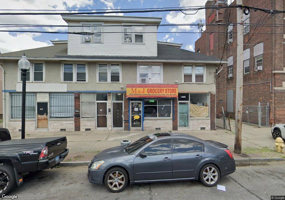
580 Newfield Ave Unit 586 Bridgeport, CT 06607
East End Neighborhood
--
Bed
--
Bath
--
Sq Ft
0.26
Acres
About This Home
This home is located at 580 Newfield Ave Unit 586, Bridgeport, CT 06607. 580 Newfield Ave Unit 586 is a home located in Fairfield County with nearby schools including Dunbar School, Harding High School, and Capital Prep Harbor Upper School.
Ownership History
Date
Name
Owned For
Owner Type
Purchase Details
Closed on
Sep 21, 2023
Sold by
Taylor Daisy
Bought by
Taylor Pervis T
Purchase Details
Closed on
Jun 21, 2005
Sold by
Bohannon Darlene
Bought by
Taylor Pervis
Home Financials for this Owner
Home Financials are based on the most recent Mortgage that was taken out on this home.
Original Mortgage
$255,750
Interest Rate
5.78%
Mortgage Type
Commercial
Create a Home Valuation Report for This Property
The Home Valuation Report is an in-depth analysis detailing your home's value as well as a comparison with similar homes in the area
Home Values in the Area
Average Home Value in this Area
Purchase History
| Date | Buyer | Sale Price | Title Company |
|---|---|---|---|
| Taylor Pervis T | -- | None Available | |
| Taylor Pervis | $90,000 | -- | |
| Taylor Pervis | $90,000 | -- |
Source: Public Records
Mortgage History
| Date | Status | Borrower | Loan Amount |
|---|---|---|---|
| Previous Owner | Taylor Pervis | $255,750 |
Source: Public Records
Tax History Compared to Growth
Tax History
| Year | Tax Paid | Tax Assessment Tax Assessment Total Assessment is a certain percentage of the fair market value that is determined by local assessors to be the total taxable value of land and additions on the property. | Land | Improvement |
|---|---|---|---|---|
| 2025 | $15,158 | $348,860 | $108,090 | $240,770 |
| 2024 | $15,158 | $348,860 | $108,090 | $240,770 |
| 2023 | $15,158 | $348,860 | $108,090 | $240,770 |
| 2022 | $15,158 | $348,860 | $108,090 | $240,770 |
| 2021 | $15,158 | $348,860 | $108,090 | $240,770 |
| 2020 | $15,737 | $291,480 | $70,860 | $220,620 |
| 2019 | $15,737 | $291,480 | $70,860 | $220,620 |
| 2018 | $15,848 | $291,480 | $70,860 | $220,620 |
| 2017 | $15,848 | $291,480 | $70,860 | $220,620 |
| 2016 | $15,848 | $291,480 | $70,860 | $220,620 |
| 2015 | $13,819 | $327,460 | $79,720 | $247,740 |
| 2014 | $13,819 | $327,460 | $79,720 | $247,740 |
Source: Public Records
Map
Nearby Homes
- 643 Newfield Ave Unit 645
- 93 Clifford St
- 40 5th St
- 54 6th St
- 49 Bunnell St Unit 51
- 408 Union Ave
- 205 Smith St
- 363 Carroll Ave Unit 365
- 320 Union Ave
- 306 Carroll Ave
- 221 Bunnell St
- 247 6th St
- 1440 Stratford Ave
- 520 Seaview Ave
- 800 Seaview Ave Unit 790-3
- 566 Wilmot Ave Unit 4
- 785 Connecticut Ave Unit 2
- 610 Wilmot Ave Unit 4
- 591 Wilmot Ave Unit 3
- 819 Connecticut Ave Unit 6
- 594 Newfield Ave Unit 596
- 591 Newfield Ave Unit 595
- 601 Newfield Ave
- 597 Newfield Ave Unit 2
- 597 Newfield Ave Unit 1
- 597 Newfield Ave Unit 597
- 568 Newfield Ave Unit 3A
- 621 Newfield Ave Unit 3
- 621 Newfield Ave Unit 2
- 618 Newfield Ave
- 50 Revere St Unit 1
- 50 Revere St Unit 1fl
- 50 Revere St
- 50 Revere St Unit 2nd
- 50 Revere St Unit 2
- 280 Beardsley St
- 26 Revere St
- 138 Clifford St Unit 140