Estimated Value: $285,000 - $328,000
4
Beds
1
Bath
2,064
Sq Ft
$151/Sq Ft
Est. Value
About This Home
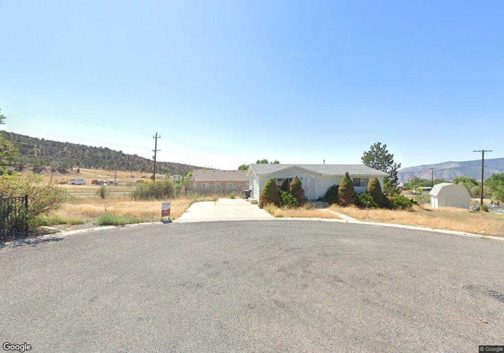
This home is located at 580 S Canyon Cir, Manti, UT 84642 and is currently estimated at $311,850, approximately $151 per square foot. 580 S Canyon Cir is a home located in Sanpete County.
Ownership History
Date
Name
Owned For
Owner Type
Purchase Details
Closed on
Aug 22, 2024
Sold by
Henretty Joyce N B
Bought by
Mcreynolds Markham
Current Estimated Value
Home Financials for this Owner
Home Financials are based on the most recent Mortgage that was taken out on this home.
Original Mortgage
$277,874
Outstanding Balance
$268,699
Interest Rate
0.61%
Mortgage Type
FHA
Estimated Equity
$43,151
Purchase Details
Closed on
Mar 5, 2013
Sold by
Williams Nka Rachelle Brancato Rachelle and Williams Nka Angela Lee Angela
Bought by
Williams E Scott
Create a Home Valuation Report for This Property
The Home Valuation Report is an in-depth analysis detailing your home's value as well as a comparison with similar homes in the area
Home Values in the Area
Average Home Value in this Area
Purchase History
| Date | Buyer | Sale Price | Title Company |
|---|---|---|---|
| Mcreynolds Markham | $280,653 | Professional Title Service | |
| Williams E Scott | -- | D Land Title |
Source: Public Records
Mortgage History
| Date | Status | Borrower | Loan Amount |
|---|---|---|---|
| Open | Mcreynolds Markham | $277,874 | |
| Closed | Mcreynolds Markham | $16,600 |
Source: Public Records
Tax History Compared to Growth
Tax History
| Year | Tax Paid | Tax Assessment Tax Assessment Total Assessment is a certain percentage of the fair market value that is determined by local assessors to be the total taxable value of land and additions on the property. | Land | Improvement |
|---|---|---|---|---|
| 2024 | $2,396 | $230,257 | $0 | $0 |
| 2023 | $2,385 | $216,203 | $0 | $0 |
| 2022 | $2,144 | $177,198 | $0 | $0 |
| 2021 | $2,042 | $146,127 | $0 | $0 |
| 2020 | $1,911 | $128,582 | $0 | $0 |
| 2019 | $1,077 | $71,184 | $0 | $0 |
| 2018 | $1,021 | $118,662 | $30,690 | $87,972 |
| 2017 | $911 | $61,269 | $0 | $0 |
| 2016 | $857 | $57,621 | $0 | $0 |
| 2015 | $860 | $57,621 | $0 | $0 |
| 2014 | $843 | $57,621 | $0 | $0 |
| 2013 | $880 | $60,487 | $0 | $0 |
Source: Public Records
Map
Nearby Homes
- 298 E 600 S
- 255 E 400 S
- 106 E 300 S
- 678 E Union St
- 298 E Union St
- 300 800 S Unit 9
- 365 N 300 E
- 345 N 300 E
- 395 N 300 E
- 189 S 300 W
- 307 W 100 S
- 50 U S Highway 89
- 30 S 300 W
- 245 W 100 N
- 1218 S 500 W Unit 8
- 1255 S 500 W Unit 8
- 1168 S 500 W Unit 1
- 1177 S 500 W Unit 2
- 1205 S 500 W Unit 4
- 1292 S 500 W Unit 11