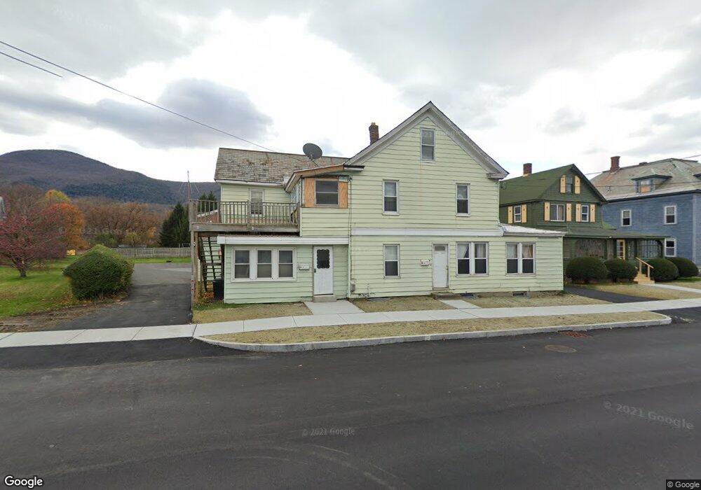
580 State Rd North Adams, MA 01247
Estimated Value: $288,000 - $338,763
6
Beds
4
Baths
3,211
Sq Ft
$98/Sq Ft
Est. Value
About This Home
This home is located at 580 State Rd, North Adams, MA 01247 and is currently estimated at $314,254, approximately $97 per square foot. 580 State Rd is a home located in Berkshire County with nearby schools including Greylock Elementary School, Drury High School, and Pine Cobble School.
Ownership History
Date
Name
Owned For
Owner Type
Purchase Details
Closed on
Nov 14, 2006
Sold by
Bush Richard J and Bush Cheryl F
Bought by
Bedard Andrew W
Current Estimated Value
Home Financials for this Owner
Home Financials are based on the most recent Mortgage that was taken out on this home.
Original Mortgage
$153,000
Outstanding Balance
$90,067
Interest Rate
6.31%
Mortgage Type
Purchase Money Mortgage
Estimated Equity
$224,187
Create a Home Valuation Report for This Property
The Home Valuation Report is an in-depth analysis detailing your home's value as well as a comparison with similar homes in the area
Home Values in the Area
Average Home Value in this Area
Purchase History
| Date | Buyer | Sale Price | Title Company |
|---|---|---|---|
| Bedard Andrew W | $176,000 | -- | |
| Bedard Andrew W | $176,000 | -- |
Source: Public Records
Mortgage History
| Date | Status | Borrower | Loan Amount |
|---|---|---|---|
| Open | Bedard Andrew W | $153,000 | |
| Closed | Bedard Andrew W | $153,000 | |
| Previous Owner | Bedard Andrew W | $50,000 | |
| Previous Owner | Bedard Andrew W | $25,000 | |
| Previous Owner | Bedard Andrew W | $25,000 |
Source: Public Records
Tax History Compared to Growth
Tax History
| Year | Tax Paid | Tax Assessment Tax Assessment Total Assessment is a certain percentage of the fair market value that is determined by local assessors to be the total taxable value of land and additions on the property. | Land | Improvement |
|---|---|---|---|---|
| 2025 | $3,895 | $233,100 | $34,400 | $198,700 |
| 2024 | $3,658 | $213,400 | $31,500 | $181,900 |
| 2023 | $3,363 | $190,300 | $31,500 | $158,800 |
| 2022 | $3,439 | $185,600 | $31,500 | $154,100 |
| 2021 | $3,197 | $171,800 | $29,200 | $142,600 |
| 2020 | $3,111 | $167,100 | $27,800 | $139,300 |
| 2019 | $3,121 | $163,300 | $28,400 | $134,900 |
| 2018 | $3,077 | $167,400 | $30,500 | $136,900 |
| 2017 | $2,931 | $165,900 | $30,200 | $135,700 |
| 2016 | $2,885 | $165,900 | $30,200 | $135,700 |
| 2015 | $2,786 | $166,900 | $31,200 | $135,700 |
Source: Public Records
Map
Nearby Homes
- 1 State Rd
- 17 Phelps Ave
- 520 State Rd Unit 207
- 520 State Rd Unit 402
- 520 State Rd Unit 208
- 11 Foucher Ave
- 25 Taft St
- 505 Barbour St
- 227 Protection Ave
- 25 College Ave
- 42 Harding Ave
- 20 Kateley Ln
- 447 Notch Rd
- 55 First St
- 34 Goodrich St
- 100 N Hoosac Rd
- 20 Barlow Ave
- 26 Charles St
- 0 Reservoir Rd
- 46 Cobble View Rd
- 586 State Rd
- 592 State Rd Unit 594
- 566 State Rd
- 26 Phelps Ave Unit 28
- 978 State Rd
- 596 State Rd
- 573 State Rd Unit 575
- 581 State Rd Unit 583
- 581 State Rd
- 34 Phelps Ave
- 587 State Rd Unit 589
- 587 State Rd
- 581-583 State Rd
- 9 Phelps Ave Unit 13
- 585 State Rd
- 585 State Rd
- 585 State Rd Unit A+B
- 585 State Rd Unit 2
- 595 State Rd Unit 597
- 27 Phelps Ave