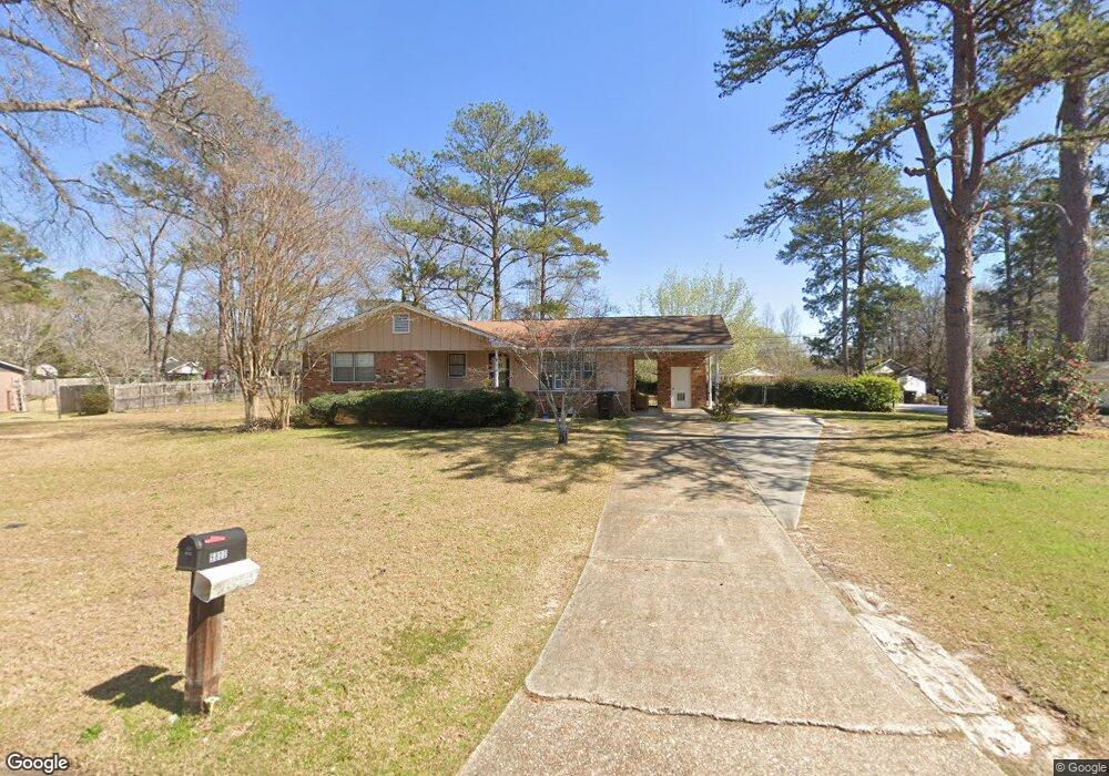
5800 Fornof Rd Columbus, GA 31909
Midland NeighborhoodEstimated Value: $142,920 - $171,000
3
Beds
3
Baths
1,211
Sq Ft
$130/Sq Ft
Est. Value
About This Home
This home is located at 5800 Fornof Rd, Columbus, GA 31909 and is currently estimated at $157,730, approximately $130 per square foot. 5800 Fornof Rd is a home located in Muscogee County with nearby schools including Waddell Elementary School, Midland Middle School, and Shaw High School.
Ownership History
Date
Name
Owned For
Owner Type
Purchase Details
Closed on
Jun 3, 2011
Sold by
Philips Constance
Bought by
Csp Investments Llc
Current Estimated Value
Purchase Details
Closed on
Feb 1, 2011
Sold by
Spradlen James and Spradlen Paulette
Bought by
Citimortgage Inc
Create a Home Valuation Report for This Property
The Home Valuation Report is an in-depth analysis detailing your home's value as well as a comparison with similar homes in the area
Home Values in the Area
Average Home Value in this Area
Purchase History
| Date | Buyer | Sale Price | Title Company |
|---|---|---|---|
| Csp Investments Llc | -- | -- | |
| Philips Constance S | $49,900 | -- | |
| Citimortgage Inc | $57,532 | None Available |
Source: Public Records
Tax History Compared to Growth
Tax History
| Year | Tax Paid | Tax Assessment Tax Assessment Total Assessment is a certain percentage of the fair market value that is determined by local assessors to be the total taxable value of land and additions on the property. | Land | Improvement |
|---|---|---|---|---|
| 2025 | $146 | $53,776 | $11,732 | $42,044 |
| 2024 | $146 | $37,333 | $11,732 | $25,601 |
| 2023 | $1,471 | $37,333 | $11,732 | $25,601 |
| 2022 | $1,176 | $41,948 | $11,732 | $30,216 |
| 2021 | $1,176 | $28,800 | $6,059 | $22,741 |
| 2020 | $1,176 | $28,800 | $6,059 | $22,741 |
| 2019 | $1,180 | $28,800 | $6,059 | $22,741 |
| 2018 | $1,180 | $28,800 | $6,059 | $22,741 |
| 2017 | $1,184 | $28,800 | $6,059 | $22,741 |
| 2016 | $1,404 | $28,799 | $6,059 | $22,740 |
| 2015 | $363 | $22,000 | $0 | $0 |
| 2014 | $364 | $22,000 | $0 | $0 |
| 2013 | -- | $31,214 | $6,059 | $25,155 |
Source: Public Records
Map
Nearby Homes
- 5791 Bishop Dr
- 5408 Old Dominion Rd
- 5966 Fornof Rd
- 5324 Colony Dr
- 5621 Hodges Dr
- 5623 Hodges Dr
- 5422 Colony Dr
- 5028 Warm Springs Rd
- 5619 Hodges Dr
- 5804 Dearborn Ave
- 6127 Stony Creek Dr
- 4847 Warm Springs Rd
- 6137 Stoneway Dr
- 6263 Potomac Cir
- 5378 Misty Ln
- 6333 Stony Creek Dr
- 5866 Morningside Dr
- 6 Jamestown Ct
- 4700 Bondale Dr
- 6251 Rockefeller Dr
- 5816 Fornof Rd
- 5303 Winburn Ave
- 5822 Fornof Rd
- 5809 Fornof Rd
- 5238 Winburn Ave
- 5801 Fornof Rd
- 5244 Winburn Ave
- 5230 Winburn Ave
- 5803 Highpoint Dr
- 5817 Fornof Rd
- 5306 Winburn Ave
- 5830 Fornof Rd
- 5222 Winburn Ave
- 5825 Fornof Rd
- 5811 Highpoint Dr
- 5312 Winburn Ave
- 5838 Fornof Rd
- 5200 Winburn Ave
- 5802 Highpoint Dr
- 5833 Fornof Rd