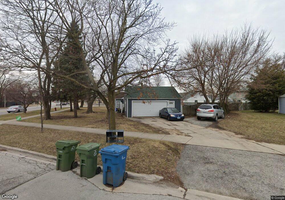
5800 W 93rd St Oak Lawn, IL 60453
Estimated Value: $266,348 - $276,000
3
Beds
1
Bath
1,056
Sq Ft
$257/Sq Ft
Est. Value
About This Home
This home is located at 5800 W 93rd St, Oak Lawn, IL 60453 and is currently estimated at $271,337, approximately $256 per square foot. 5800 W 93rd St is a home located in Cook County with nearby schools including Harnew Elementary School, Simmons Middle School, and Oak Lawn Community High School.
Ownership History
Date
Name
Owned For
Owner Type
Purchase Details
Closed on
Apr 14, 2022
Sold by
Korenchan Janice C and Mccarty Wayne G
Bought by
Korenchan Janice C and Korenchan Daniel
Current Estimated Value
Purchase Details
Closed on
Feb 1, 1996
Sold by
Korenchan Janice C
Bought by
Mccarty Wayne G and Mccarty Catherine M
Purchase Details
Closed on
Sep 14, 1995
Sold by
Mccarty Wayne G
Bought by
Korenchan Janice C
Create a Home Valuation Report for This Property
The Home Valuation Report is an in-depth analysis detailing your home's value as well as a comparison with similar homes in the area
Home Values in the Area
Average Home Value in this Area
Purchase History
| Date | Buyer | Sale Price | Title Company |
|---|---|---|---|
| Korenchan Janice C | -- | Zubek Matthew F | |
| Mccarty Wayne G | -- | -- | |
| Korenchan Janice C | -- | -- |
Source: Public Records
Tax History Compared to Growth
Tax History
| Year | Tax Paid | Tax Assessment Tax Assessment Total Assessment is a certain percentage of the fair market value that is determined by local assessors to be the total taxable value of land and additions on the property. | Land | Improvement |
|---|---|---|---|---|
| 2024 | $4,940 | $17,000 | $6,510 | $10,490 |
| 2023 | $6,225 | $17,000 | $6,510 | $10,490 |
| 2022 | $6,225 | $17,724 | $5,661 | $12,063 |
| 2021 | $6,032 | $17,723 | $5,661 | $12,062 |
| 2020 | $5,910 | $17,723 | $5,661 | $12,062 |
| 2019 | $4,980 | $15,339 | $5,094 | $10,245 |
| 2018 | $4,772 | $15,339 | $5,094 | $10,245 |
| 2017 | $4,840 | $15,339 | $5,094 | $10,245 |
| 2016 | $4,404 | $13,117 | $4,245 | $8,872 |
| 2015 | $4,370 | $13,117 | $4,245 | $8,872 |
| 2014 | $4,331 | $13,117 | $4,245 | $8,872 |
| 2013 | $4,915 | $16,341 | $4,245 | $12,096 |
Source: Public Records
Map
Nearby Homes
- 9258 Austin Ave
- 9520 S Mayfield Ave Unit N105
- 9422 Central Ave
- 9100 Lynwood Dr
- 9228 S 55th Ct
- 9540 S Mayfield Ave Unit 103S
- 9542 Massasoit Ave
- 9239 S 55th Ct
- 9545 Southwest Hwy Unit 5
- 9542 Parkside Ave
- 9001 Major Ave
- 9609 S Austin Ave Unit 1E
- 5840 W 90th St
- 9600 Central Ave
- 9429 S 55th Ave
- 5810 W 97th St
- 5555 W 90th St
- 5831 W 89th St
- 9624 W Shore Dr
- 8952 S 55th Ct
- 5808 W 93rd St
- 9240 Menard Ave
- 5812 W 93rd St
- 9236 Menard Ave
- 9301 Menard Ave
- 9330 Menard Ave
- 9317 Menard Ave
- 9232 Menard Ave
- 9237 Monitor Ave
- 9245 Menard Ave
- 9321 Menard Ave
- 9233 Monitor Ave
- 9231 Menard Ave
- 9228 Menard Ave
- 9325 Menard Ave
- 9306 Massasoit Ave
- 9229 Monitor Ave
- 9308 Massasoit Ave
- 9329 Menard Ave
- 9316 Massasoit Ave