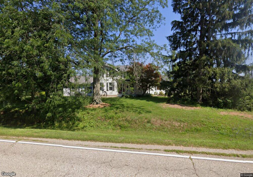
5800 W Territorial Rd Camden, MI 49232
Estimated Value: $217,787 - $280,000
--
Bed
1
Bath
1,364
Sq Ft
$184/Sq Ft
Est. Value
About This Home
This home is located at 5800 W Territorial Rd, Camden, MI 49232 and is currently estimated at $251,262, approximately $184 per square foot. 5800 W Territorial Rd is a home located in Hillsdale County with nearby schools including Camden-Frontier K-8 School and Camden-Frontier High School.
Ownership History
Date
Name
Owned For
Owner Type
Purchase Details
Closed on
May 21, 2014
Sold by
Rodgers Bradley L and Rodgers Mary A
Bought by
Rodgers Bradley L and Rodgers Mary A
Current Estimated Value
Purchase Details
Closed on
Dec 16, 2002
Sold by
Greek Linda and Mehigan Tracy
Bought by
Rodgers Bradley and Rodgers Mary A
Purchase Details
Closed on
Nov 19, 2002
Sold by
Combs Shelby J Charitable Unitrust
Bought by
Greek Linda and Mehigan Tracy
Purchase Details
Closed on
Nov 4, 2002
Bought by
Combs Shelby J Charitable Unitrust
Purchase Details
Closed on
Aug 19, 2002
Bought by
Combs Shelby J Charitable Unitrust
Purchase Details
Closed on
Nov 12, 1998
Bought by
Combs, Shelby Trust
Create a Home Valuation Report for This Property
The Home Valuation Report is an in-depth analysis detailing your home's value as well as a comparison with similar homes in the area
Home Values in the Area
Average Home Value in this Area
Purchase History
| Date | Buyer | Sale Price | Title Company |
|---|---|---|---|
| Rodgers Bradley L | -- | None Available | |
| Rodgers Bradley | $73,000 | -- | |
| Greek Linda | $351,000 | -- | |
| Combs Shelby J Charitable Unitrust | -- | -- | |
| Combs Shelby J Charitable Unitrust | -- | -- | |
| Combs, Shelby Trust | -- | -- |
Source: Public Records
Tax History Compared to Growth
Tax History
| Year | Tax Paid | Tax Assessment Tax Assessment Total Assessment is a certain percentage of the fair market value that is determined by local assessors to be the total taxable value of land and additions on the property. | Land | Improvement |
|---|---|---|---|---|
| 2025 | -- | $88,300 | $0 | $0 |
| 2024 | -- | $94,800 | $0 | $0 |
| 2023 | -- | $85,071 | $10,320 | $74,751 |
| 2022 | -- | $72,520 | $10,000 | $62,520 |
| 2021 | $0 | $63,350 | $10,748 | $52,602 |
| 2020 | $0 | $59,619 | $10,488 | $49,131 |
| 2019 | $0 | $53,158 | $8,850 | $44,308 |
| 2018 | $0 | $0 | $0 | $0 |
| 2017 | -- | $0 | $0 | $0 |
| 2016 | $37 | $0 | $0 | $0 |
| 2015 | -- | $0 | $0 | $0 |
| 2013 | $433 | $41,780 | $0 | $0 |
| 2012 | $412 | $37,650 | $0 | $0 |
Source: Public Records
Map
Nearby Homes
- 8800 W Territorial Rd
- 0 W Territorial Rd Unit 25043960
- 15791 Rice Rd
- 5-50 County Rd S
- 8833 W Territorial Rd
- 18405 County Road 2-50
- 14934 Heather Ct
- 14401 Woodbridge Rd
- 214 Miller St
- 202 W Bell St
- 16702 Ohio 49
- 14600 W Diane Dr
- 623-624 Yuma Trail
- 362 Wasco Trail
- 17930 County Road 1 50
- 13857 E Diane Dr
- 13791 E Diane Dr
- 600 Seneca Dr
- 988-989 Seneca Dr
- 15297 County Road 5
- 5950 W Territorial Rd
- 5983 W Territorial Rd
- 5740 W Territorial Rd
- 14942 Rice Rd
- 14866 Rice Rd
- 000 W Territorial Rd Unit A and B
- 14810 Rice Rd
- 1 Rice Rd
- 2 Rice Rd
- 14740 Rice Rd
- 14774 Rice Rd
- 6011 W Territorial Rd
- 6200 W Territorial Rd
- 14600 Rice
- 0 W Territorial Rd Unit 4679315
- 0 W Territorial Rd Unit 4679314
- 0 W Territorial Rd Unit 5561409
- 0 W Territorial Rd Unit 12060161
- 0 W Territorial Rd Unit 12060144
- 0 W Territorial Rd Unit 53011001416