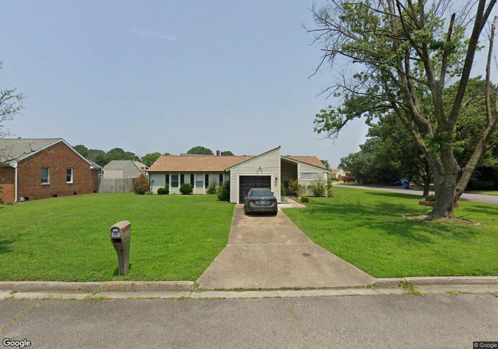
5800 Woodside Ln Portsmouth, VA 23703
Churchland NeighborhoodEstimated Value: $344,000 - $374,000
4
Beds
2
Baths
1,825
Sq Ft
$197/Sq Ft
Est. Value
About This Home
This home is located at 5800 Woodside Ln, Portsmouth, VA 23703 and is currently estimated at $360,214, approximately $197 per square foot. 5800 Woodside Ln is a home located in Portsmouth City with nearby schools including Churchland Primary/Intermediate School, Churchland Middle School, and Churchland High School.
Ownership History
Date
Name
Owned For
Owner Type
Purchase Details
Closed on
Apr 14, 2023
Sold by
Martinez Bryan
Bought by
Grant Larry T and Grant Mary Jean
Current Estimated Value
Home Financials for this Owner
Home Financials are based on the most recent Mortgage that was taken out on this home.
Original Mortgage
$315,000
Outstanding Balance
$305,615
Interest Rate
6.42%
Mortgage Type
VA
Estimated Equity
$54,599
Purchase Details
Closed on
Apr 29, 2020
Sold by
Velazquez Dora
Bought by
Martinez Bryan and Martinez Reyes
Home Financials for this Owner
Home Financials are based on the most recent Mortgage that was taken out on this home.
Original Mortgage
$244,497
Interest Rate
3.6%
Mortgage Type
VA
Purchase Details
Closed on
Jul 30, 2001
Sold by
King Harvey T
Bought by
Velazouez Benjamin
Create a Home Valuation Report for This Property
The Home Valuation Report is an in-depth analysis detailing your home's value as well as a comparison with similar homes in the area
Home Values in the Area
Average Home Value in this Area
Purchase History
| Date | Buyer | Sale Price | Title Company |
|---|---|---|---|
| Grant Larry T | $315,000 | Rw Towne Title | |
| Martinez Bryan | $239,000 | Attorney | |
| Velazouez Benjamin | $115,500 | -- |
Source: Public Records
Mortgage History
| Date | Status | Borrower | Loan Amount |
|---|---|---|---|
| Open | Grant Larry T | $315,000 | |
| Previous Owner | Martinez Bryan | $244,497 |
Source: Public Records
Tax History Compared to Growth
Tax History
| Year | Tax Paid | Tax Assessment Tax Assessment Total Assessment is a certain percentage of the fair market value that is determined by local assessors to be the total taxable value of land and additions on the property. | Land | Improvement |
|---|---|---|---|---|
| 2025 | $4,070 | $321,910 | $100,800 | $221,110 |
| 2024 | $4,070 | $316,980 | $100,800 | $216,180 |
| 2023 | $3,580 | $286,430 | $100,800 | $185,630 |
| 2022 | $3,276 | $252,030 | $84,000 | $168,030 |
| 2021 | $2,917 | $224,380 | $56,350 | $168,030 |
| 2020 | $2,882 | $221,700 | $53,670 | $168,030 |
| 2019 | $2,778 | $213,690 | $53,670 | $160,020 |
| 2018 | $2,778 | $213,690 | $53,670 | $160,020 |
| 2017 | $2,778 | $213,690 | $53,670 | $160,020 |
| 2016 | $2,778 | $213,690 | $53,670 | $160,020 |
| 2015 | $2,674 | $205,690 | $53,670 | $152,020 |
| 2014 | $2,612 | $205,690 | $53,670 | $152,020 |
Source: Public Records
Map
Nearby Homes
- 4444 Southampton Arch
- 4619 River Shore Rd
- 5728 Hawthorne Ln
- 21 Windy Pines Crescent
- 5833 Hawthorne Ln
- 5693 Rivermill Cir
- 5606 Gregory Ct
- 4232 Summerset Dr
- 4224 Burnham Dr
- 4726 River Shore Rd
- 4200 Quince Rd
- 4028 Swannanoa Dr
- 8 Compass Ct
- 4100 Mayfair Way
- 17 Shoal Ct
- 4071 Long Point Blvd
- 5807 Dunkin St
- 6750 Burbage Landing Cir
- 6602 James Point Ct
- 5028 Bay Cir
- 5804 Woodside Ln
- 4510 Southampton Arch
- 4505 Southampton Arch
- 5806 Woodside Ln
- 5801 Woodside Ln
- 4507 Southampton Arch
- 5805 Woodside Ln
- 4503 Southampton Arch
- 4600 Southampton Arch
- 4509 Southampton Arch
- 5807 Woodside Ln
- 5810 Woodside Ln
- 5804 Southampton Ln
- 4511 Southampton Arch
- 4508 River Shore Rd
- 4602 Southampton Arch
- 4510 River Shore Rd
- 5809 Woodside Ln
- 4504 River Shore Rd
- 4601 Southampton Arch