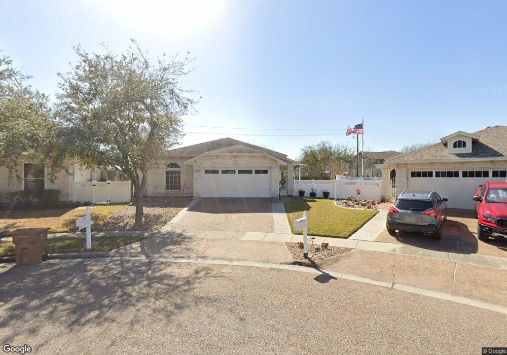
5801 Commonwealth Dr Corpus Christi, TX 78414
Southside NeighborhoodEstimated Value: $270,846 - $293,000
2
Beds
--
Bath
1,765
Sq Ft
$160/Sq Ft
Est. Value
About This Home
This home is located at 5801 Commonwealth Dr, Corpus Christi, TX 78414 and is currently estimated at $282,462, approximately $160 per square foot. 5801 Commonwealth Dr is a home located in Nueces County with nearby schools including Faye Webb Elementary School, Kaffie Middle School, and Veterans Memorial High School.
Ownership History
Date
Name
Owned For
Owner Type
Purchase Details
Closed on
Jan 17, 2019
Sold by
Ballantyne Lorene
Bought by
Rodriguez George and Rodriguez Sheila
Current Estimated Value
Home Financials for this Owner
Home Financials are based on the most recent Mortgage that was taken out on this home.
Original Mortgage
$200,000
Outstanding Balance
$176,196
Interest Rate
4.7%
Mortgage Type
Seller Take Back
Estimated Equity
$106,266
Purchase Details
Closed on
Jun 9, 2005
Sold by
Braselton Fred
Bought by
Ballantyne George D and Ballantyne Lorene
Home Financials for this Owner
Home Financials are based on the most recent Mortgage that was taken out on this home.
Original Mortgage
$50,150
Interest Rate
5.78%
Mortgage Type
New Conventional
Create a Home Valuation Report for This Property
The Home Valuation Report is an in-depth analysis detailing your home's value as well as a comparison with similar homes in the area
Home Values in the Area
Average Home Value in this Area
Purchase History
| Date | Buyer | Sale Price | Title Company |
|---|---|---|---|
| Rodriguez George | -- | None Available | |
| Ballantyne George D | -- | None Available |
Source: Public Records
Mortgage History
| Date | Status | Borrower | Loan Amount |
|---|---|---|---|
| Open | Rodriguez George | $200,000 | |
| Previous Owner | Ballantyne George D | $50,150 |
Source: Public Records
Tax History Compared to Growth
Tax History
| Year | Tax Paid | Tax Assessment Tax Assessment Total Assessment is a certain percentage of the fair market value that is determined by local assessors to be the total taxable value of land and additions on the property. | Land | Improvement |
|---|---|---|---|---|
| 2025 | $6,045 | $319,447 | $35,601 | $283,846 |
| 2024 | $6,045 | $277,971 | $35,601 | $242,370 |
| 2023 | $6,131 | $287,666 | $35,601 | $252,065 |
| 2022 | $6,386 | $256,689 | $35,601 | $221,088 |
| 2021 | $6,193 | $236,877 | $35,601 | $201,276 |
| 2020 | $5,509 | $210,187 | $35,601 | $174,586 |
| 2019 | $5,600 | $211,789 | $35,601 | $176,188 |
| 2018 | $5,025 | $198,471 | $35,601 | $162,870 |
| 2017 | $5,055 | $200,241 | $35,601 | $164,640 |
| 2016 | $4,858 | $195,671 | $35,601 | $160,070 |
| 2015 | $1,431 | $174,950 | $35,601 | $139,349 |
| 2014 | $1,431 | $195,772 | $35,601 | $160,171 |
Source: Public Records
Map
Nearby Homes
- 6046 Oriental Ave
- 6638 Opengate Dr
- 7009 Tocken Ct
- 5501 Huntwick Ave
- 6133 Cumberland Cir
- 6709 Oakgate Dr
- 5918 Woodmere Dr
- 6005 Tapestry Dr
- 5914 Vandemere Dr
- 6714 Northgate Dr
- 5917 Harvest Hill Rd
- 5906 Lindenwood Dr
- 3525 Picadilly Ln
- 5422 Pressler Dr
- 6726 Hunt Dr
- 5337 Inverness Dr
- 6313 Ramsgate Cir
- 6602 Hunt Dr
- 5306 Woodgate Dr
- 6622 Hunt Dr
- 6749 Shilling Way Ln
- 5805 Commonwealth Dr
- 5809 Commonwealth Dr
- 6745 Shilling Way Ln
- 5813 Commonwealth Dr
- 6741 Shilling Way Ln
- 5802 Commonwealth Dr
- 6737 Shilling Way Ln
- 5810 Commonwealth Dr
- 5814 Commonwealth Dr
- 5801 Makepeace Ln
- 5805 Makepeace Ln
- 6729 Shilling Way Ln
- 5809 Makepeace Ln
- 5813 Makepeace Ln
- 6745 Sudbury
- 6725 Shilling Way Ln
- 6741 Sudbury
- 6721 Shilling Way Ln