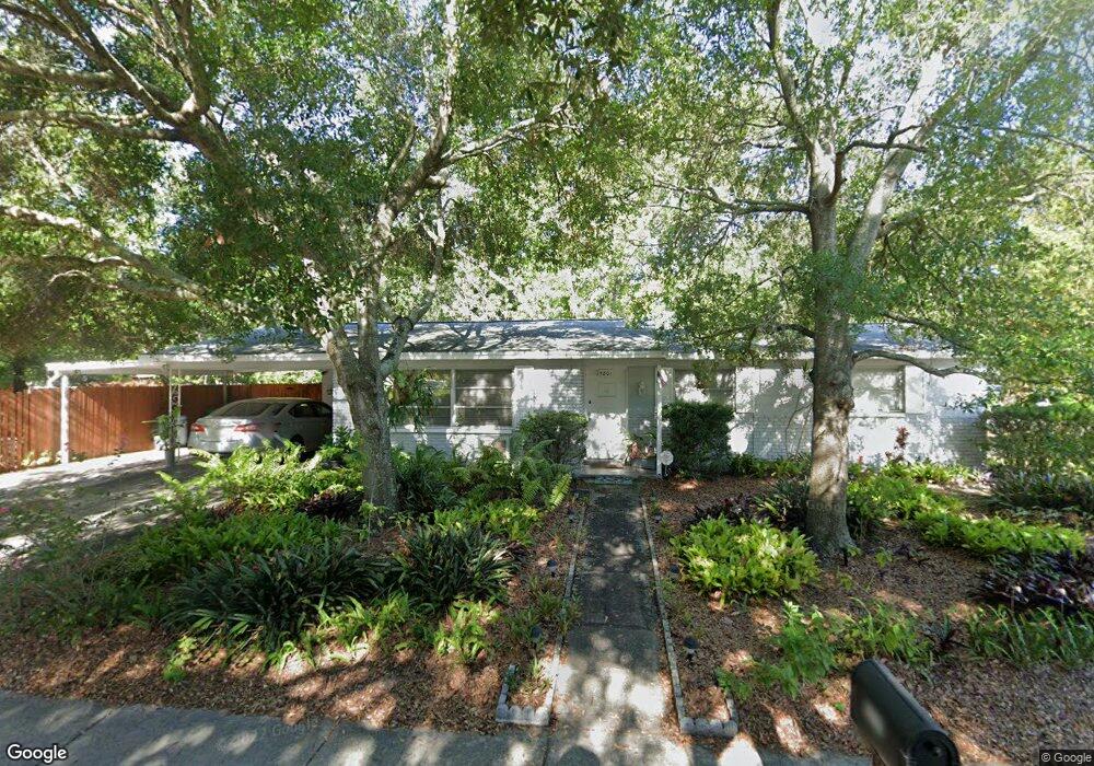
5801 S Lois Ave Tampa, FL 33616
Sun Bay South NeighborhoodEstimated Value: $339,000 - $388,000
2
Beds
2
Baths
1,233
Sq Ft
$291/Sq Ft
Est. Value
About This Home
This home is located at 5801 S Lois Ave, Tampa, FL 33616 and is currently estimated at $358,838, approximately $291 per square foot. 5801 S Lois Ave is a home located in Hillsborough County with nearby schools including Lanier Elementary School, Monroe Middle School, and Robinson High School.
Ownership History
Date
Name
Owned For
Owner Type
Purchase Details
Closed on
Aug 29, 2025
Sold by
Domain Homes Inc
Bought by
Sharma Ankur and Sharma Riya
Current Estimated Value
Purchase Details
Closed on
Sep 29, 2020
Sold by
Kimsey Eileen H
Bought by
Kimsey Eileen H
Purchase Details
Closed on
Feb 22, 2002
Sold by
Mcgee Robert T
Bought by
Kimsey Eileen H
Home Financials for this Owner
Home Financials are based on the most recent Mortgage that was taken out on this home.
Original Mortgage
$45,000
Interest Rate
7.02%
Create a Home Valuation Report for This Property
The Home Valuation Report is an in-depth analysis detailing your home's value as well as a comparison with similar homes in the area
Home Values in the Area
Average Home Value in this Area
Purchase History
| Date | Buyer | Sale Price | Title Company |
|---|---|---|---|
| Sharma Ankur | $1,120,000 | Vintage Title | |
| Kimsey Eileen H | -- | Attorney | |
| Kimsey Eileen H | $23,000 | -- |
Source: Public Records
Mortgage History
| Date | Status | Borrower | Loan Amount |
|---|---|---|---|
| Previous Owner | Kimsey Eileen H | $45,000 |
Source: Public Records
Tax History Compared to Growth
Tax History
| Year | Tax Paid | Tax Assessment Tax Assessment Total Assessment is a certain percentage of the fair market value that is determined by local assessors to be the total taxable value of land and additions on the property. | Land | Improvement |
|---|---|---|---|---|
| 2024 | $843 | $78,172 | -- | -- |
| 2023 | $804 | $75,895 | $0 | $0 |
| 2022 | $784 | $73,684 | $0 | $0 |
| 2021 | $790 | $71,538 | $0 | $0 |
| 2020 | $784 | $70,550 | $0 | $0 |
| 2019 | $770 | $68,964 | $0 | $0 |
| 2018 | $765 | $67,678 | $0 | $0 |
| 2017 | $756 | $129,325 | $0 | $0 |
| 2016 | $741 | $64,923 | $0 | $0 |
| 2015 | $662 | $64,472 | $0 | $0 |
| 2014 | $662 | $63,960 | $0 | $0 |
| 2013 | $669 | $63,015 | $0 | $0 |
Source: Public Records
Map
Nearby Homes
- 4114 W Oklahoma Ave
- 5805 S Hubert Ave
- 4316 Wallace Cir
- 4206 W Iowa Ave
- 4308 W Iowa Ave
- 4407 W Trilby Ave
- 4009 W Wallace Ave
- 4008 W Tyson Ave
- 4412 W Oklahoma Ave
- 4414 W Oklahoma Ave
- 3914 W Oklahoma Ave
- 4005 W Tyson Ave
- 4410 Algonkin Ct
- 5528 Liberty Plain Cir
- 4420 W Wyoming Ave
- 3909 W Oklahoma Ave
- 4422 W Trilby Ave
- 4421 W Leila Ave
- 4501 Bay Spring Ct
- 4412 W Pearl Ave
- 4204 W Wyoming Ave
- 4206 W Wyoming Ave
- 4116 W Wyoming Ave
- 4201 W Wisconsin Ave
- 4203 W Wisconsin Ave
- 4208 W Wyoming Ave
- 4115 W Wisconsin Ave
- 4205 W Wisconsin Ave
- 4114 W Wyoming Ave
- 4201 W Wyoming Ave
- 4205 W Wyoming Ave
- 4207 W Wisconsin Ave
- 4210 W Wyoming Ave
- 4115 W Wyoming Ave
- 4113 W Wisconsin Ave
- 4209 W Wyoming Ave
- 4112 W Wyoming Ave
- 4209 W Wisconsin Ave
- 4113 W Wyoming Ave
- 4212 W Wyoming Ave