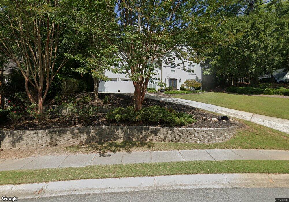
5802 Brookstone Cir NW Unit 1 Acworth, GA 30101
Estimated Value: $522,894 - $630,000
5
Beds
3
Baths
3,163
Sq Ft
$181/Sq Ft
Est. Value
About This Home
This home is located at 5802 Brookstone Cir NW Unit 1, Acworth, GA 30101 and is currently estimated at $573,224, approximately $181 per square foot. 5802 Brookstone Cir NW Unit 1 is a home located in Cobb County with nearby schools including Pickett's Mill Elementary School, Durham Middle School, and Allatoona High School.
Ownership History
Date
Name
Owned For
Owner Type
Purchase Details
Closed on
Jun 7, 2022
Sold by
Joe Scaturno Linda
Bought by
Scaturro Linda Jo
Current Estimated Value
Purchase Details
Closed on
Sep 18, 2014
Sold by
Scaturro Michael C
Bought by
Scaturro Linda Joe
Purchase Details
Closed on
May 1, 1998
Sold by
Mercer Gregory S and Mercer Debra Ann
Bought by
Scatturo Michael C
Home Financials for this Owner
Home Financials are based on the most recent Mortgage that was taken out on this home.
Original Mortgage
$140,800
Interest Rate
7.03%
Mortgage Type
New Conventional
Create a Home Valuation Report for This Property
The Home Valuation Report is an in-depth analysis detailing your home's value as well as a comparison with similar homes in the area
Home Values in the Area
Average Home Value in this Area
Purchase History
| Date | Buyer | Sale Price | Title Company |
|---|---|---|---|
| Scaturro Linda Jo | -- | None Listed On Document | |
| Scaturro Linda Joe | -- | -- | |
| Scatturo Michael C | $176,000 | -- |
Source: Public Records
Mortgage History
| Date | Status | Borrower | Loan Amount |
|---|---|---|---|
| Previous Owner | Scatturo Michael C | $140,800 |
Source: Public Records
Tax History Compared to Growth
Tax History
| Year | Tax Paid | Tax Assessment Tax Assessment Total Assessment is a certain percentage of the fair market value that is determined by local assessors to be the total taxable value of land and additions on the property. | Land | Improvement |
|---|---|---|---|---|
| 2024 | $5,748 | $212,784 | $52,000 | $160,784 |
| 2023 | $5,006 | $166,032 | $34,000 | $132,032 |
| 2022 | $5,039 | $166,032 | $34,000 | $132,032 |
| 2021 | $3,660 | $120,608 | $34,000 | $86,608 |
| 2020 | $3,418 | $112,608 | $26,000 | $86,608 |
| 2019 | $2,852 | $112,608 | $26,000 | $86,608 |
| 2018 | $2,443 | $93,916 | $24,000 | $69,916 |
| 2017 | $2,337 | $93,916 | $24,000 | $69,916 |
| 2016 | $2,339 | $93,916 | $24,000 | $69,916 |
| 2015 | $2,449 | $96,392 | $24,000 | $72,392 |
| 2014 | $2,468 | $96,392 | $0 | $0 |
Source: Public Records
Map
Nearby Homes
- 1799 Mclain Rd NW
- 5654 Brookstone Dr NW
- The Ashburn Plan at Woodford
- The Rebecca Plan at Woodford
- The Dillard Plan at Woodford
- The Oxford Plan at Woodford
- The Pinehurst Plan at Woodford
- The Trenton Plan at Woodford
- The Vinings Plan at Woodford
- The Bainbridge Plan at Woodford
- The Brooks Plan at Woodford
- The Evans Plan at Woodford
- 1670 Knob Creek Ct NW
- 002 Knob Creek Ct NW
- 5894 Amber Glow Ln
- 5485 Brookstone Dr NW
- 5711 Brynwood Cir NW
- 001 Amber Glow Ln NW
- 2009 Mclain Rd NW
- 1496 Fallsbrook Ct NW
- 5800 Brookstone Cir NW
- 5804 Brookstone Cir NW
- 5806 Brookstone Cir NW
- 5626 Brookstone Dr NW
- 5808 Brookstone Cir NW Unit 1
- 5624 Brookstone Dr NW Unit 1
- 5630 Brookstone Dr NW
- 5805 Brookstone Cir NW
- 0 Brookstone Cir NW Unit 8650410
- 0 Brookstone Cir NW Unit 8606721
- 0 Brookstone Cir NW Unit 8398127
- 0 Brookstone Cir NW Unit 9028965
- 0 Brookstone Cir NW Unit 9014196
- 0 Brookstone Cir NW Unit 8790150
- 0 Brookstone Cir NW Unit 8794349
- 0 Brookstone Cir NW Unit 7114101
- 0 Brookstone Cir NW Unit 7271131
- 0 Brookstone Cir NW Unit 7399839
- 0 Brookstone Cir NW Unit 7536932
- 0 Brookstone Cir NW Unit 8062900