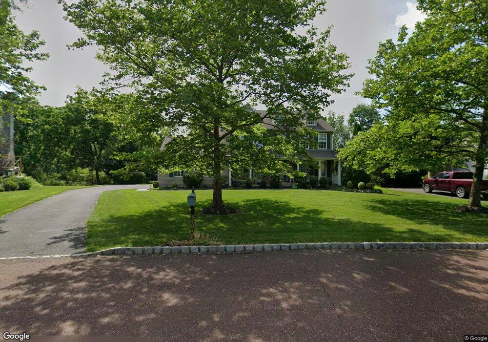
5804 Emily Dr Doylestown, PA 18902
Plumstead NeighborhoodEstimated Value: $726,000 - $785,000
4
Beds
3
Baths
2,427
Sq Ft
$312/Sq Ft
Est. Value
About This Home
This home is located at 5804 Emily Dr, Doylestown, PA 18902 and is currently estimated at $757,070, approximately $311 per square foot. 5804 Emily Dr is a home located in Bucks County with nearby schools including Groveland Elementary School, Tohickon Middle School, and Central Bucks High School-West.
Ownership History
Date
Name
Owned For
Owner Type
Purchase Details
Closed on
Jan 22, 2024
Sold by
Scott James W and Scott Maryanne V
Bought by
James W And Maryanne V Scott Family Trust and Scott
Current Estimated Value
Purchase Details
Closed on
Oct 30, 2003
Sold by
Boardman David M and Toewe Mary Louise
Bought by
Scott James and Scott Maryann
Home Financials for this Owner
Home Financials are based on the most recent Mortgage that was taken out on this home.
Original Mortgage
$210,000
Interest Rate
3.75%
Mortgage Type
Purchase Money Mortgage
Purchase Details
Closed on
Dec 15, 1997
Sold by
Landis Greene Lp
Bought by
Boardman David M and Toewe Mary Louise
Home Financials for this Owner
Home Financials are based on the most recent Mortgage that was taken out on this home.
Original Mortgage
$195,000
Interest Rate
7.08%
Create a Home Valuation Report for This Property
The Home Valuation Report is an in-depth analysis detailing your home's value as well as a comparison with similar homes in the area
Home Values in the Area
Average Home Value in this Area
Purchase History
| Date | Buyer | Sale Price | Title Company |
|---|---|---|---|
| James W And Maryanne V Scott Family Trust | -- | None Listed On Document | |
| Scott James | $399,900 | -- | |
| Boardman David M | $230,145 | -- |
Source: Public Records
Mortgage History
| Date | Status | Borrower | Loan Amount |
|---|---|---|---|
| Previous Owner | Scott James | $210,000 | |
| Previous Owner | Boardman David M | $195,000 |
Source: Public Records
Tax History Compared to Growth
Tax History
| Year | Tax Paid | Tax Assessment Tax Assessment Total Assessment is a certain percentage of the fair market value that is determined by local assessors to be the total taxable value of land and additions on the property. | Land | Improvement |
|---|---|---|---|---|
| 2025 | $8,048 | $46,320 | $5,760 | $40,560 |
| 2024 | $8,048 | $46,320 | $5,760 | $40,560 |
| 2023 | $7,792 | $46,320 | $5,760 | $40,560 |
| 2022 | $7,705 | $46,320 | $5,760 | $40,560 |
| 2021 | $7,619 | $46,320 | $5,760 | $40,560 |
| 2020 | $7,619 | $46,320 | $5,760 | $40,560 |
| 2019 | $7,573 | $46,320 | $5,760 | $40,560 |
| 2018 | $7,573 | $46,320 | $5,760 | $40,560 |
| 2017 | $7,469 | $46,320 | $5,760 | $40,560 |
| 2016 | $7,469 | $46,320 | $5,760 | $40,560 |
| 2015 | -- | $46,320 | $5,760 | $40,560 |
| 2014 | -- | $46,320 | $5,760 | $40,560 |
Source: Public Records
Map
Nearby Homes
- 4000 Miriam Dr
- 3789 Stump Rd
- 1214 Hockley Dr
- 1222 Hockley Dr
- 204 Pennland Farm Dr
- 81 Williams Dr
- 319 Pennington Way
- 4811 Lincoln Aly
- Lot 10 Schadle Rd
- 316 Schadle Rd
- Lot 6 Henry Ct
- 137 S Main St
- 17 Ruhl Dr
- 116 Bishop Way
- 238 Allem Ln Unit 238
- 135 Bishop Way
- 5068 Kratz Carriage Rd
- 178 Elephant Rd Unit C26
- 178 Elephant Rd Unit A6
- 4936 Curly Hill Rd
- 5806 Emily Dr
- 5802 Emily Dr
- 5807 Emily Dr
- 4154 Gregory Dr
- 5798 Emily Dr
- 5808 Emily Dr
- 4134 Gregory Dr
- 4162 Gregory Dr
- 5813 Emily Dr
- 5812 Emily Dr
- 4164 Gregory Dr
- 4128 Gregory Dr
- 4143 Gregory Dr
- 4151 Gregory Dr
- 4159 Gregory Dr
- 4135 Gregory Dr
- 5818 Emily Dr
- 5821 Emily Dr
- 4120 Gregory Dr
- 4168 Gregory Dr