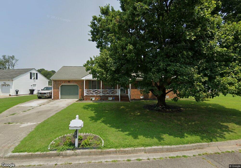
5804 Woodside Ln Portsmouth, VA 23703
Churchland NeighborhoodEstimated Value: $363,000 - $395,000
3
Beds
3
Baths
1,823
Sq Ft
$205/Sq Ft
Est. Value
About This Home
This home is located at 5804 Woodside Ln, Portsmouth, VA 23703 and is currently estimated at $373,268, approximately $204 per square foot. 5804 Woodside Ln is a home located in Portsmouth City with nearby schools including Churchland Primary/Intermediate School, Churchland Middle School, and Churchland High School.
Ownership History
Date
Name
Owned For
Owner Type
Purchase Details
Closed on
Jun 22, 2018
Sold by
Corbus William H and Corbus Donna Sanders
Bought by
Moore Lisa M
Current Estimated Value
Home Financials for this Owner
Home Financials are based on the most recent Mortgage that was taken out on this home.
Original Mortgage
$237,650
Outstanding Balance
$205,559
Interest Rate
4.6%
Mortgage Type
New Conventional
Estimated Equity
$167,709
Create a Home Valuation Report for This Property
The Home Valuation Report is an in-depth analysis detailing your home's value as well as a comparison with similar homes in the area
Home Values in the Area
Average Home Value in this Area
Purchase History
| Date | Buyer | Sale Price | Title Company |
|---|---|---|---|
| Moore Lisa M | $245,000 | Attorney |
Source: Public Records
Mortgage History
| Date | Status | Borrower | Loan Amount |
|---|---|---|---|
| Open | Moore Lisa M | $237,650 |
Source: Public Records
Tax History Compared to Growth
Tax History
| Year | Tax Paid | Tax Assessment Tax Assessment Total Assessment is a certain percentage of the fair market value that is determined by local assessors to be the total taxable value of land and additions on the property. | Land | Improvement |
|---|---|---|---|---|
| 2025 | $4,333 | $344,020 | $91,800 | $252,220 |
| 2024 | $4,333 | $338,380 | $91,800 | $246,580 |
| 2023 | $3,877 | $310,180 | $91,800 | $218,380 |
| 2022 | $3,565 | $274,200 | $76,500 | $197,700 |
| 2021 | $3,237 | $249,020 | $51,320 | $197,700 |
| 2020 | $3,205 | $246,570 | $48,870 | $197,700 |
| 2019 | $3,083 | $237,170 | $48,870 | $188,300 |
| 2018 | $3,083 | $237,170 | $48,870 | $188,300 |
| 2017 | $3,083 | $237,170 | $48,870 | $188,300 |
| 2016 | $3,079 | $236,870 | $48,870 | $188,000 |
| 2015 | $2,957 | $227,470 | $48,870 | $178,600 |
| 2014 | $2,889 | $227,470 | $48,870 | $178,600 |
Source: Public Records
Map
Nearby Homes
- 4444 Southampton Arch
- 4619 River Shore Rd
- 21 Windy Pines Crescent
- 5728 Hawthorne Ln
- 5833 Hawthorne Ln
- 5693 Rivermill Cir
- 4232 Summerset Dr
- 4224 Burnham Dr
- 4726 River Shore Rd
- 5606 Gregory Ct
- 4200 Quince Rd
- 8 Compass Ct
- 4028 Swannanoa Dr
- 4100 Mayfair Way
- 17 Shoal Ct
- 4071 Long Point Blvd
- 5807 Dunkin St
- 6750 Burbage Landing Cir
- 6602 James Point Ct
- 5028 Bay Cir
- 5806 Woodside Ln
- 5800 Woodside Ln
- 4510 Southampton Arch
- 5810 Woodside Ln
- 5805 Woodside Ln
- 4600 Southampton Arch
- 5807 Woodside Ln
- 5801 Woodside Ln
- 5809 Woodside Ln
- 4602 Southampton Arch
- 5814 Woodside Ln
- 4505 Southampton Arch
- 4507 Southampton Arch
- 5811 Woodside Ln
- 4503 Southampton Arch
- 4509 Southampton Arch
- 5804 Southampton Ln
- 4511 Southampton Arch
- 4604 Southampton Arch
- 5818 Woodside Ln