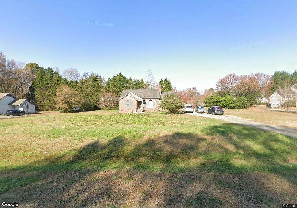
5809 Phillips Landing Dr Wake Forest, NC 27587
Estimated Value: $269,000 - $411,000
3
Beds
2
Baths
1,475
Sq Ft
$231/Sq Ft
Est. Value
About This Home
This home is located at 5809 Phillips Landing Dr, Wake Forest, NC 27587 and is currently estimated at $341,100, approximately $231 per square foot. 5809 Phillips Landing Dr is a home located in Wake County with nearby schools including Rolesville Elementary School, Rolesville Middle School, and Rolesville High School.
Ownership History
Date
Name
Owned For
Owner Type
Purchase Details
Closed on
Feb 12, 2020
Sold by
Freeman Ty C
Bought by
Freeman Michelle Barndt
Current Estimated Value
Purchase Details
Closed on
Jan 12, 2001
Sold by
Edwards Jerry Allen and Edwards Kim Swilley
Bought by
Freeman Ty C and Freeman Michelle B
Home Financials for this Owner
Home Financials are based on the most recent Mortgage that was taken out on this home.
Original Mortgage
$127,893
Interest Rate
7.53%
Purchase Details
Closed on
Jun 14, 2000
Sold by
Leggett Marshall W
Bought by
Edwards Jerry Allen and Edwards Kim Swilley
Home Financials for this Owner
Home Financials are based on the most recent Mortgage that was taken out on this home.
Original Mortgage
$113,905
Interest Rate
8.27%
Create a Home Valuation Report for This Property
The Home Valuation Report is an in-depth analysis detailing your home's value as well as a comparison with similar homes in the area
Home Values in the Area
Average Home Value in this Area
Purchase History
| Date | Buyer | Sale Price | Title Company |
|---|---|---|---|
| Freeman Michelle Barndt | -- | None Available | |
| Freeman Michelle Barndt | -- | None Listed On Document | |
| Freeman Ty C | $130,000 | -- | |
| Edwards Jerry Allen | $120,000 | -- |
Source: Public Records
Mortgage History
| Date | Status | Borrower | Loan Amount |
|---|---|---|---|
| Previous Owner | Freeman Ty C | $127,893 | |
| Previous Owner | Edwards Jerry Allen | $113,905 |
Source: Public Records
Tax History
| Year | Tax Paid | Tax Assessment Tax Assessment Total Assessment is a certain percentage of the fair market value that is determined by local assessors to be the total taxable value of land and additions on the property. | Land | Improvement |
|---|---|---|---|---|
| 2025 | $2,123 | $328,776 | $80,000 | $248,776 |
| 2024 | $2,062 | $328,776 | $80,000 | $248,776 |
Source: Public Records
Map
Nearby Homes
- 5820 Phillips Landing Dr
- 3604 Bailey Meadows Dr
- 3612 Bailey Meadows Dr
- 4315 Mitchell Mill Rd
- 2101 Stoneridge Barn Way
- 2108 Stoneridge Barn Way
- 2105 Stoneridge Barn Way
- 2112 Stoneridge Barn Way
- 2100 Stoneridge Barn Way
- 3741 Jonesville Rd
- 4605 Mineral Springs Ln
- 4704 Upchurch Ln
- 2245 Seraphic Way Unit 394
- 305 Cherubic Way
- 2433 Ln
- 2541 Quarry Rd
- 2456 Rosslare Mews Ln
- 2241 Seraphic Way Unit 395
- 2553 Quarry Rd
- 937 Fetching Place
- 5817 Phillips Landing Dr
- 3421 Buccaneer Ct
- 5805 Phillips Landing Dr
- 3417 Buccaneer Ct
- 5812 Phillips Landing Dr
- 5804 Phillips Landing Dr
- 3428 Buccaneer Ct
- 5801 Phillips Landing Dr
- 5829 Phillips Landing Dr
- 3409 Buccaneer Ct
- 3420 Buccaneer Ct
- 5824 Phillips Landing Dr
- 3412 Buccaneer Ct
- 5841 Phillips Landing Dr
- 5821 Fix It Shop Rd
- 3309 Starboard Ct
- 3404 Buccaneer Ct
- 3305 Starboard Ct
- 3308 Starboard Ct
- 3400 Buccaneer Ct
Your Personal Tour Guide
Ask me questions while you tour the home.