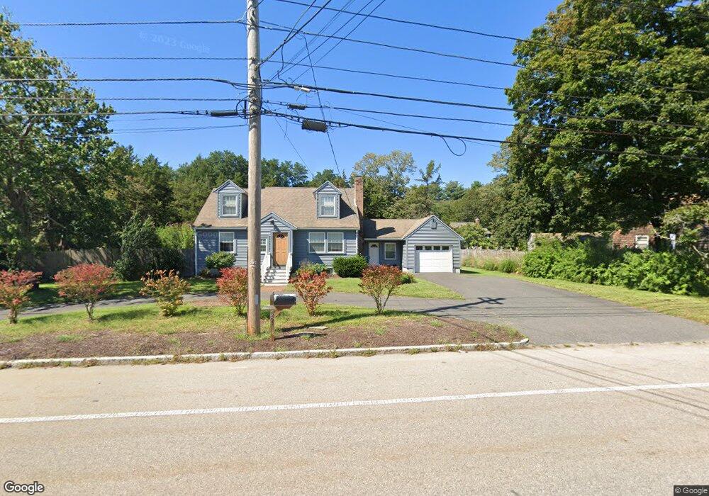
581 East St Wrentham, MA 02093
Estimated Value: $601,000 - $642,000
3
Beds
2
Baths
1,682
Sq Ft
$368/Sq Ft
Est. Value
About This Home
This home is located at 581 East St, Wrentham, MA 02093 and is currently estimated at $619,411, approximately $368 per square foot. 581 East St is a home located in Norfolk County with nearby schools including Delaney Elementary School, Charles E Roderick, and Foxborough Regional Charter School.
Ownership History
Date
Name
Owned For
Owner Type
Purchase Details
Closed on
Aug 21, 2007
Sold by
Sullivan Lisa M and Sullivan Thomas W
Bought by
Mercer Justin and Mercer Melissa
Current Estimated Value
Home Financials for this Owner
Home Financials are based on the most recent Mortgage that was taken out on this home.
Original Mortgage
$275,500
Interest Rate
6.67%
Mortgage Type
Purchase Money Mortgage
Purchase Details
Closed on
May 28, 1999
Sold by
Reardon Robert J and Reardon Tracy L
Bought by
Sullivan Thomas W
Home Financials for this Owner
Home Financials are based on the most recent Mortgage that was taken out on this home.
Original Mortgage
$203,000
Interest Rate
6.82%
Mortgage Type
Purchase Money Mortgage
Purchase Details
Closed on
Apr 9, 1999
Sold by
East St Rt
Bought by
Reardon Robert J and Reardon Tracy L
Home Financials for this Owner
Home Financials are based on the most recent Mortgage that was taken out on this home.
Original Mortgage
$203,000
Interest Rate
6.82%
Mortgage Type
Purchase Money Mortgage
Purchase Details
Closed on
Jan 14, 1993
Sold by
Mcclain Patrick M and Mcclain Dawn A
Bought by
Reardon Tr John E
Home Financials for this Owner
Home Financials are based on the most recent Mortgage that was taken out on this home.
Original Mortgage
$127,000
Interest Rate
8.3%
Mortgage Type
Purchase Money Mortgage
Create a Home Valuation Report for This Property
The Home Valuation Report is an in-depth analysis detailing your home's value as well as a comparison with similar homes in the area
Home Values in the Area
Average Home Value in this Area
Purchase History
| Date | Buyer | Sale Price | Title Company |
|---|---|---|---|
| Mercer Justin | $344,435 | -- | |
| Sullivan Thomas W | $215,000 | -- | |
| Reardon Robert J | $125,000 | -- | |
| Reardon Tr John E | $140,000 | -- |
Source: Public Records
Mortgage History
| Date | Status | Borrower | Loan Amount |
|---|---|---|---|
| Open | Reardon Tr John E | $265,000 | |
| Closed | Mercer Justin | $275,500 | |
| Previous Owner | Reardon Tr John E | $203,000 | |
| Previous Owner | Reardon Tr John E | $127,000 | |
| Previous Owner | Reardon Tr John E | $15,000 |
Source: Public Records
Tax History Compared to Growth
Tax History
| Year | Tax Paid | Tax Assessment Tax Assessment Total Assessment is a certain percentage of the fair market value that is determined by local assessors to be the total taxable value of land and additions on the property. | Land | Improvement |
|---|---|---|---|---|
| 2025 | $5,896 | $508,700 | $243,800 | $264,900 |
| 2024 | $5,656 | $471,300 | $243,800 | $227,500 |
| 2023 | $5,461 | $432,700 | $221,700 | $211,000 |
| 2022 | $5,129 | $375,200 | $199,600 | $175,600 |
| 2021 | $4,860 | $345,400 | $178,300 | $167,100 |
| 2020 | $4,999 | $350,800 | $162,700 | $188,100 |
| 2019 | $4,819 | $341,300 | $162,700 | $178,600 |
| 2018 | $4,602 | $323,200 | $162,700 | $160,500 |
| 2017 | $4,322 | $303,300 | $159,600 | $143,700 |
| 2016 | $4,225 | $295,900 | $154,900 | $141,000 |
| 2015 | $3,905 | $260,700 | $135,400 | $125,300 |
| 2014 | $3,841 | $250,900 | $130,200 | $120,700 |
Source: Public Records
Map
Nearby Homes
- 1 Lorraine Metcalf Dr
- 362 East St
- 270 Dedham St
- 65 Pond St
- 25 Foxboro Rd
- 10 Nature View Dr
- 15 Nature View Dr
- 11 Goodwin Dr
- 7 Hill St Unit 10
- 10 W Birch Rd
- 483 Thurston St
- 0 W Birch Rd
- 71 Pond St
- 20 Valley St Unit 20
- 120 Hawes St
- 3 Oak Rd
- 319 Taunton St
- 246 Forest Grove Ave
- 131 Creek St Unit 7
- 11 Earle Stewart Ln