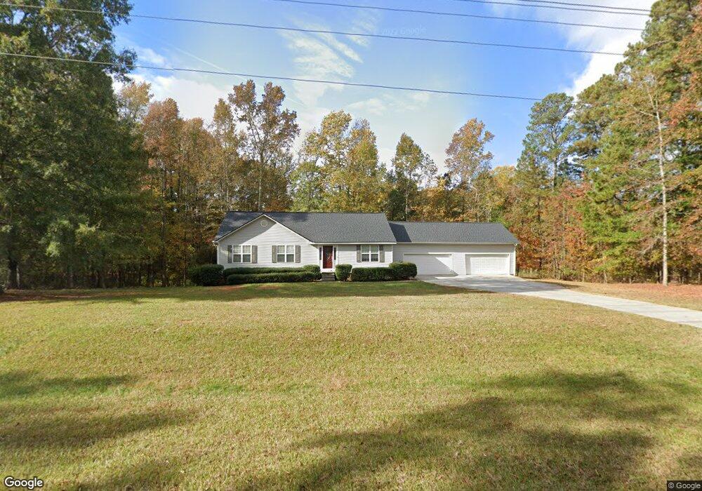
581 Poplar St Monroe, GA 30655
Estimated Value: $281,000 - $332,000
--
Bed
--
Bath
1,599
Sq Ft
$194/Sq Ft
Est. Value
About This Home
This home is located at 581 Poplar St, Monroe, GA 30655 and is currently estimated at $310,636, approximately $194 per square foot. 581 Poplar St is a home located in Walton County with nearby schools including Harmony Elementary School, Carver Middle School, and Monroe Area High School.
Ownership History
Date
Name
Owned For
Owner Type
Purchase Details
Closed on
Sep 19, 2002
Sold by
Hud
Bought by
Campbell Bobby L and Campbell Edith E
Current Estimated Value
Home Financials for this Owner
Home Financials are based on the most recent Mortgage that was taken out on this home.
Original Mortgage
$129,000
Interest Rate
6.3%
Mortgage Type
New Conventional
Purchase Details
Closed on
Mar 5, 2002
Sold by
Homeside Lending Inc
Bought by
Sec Of Hud
Purchase Details
Closed on
Mar 26, 1999
Sold by
Paramount Homes Inc
Bought by
Williams Thomas H and Williams Cinda
Home Financials for this Owner
Home Financials are based on the most recent Mortgage that was taken out on this home.
Original Mortgage
$135,736
Interest Rate
6.85%
Mortgage Type
FHA
Create a Home Valuation Report for This Property
The Home Valuation Report is an in-depth analysis detailing your home's value as well as a comparison with similar homes in the area
Home Values in the Area
Average Home Value in this Area
Purchase History
| Date | Buyer | Sale Price | Title Company |
|---|---|---|---|
| Campbell Bobby L | -- | -- | |
| Sec Of Hud | -- | -- | |
| Homeside Lending Inc | $144,909 | -- | |
| Williams Thomas H | $136,900 | -- |
Source: Public Records
Mortgage History
| Date | Status | Borrower | Loan Amount |
|---|---|---|---|
| Closed | Campbell Bobby L | $129,000 | |
| Previous Owner | Williams Thomas H | $135,736 |
Source: Public Records
Tax History Compared to Growth
Tax History
| Year | Tax Paid | Tax Assessment Tax Assessment Total Assessment is a certain percentage of the fair market value that is determined by local assessors to be the total taxable value of land and additions on the property. | Land | Improvement |
|---|---|---|---|---|
| 2024 | $622 | $104,480 | $20,240 | $84,240 |
| 2023 | $609 | $97,600 | $16,640 | $80,960 |
| 2022 | $584 | $87,000 | $14,840 | $72,160 |
| 2021 | $584 | $74,120 | $10,880 | $63,240 |
| 2020 | $597 | $69,920 | $8,720 | $61,200 |
| 2019 | $608 | $62,280 | $7,040 | $55,240 |
| 2018 | $608 | $62,280 | $7,040 | $55,240 |
| 2017 | $2,022 | $58,680 | $4,880 | $53,800 |
| 2016 | $558 | $51,040 | $4,640 | $46,400 |
| 2015 | $499 | $46,080 | $4,640 | $41,440 |
| 2014 | $439 | $39,720 | $0 | $0 |
Source: Public Records
Map
Nearby Homes
- 725 Poplar St
- 710 Poplar St
- 1042 Wheel House Ln Unit C
- 838 Store House Ct Unit A
- 838 Store House Ct Unit C
- 842 Store House Ct Unit A
- 842 Store House Ct Unit B
- 829 Store House Ct Unit B
- 829 Store House Ct Unit C
- 845 Store House Ct Unit B
- 833 Store House Ct Unit B
- 1628 Brook Ln
- 455 Tate St
- 449 Tate St
- 531 Landers St
- 607 Cantor Way
- Ashmore Plan at Brookland Commons
- 561 Poplar St
- 580 Poplar St
- 621 Poplar St
- 601 Poplar St
- 641 Poplar St
- 541 Poplar St
- 639 Poplar St
- 640 Poplar St
- 487 Poplar St
- 0 Poplar St Unit 20041986
- 0 Poplar St Unit 7219613
- 0 Poplar St Unit 7139795
- 0 Poplar St Unit 8342612
- 0 Poplar St Unit 8104252
- 0 Poplar St
- 477 Poplar St
- 620 Poplar St
- 699 Poplar St
- 804 Old Forrester Rd
- 745 Poplar St