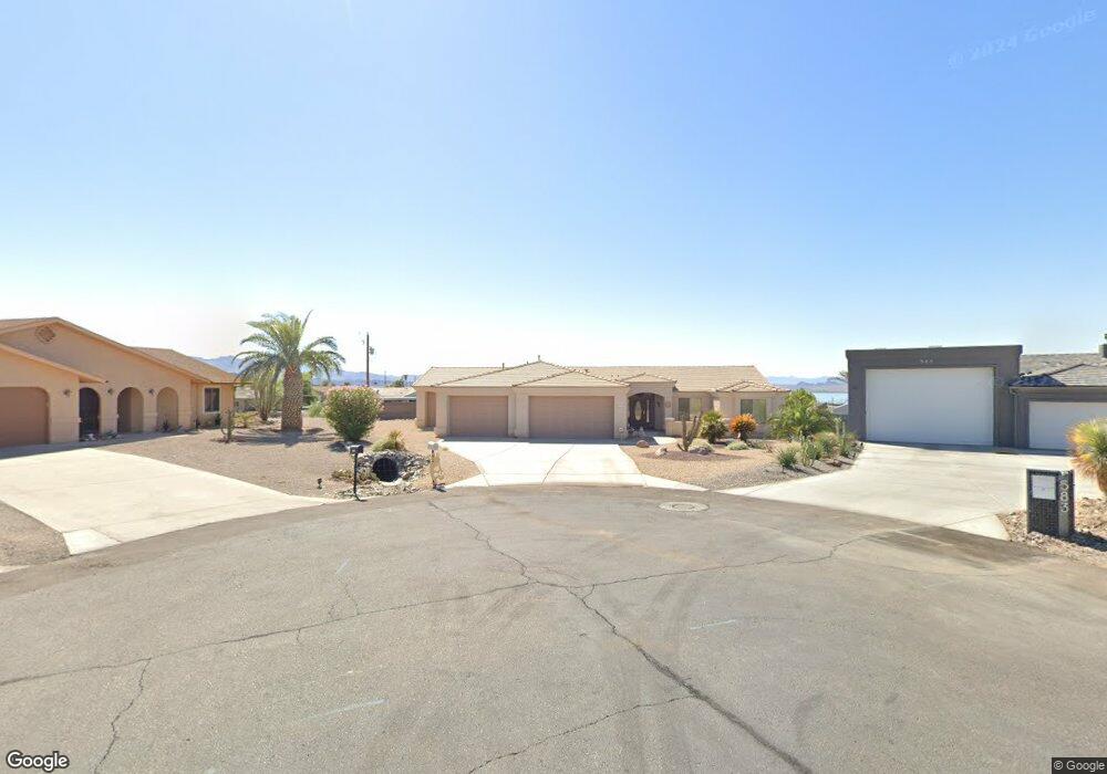
581 Robin Ln Lake Havasu City, AZ 86403
Estimated Value: $594,347 - $707,000
--
Bed
1
Bath
1,753
Sq Ft
$377/Sq Ft
Est. Value
About This Home
This home is located at 581 Robin Ln, Lake Havasu City, AZ 86403 and is currently estimated at $660,087, approximately $376 per square foot. 581 Robin Ln is a home located in Mohave County with nearby schools including Smoketree Elementary School, Thunderbolt Middle School, and Lake Havasu High School.
Ownership History
Date
Name
Owned For
Owner Type
Purchase Details
Closed on
Feb 10, 2020
Sold by
Hougland Bonnie and The Bonnie Hougland Trust
Bought by
Garrett Jess and Garrett Jane
Current Estimated Value
Purchase Details
Closed on
Apr 17, 2013
Sold by
Kelley Verna L
Bought by
Houghland Bonnie
Purchase Details
Closed on
Apr 3, 2008
Sold by
Kelley Verna L
Bought by
Kelley Verna L
Purchase Details
Closed on
Jan 11, 2003
Sold by
Berger Bonnie L
Bought by
Kelley John and Kelley Verna
Purchase Details
Closed on
May 1, 2001
Sold by
Soler Peter S
Bought by
Berger Bonnie L
Home Financials for this Owner
Home Financials are based on the most recent Mortgage that was taken out on this home.
Original Mortgage
$12,000
Interest Rate
7.03%
Mortgage Type
Seller Take Back
Create a Home Valuation Report for This Property
The Home Valuation Report is an in-depth analysis detailing your home's value as well as a comparison with similar homes in the area
Home Values in the Area
Average Home Value in this Area
Purchase History
| Date | Buyer | Sale Price | Title Company |
|---|---|---|---|
| Garrett Jess | -- | Accommodation | |
| Houghland Bonnie | $255,000 | Stewart Title & Trust Of Pho | |
| Kelley Verna L | -- | None Available | |
| Kelley John | $39,500 | Capital Title Agency Inc | |
| Berger Bonnie L | $15,000 | Transnation Title Insurance |
Source: Public Records
Mortgage History
| Date | Status | Borrower | Loan Amount |
|---|---|---|---|
| Previous Owner | Berger Bonnie L | $12,000 |
Source: Public Records
Tax History Compared to Growth
Tax History
| Year | Tax Paid | Tax Assessment Tax Assessment Total Assessment is a certain percentage of the fair market value that is determined by local assessors to be the total taxable value of land and additions on the property. | Land | Improvement |
|---|---|---|---|---|
| 2026 | -- | -- | -- | -- |
| 2025 | $2,560 | $51,659 | $0 | $0 |
| 2024 | $2,560 | $55,294 | $0 | $0 |
| 2023 | $2,560 | $48,481 | $0 | $0 |
| 2022 | $2,450 | $37,056 | $0 | $0 |
| 2021 | $2,639 | $34,746 | $0 | $0 |
| 2019 | $2,504 | $30,355 | $0 | $0 |
| 2018 | $2,036 | $28,456 | $0 | $0 |
| 2017 | $2,000 | $27,936 | $0 | $0 |
| 2016 | $1,767 | $25,878 | $0 | $0 |
| 2015 | $1,719 | $23,108 | $0 | $0 |
Source: Public Records
Map
Nearby Homes
- 583 Robin Ln
- 1790 Rainbow Ave S
- 640 Acoma Blvd N
- 532 Acoma Blvd N
- 2200 Clarke Dr
- 1986 Bahama Ave
- 1960 Pirate Ln
- 675 Knobhill Ln
- 2311 Rainbow Ave N
- 2270 Constellation Dr
- 2021 Industrial
- 320 Chipeta Ln
- 2301 Sahara Dr
- 2295 Cosnina Dr
- 2305 Cosnina Dr
- 2075 Palo Verde Blvd S
- 2067 Palo Verde Blvd S
- 2100 Chaparral Dr
- 2349 Clarke Dr
- 1930 Bahama Ave
- 583 Robin Ln
- 579 Robin Ln
- 585 Acoma Blvd N
- 2114 Polaris Dr
- 575 Robin Ln
- 591 Acoma Blvd N
- 571 Acoma Blvd N
- 483 Cheyenne Ln
- 483 Cheyenne Ln
- 2110 Polaris Dr
- 481 Cheyenne Ln
- 485 Cheyenne Ln
- 2100 Polaris Dr
- 479 Cheyenne Ln
- 565 Gem Ln
- 487 Cheyenne Ln
- 580 Acoma Blvd N
- 586 Acoma Blvd N
- 569 Acoma Blvd N
- 595 Acoma Blvd N