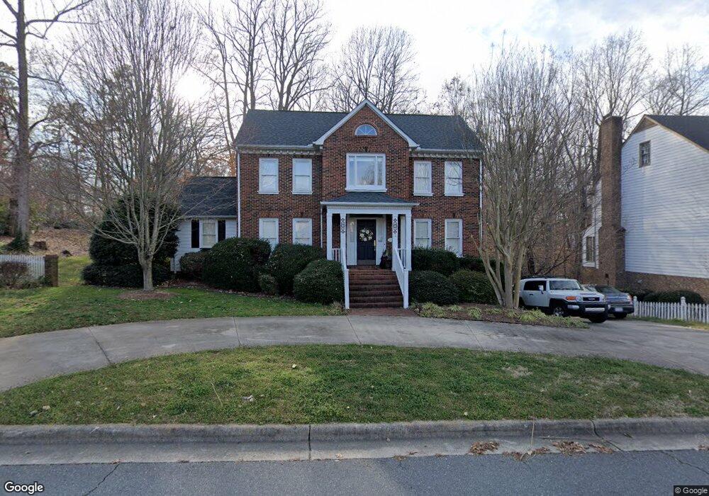
581 Sandringham Place Concord, NC 28025
Estimated Value: $418,809 - $539,000
3
Beds
3
Baths
2,244
Sq Ft
$216/Sq Ft
Est. Value
About This Home
This home is located at 581 Sandringham Place, Concord, NC 28025 and is currently estimated at $485,702, approximately $216 per square foot. 581 Sandringham Place is a home located in Cabarrus County with nearby schools including Beverly Hills STEM Elementary, Concord Middle School, and Concord High School.
Ownership History
Date
Name
Owned For
Owner Type
Purchase Details
Closed on
Nov 4, 2013
Sold by
Logan William Robert and Logan Beverly Whitley
Bought by
Tierney John Connelly and Tierney Katherine Clement
Current Estimated Value
Purchase Details
Closed on
Jan 1, 1997
Bought by
Whitley Joseph Edward
Purchase Details
Closed on
May 1, 1992
Purchase Details
Closed on
Nov 1, 1988
Create a Home Valuation Report for This Property
The Home Valuation Report is an in-depth analysis detailing your home's value as well as a comparison with similar homes in the area
Home Values in the Area
Average Home Value in this Area
Purchase History
| Date | Buyer | Sale Price | Title Company |
|---|---|---|---|
| Tierney John Connelly | $226,500 | None Available | |
| Whitley Joseph Edward | $137,000 | -- | |
| -- | $190,000 | -- | |
| -- | $28,000 | -- |
Source: Public Records
Tax History Compared to Growth
Tax History
| Year | Tax Paid | Tax Assessment Tax Assessment Total Assessment is a certain percentage of the fair market value that is determined by local assessors to be the total taxable value of land and additions on the property. | Land | Improvement |
|---|---|---|---|---|
| 2025 | $3,772 | $378,710 | $114,000 | $264,710 |
| 2024 | $3,772 | $378,710 | $114,000 | $264,710 |
| 2023 | $2,983 | $244,470 | $57,500 | $186,970 |
| 2022 | $2,983 | $244,470 | $57,500 | $186,970 |
| 2021 | $2,983 | $244,470 | $57,500 | $186,970 |
| 2020 | $2,983 | $244,470 | $57,500 | $186,970 |
| 2019 | $2,776 | $227,560 | $51,750 | $175,810 |
| 2018 | $2,731 | $227,560 | $51,750 | $175,810 |
| 2017 | $2,685 | $227,560 | $51,750 | $175,810 |
| 2016 | $1,593 | $218,440 | $51,750 | $166,690 |
| 2015 | $2,578 | $218,440 | $51,750 | $166,690 |
| 2014 | $2,578 | $218,440 | $51,750 | $166,690 |
Source: Public Records
Map
Nearby Homes
- 138 Tetbury Ave NE
- 629 Camrose Cir NE Unit 45
- 606 Camrose Cir NE
- 649 Camrose Cir NE
- 653 Camrose Cir NE
- 148 Palaside Dr NE
- 19 Todd Dr NE
- 457 Birchwood Trail NE
- 80 Lecline Cir NE
- 159 Madison Ave NE
- 147 Madison Ave NE
- 635 Windsor Place NE
- 722 Wilmar St NW
- 336 Hamilton Dr NE
- 333 Hillandale St NE
- 636 Forest St NW
- 642 Forest St NW
- 63 Brookwood Ave NW
- 84 Lake Concord Rd NE Unit Q
- 1012 Burrage Rd NE
- 583 Sandringham Place
- 586 Todd Dr NE
- 134 Tetbury Ave NE
- 135 Tetbury Ave NE
- 585 Sandringham Place
- 136 Tetbury Ave NE
- 570 Todd Dr NE
- 594 Todd Dr NE
- 587 Sandringham Place
- 117 Winecoff Ave NE
- 137 Tetbury Ave NE
- 584 Sandringham Place
- 568 Todd Dr NE
- 585 Todd Dr NE
- 546 Camrose Cir NE
- 544 Camrose Cir NE
- 111 Winecoff Ave NE
- 140 Tetbury Ave NE
- 112 Winecoff Ave NE
- 596 Todd Dr NE